Richland Topo Map Kansas
To zoom in, hover over the map of Richland
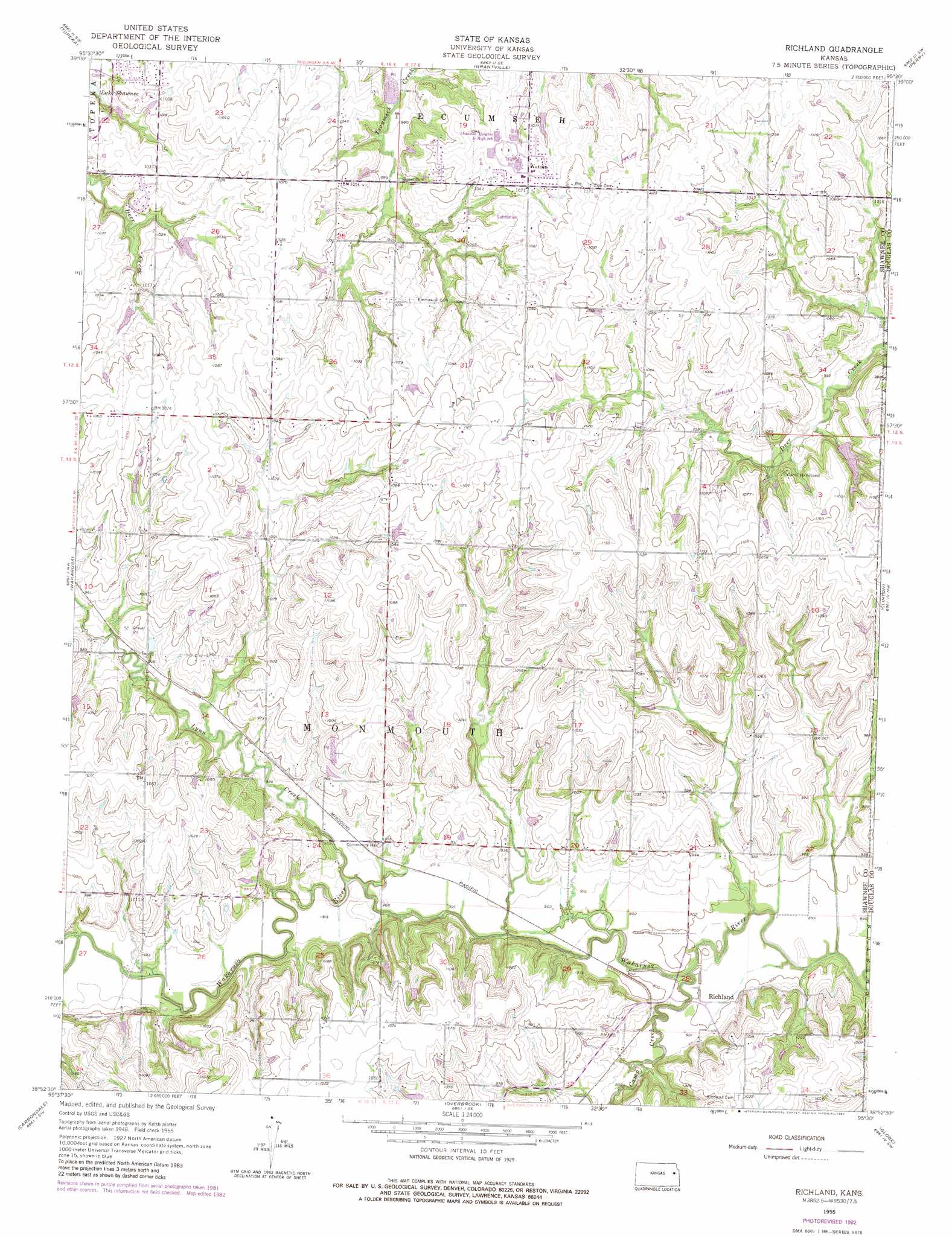
USGS Topo Quad 38095h5 - 1:24,000 scale
| Topo Map Name: | Richland |
| USGS Topo Quad ID: | 38095h5 |
| Print Size: | ca. 21 1/4" wide x 27" high |
| Southeast Coordinates: | 38.875° N latitude / 95.5° W longitude |
| Map Center Coordinates: | 38.9375° N latitude / 95.5625° W longitude |
| U.S. State: | KS |
| Filename: | o38095h5.jpg |
| Download Map JPG Image: | Richland topo map 1:24,000 scale |
| Map Type: | Topographic |
| Topo Series: | 7.5´ |
| Map Scale: | 1:24,000 |
| Source of Map Images: | United States Geological Survey (USGS) |
| Alternate Map Versions: |
Richland KS 1955, updated 1956 Download PDF Buy paper map Richland KS 1955, updated 1971 Download PDF Buy paper map Richland KS 1955, updated 1982 Download PDF Buy paper map Richland KS 2009 Download PDF Buy paper map Richland KS 2012 Download PDF Buy paper map Richland KS 2015 Download PDF Buy paper map |
1:24,000 Topo Quads surrounding Richland
Grove |
Elmont |
Meriden |
Ozawkie |
Oskaloosa |
Silver Lake |
Topeka |
Grantville |
Perry |
Williamstown |
Auburn |
Wakarusa |
Richland |
Clinton |
Lawrence West |
Burlingame |
Carbondale |
Overbrook |
Globe |
Lone Star |
Osage City |
Lyndon Nw |
Vassar |
Ottawa Nw |
Ottawa North |
> Back to 38095e1 at 1:100,000 scale
> Back to 38094a1 at 1:250,000 scale
> Back to U.S. Topo Maps home
Richland topo map: Gazetteer
Richland: Airports
Starshire Farm Airport elevation 278m 912′Richland: Populated Places
Lindbloom Park (historical) elevation 298m 977′Richland elevation 285m 935′
Watson elevation 330m 1082′
Richland: Streams
Camp Creek elevation 272m 892′Lynn Creek elevation 273m 895′
Richland digital topo map on disk
Buy this Richland topo map showing relief, roads, GPS coordinates and other geographical features, as a high-resolution digital map file on DVD: