Radium Topo Map Kansas
To zoom in, hover over the map of Radium
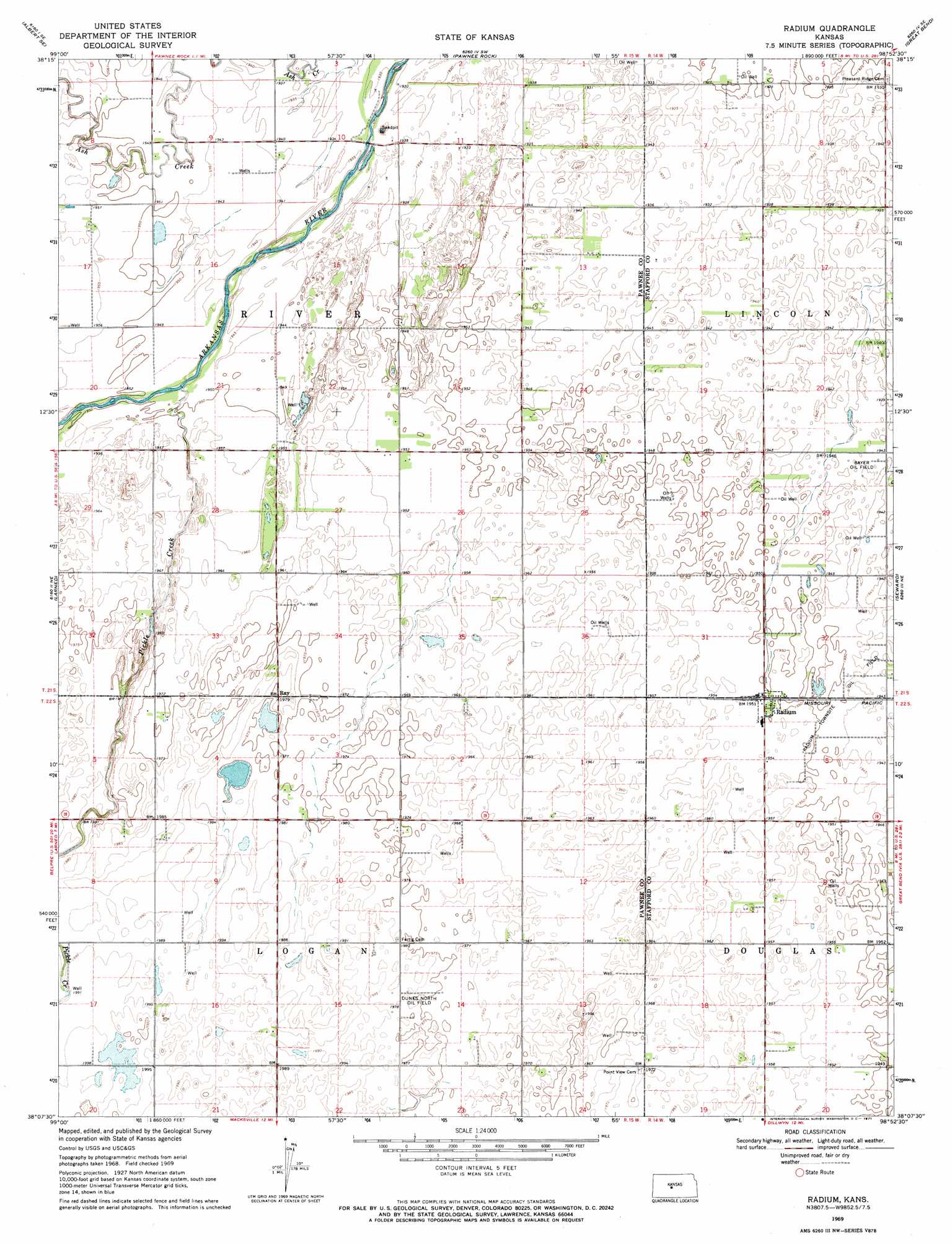
USGS Topo Quad 38098b8 - 1:24,000 scale
| Topo Map Name: | Radium |
| USGS Topo Quad ID: | 38098b8 |
| Print Size: | ca. 21 1/4" wide x 27" high |
| Southeast Coordinates: | 38.125° N latitude / 98.875° W longitude |
| Map Center Coordinates: | 38.1875° N latitude / 98.9375° W longitude |
| U.S. State: | KS |
| Filename: | o38098b8.jpg |
| Download Map JPG Image: | Radium topo map 1:24,000 scale |
| Map Type: | Topographic |
| Topo Series: | 7.5´ |
| Map Scale: | 1:24,000 |
| Source of Map Images: | United States Geological Survey (USGS) |
| Alternate Map Versions: |
Radium KS 1969, updated 1971 Download PDF Buy paper map Radium KS 2009 Download PDF Buy paper map Radium KS 2012 Download PDF Buy paper map Radium KS 2015 Download PDF Buy paper map |
1:24,000 Topo Quads surrounding Radium
Timken |
Albert |
Heizer |
Great Bend Ne |
Ellinwood Nw |
Ash Valley |
Albert Se |
Pawnee Rock |
Great Bend |
Ellinwood Sw |
Fort Larned |
Larned |
Radium |
Seward |
Hudson Nw |
Garfield |
Zook |
Saint John Sw |
Saint John North |
Hudson |
Belpre Nw |
Belpre |
Macksville |
Saint John South |
Stafford Nw |
> Back to 38098a1 at 1:100,000 scale
> Back to 38098a1 at 1:250,000 scale
> Back to U.S. Topo Maps home
Radium topo map: Gazetteer
Radium: Oilfields
Bayer Oil Field elevation 593m 1945′Dunes North Oil Field elevation 602m 1975′
Radium Townsite Oil Field elevation 593m 1945′
Radium: Populated Places
Radium elevation 595m 1952′Ray elevation 603m 1978′
Radium: Streams
Pickle Creek elevation 592m 1942′Radium digital topo map on disk
Buy this Radium topo map showing relief, roads, GPS coordinates and other geographical features, as a high-resolution digital map file on DVD: