Pawnee Rock Topo Map Kansas
To zoom in, hover over the map of Pawnee Rock
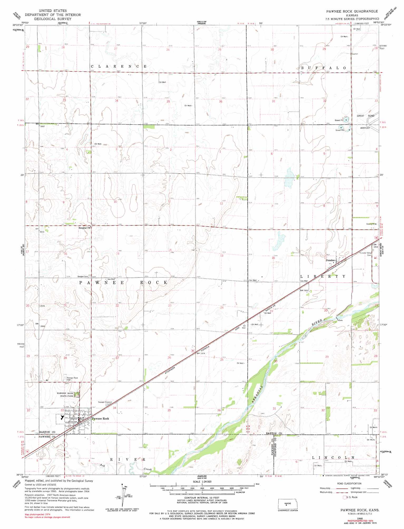
USGS Topo Quad 38098c8 - 1:24,000 scale
| Topo Map Name: | Pawnee Rock |
| USGS Topo Quad ID: | 38098c8 |
| Print Size: | ca. 21 1/4" wide x 27" high |
| Southeast Coordinates: | 38.25° N latitude / 98.875° W longitude |
| Map Center Coordinates: | 38.3125° N latitude / 98.9375° W longitude |
| U.S. State: | KS |
| Filename: | o38098c8.jpg |
| Download Map JPG Image: | Pawnee Rock topo map 1:24,000 scale |
| Map Type: | Topographic |
| Topo Series: | 7.5´ |
| Map Scale: | 1:24,000 |
| Source of Map Images: | United States Geological Survey (USGS) |
| Alternate Map Versions: |
Pawnee Rock KS 1960, updated 1961 Download PDF Buy paper map Pawnee Rock KS 1960, updated 1978 Download PDF Buy paper map Pawnee Rock KS 2009 Download PDF Buy paper map Pawnee Rock KS 2012 Download PDF Buy paper map Pawnee Rock KS 2015 Download PDF Buy paper map |
1:24,000 Topo Quads surrounding Pawnee Rock
Bison |
Otis |
Olmitz |
Hoisington |
Redwing |
Timken |
Albert |
Heizer |
Great Bend Ne |
Ellinwood Nw |
Ash Valley |
Albert Se |
Pawnee Rock |
Great Bend |
Ellinwood Sw |
Fort Larned |
Larned |
Radium |
Seward |
Hudson Nw |
Garfield |
Zook |
Saint John Sw |
Saint John North |
Hudson |
> Back to 38098a1 at 1:100,000 scale
> Back to 38098a1 at 1:250,000 scale
> Back to U.S. Topo Maps home
Pawnee Rock topo map: Gazetteer
Pawnee Rock: Airports
Great Bend Municipal Airport elevation 576m 1889′Pawnee Rock: Parks
Pawnee Rock State Park elevation 614m 2014′Pawnee Rock: Populated Places
Dundee elevation 580m 1902′Pawnee Rock elevation 594m 1948′
Pawnee Rock: Streams
Ash Creek elevation 585m 1919′North Fork Little Arkansas River elevation 603m 1978′
Pawnee Rock digital topo map on disk
Buy this Pawnee Rock topo map showing relief, roads, GPS coordinates and other geographical features, as a high-resolution digital map file on DVD: