Cedar Bluff Dam Topo Map Kansas
To zoom in, hover over the map of Cedar Bluff Dam
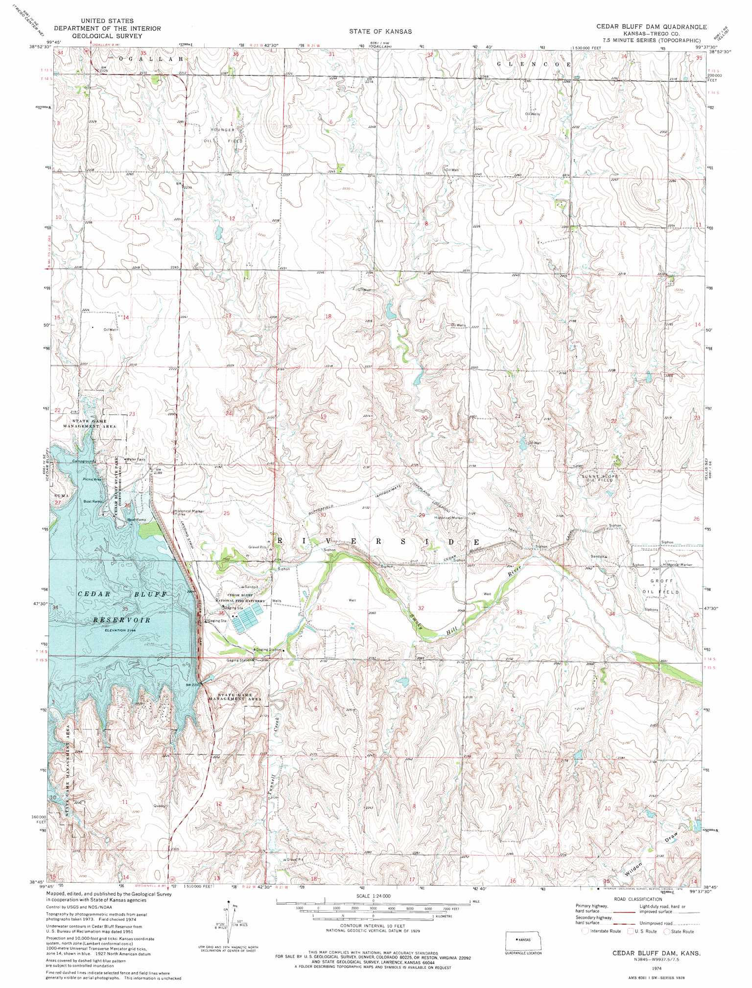
USGS Topo Quad 38099g6 - 1:24,000 scale
| Topo Map Name: | Cedar Bluff Dam |
| USGS Topo Quad ID: | 38099g6 |
| Print Size: | ca. 21 1/4" wide x 27" high |
| Southeast Coordinates: | 38.75° N latitude / 99.625° W longitude |
| Map Center Coordinates: | 38.8125° N latitude / 99.6875° W longitude |
| U.S. State: | KS |
| Filename: | o38099g6.jpg |
| Download Map JPG Image: | Cedar Bluff Dam topo map 1:24,000 scale |
| Map Type: | Topographic |
| Topo Series: | 7.5´ |
| Map Scale: | 1:24,000 |
| Source of Map Images: | United States Geological Survey (USGS) |
| Alternate Map Versions: |
Cedar Bluff Dam KS 1974, updated 1976 Download PDF Buy paper map Cedar Bluff Dam KS 2010 Download PDF Buy paper map Cedar Bluff Dam KS 2012 Download PDF Buy paper map Cedar Bluff Dam KS 2015 Download PDF Buy paper map |
1:24,000 Topo Quads surrounding Cedar Bluff Dam
Wa Keeney West |
Wa Keeney East |
Hill City 4 Sw |
Hill City 4 Se |
Plainville Sw |
Trego Center |
Trego Center Ne |
Ogallah |
Ellis |
Yocemento |
Fort Downer |
Cedar Bluff |
Cedar Bluff Dam |
Ellis Se |
Antonino |
Ransom |
Osgood |
Brownell |
Mccracken Ne |
La Crosse Nw |
Ransom Sw |
Ransom Se |
Mccracken Sw |
Mccracken |
Hargrave |
> Back to 38099e1 at 1:100,000 scale
> Back to 38098a1 at 1:250,000 scale
> Back to U.S. Topo Maps home
Cedar Bluff Dam topo map: Gazetteer
Cedar Bluff Dam: Dams
Cedar Bluff Dam elevation 668m 2191′Cedar Bluff Dam: Oilfields
Groff Oil Field elevation 639m 2096′Sunny Slope Oil Field elevation 650m 2132′
Younger Oil Field elevation 691m 2267′
Cedar Bluff Dam: Parks
Cedar Bluff National Fish Hatchery elevation 632m 2073′Cedar Bluff Dam: Streams
Page Creek elevation 654m 2145′Tunnel Creek elevation 627m 2057′
Cedar Bluff Dam digital topo map on disk
Buy this Cedar Bluff Dam topo map showing relief, roads, GPS coordinates and other geographical features, as a high-resolution digital map file on DVD: