Wa Keeney East Topo Map Kansas
To zoom in, hover over the map of Wa Keeney East
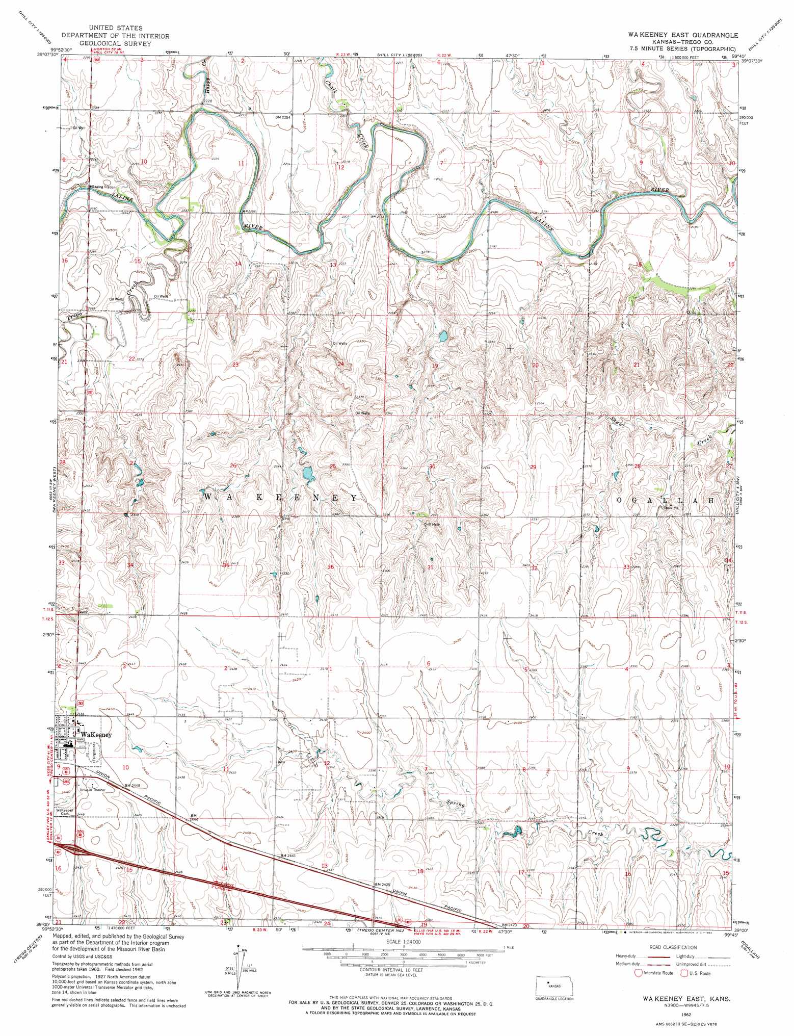
USGS Topo Quad 39099a7 - 1:24,000 scale
| Topo Map Name: | Wa Keeney East |
| USGS Topo Quad ID: | 39099a7 |
| Print Size: | ca. 21 1/4" wide x 27" high |
| Southeast Coordinates: | 39° N latitude / 99.75° W longitude |
| Map Center Coordinates: | 39.0625° N latitude / 99.8125° W longitude |
| U.S. State: | KS |
| Filename: | o39099a7.jpg |
| Download Map JPG Image: | Wa Keeney East topo map 1:24,000 scale |
| Map Type: | Topographic |
| Topo Series: | 7.5´ |
| Map Scale: | 1:24,000 |
| Source of Map Images: | United States Geological Survey (USGS) |
| Alternate Map Versions: |
Wa Keeney East KS 1962, updated 1964 Download PDF Buy paper map WaKeeney East KS 2010 Download PDF Buy paper map WaKeeney East KS 2012 Download PDF Buy paper map WaKeeney East KS 2015 Download PDF Buy paper map |
1:24,000 Topo Quads surrounding Wa Keeney East
Morland |
Penokee |
Hill City South |
Bogue |
Palco |
Saint Peter |
Hay Hollow |
Togo |
Hill City 4 Nw |
Wild Horse Creek |
Collyer |
Wa Keeney West |
Wa Keeney East |
Hill City 4 Sw |
Hill City 4 Se |
Castle Rock Ne |
Trego Center |
Trego Center Ne |
Ogallah |
Ellis |
Gibson Creek |
Fort Downer |
Cedar Bluff |
Cedar Bluff Dam |
Ellis Se |
> Back to 39099a1 at 1:100,000 scale
> Back to 39098a1 at 1:250,000 scale
> Back to U.S. Topo Maps home
Wa Keeney East topo map: Gazetteer
Wa Keeney East: Airports
Galloway Airport elevation 693m 2273′Wa Keeney East: Streams
Chalk Creek elevation 668m 2191′Happy Creek elevation 674m 2211′
Trego Creek elevation 677m 2221′
Wa Keeney East digital topo map on disk
Buy this Wa Keeney East topo map showing relief, roads, GPS coordinates and other geographical features, as a high-resolution digital map file on DVD: