Arnold Topo Map Kansas
To zoom in, hover over the map of Arnold
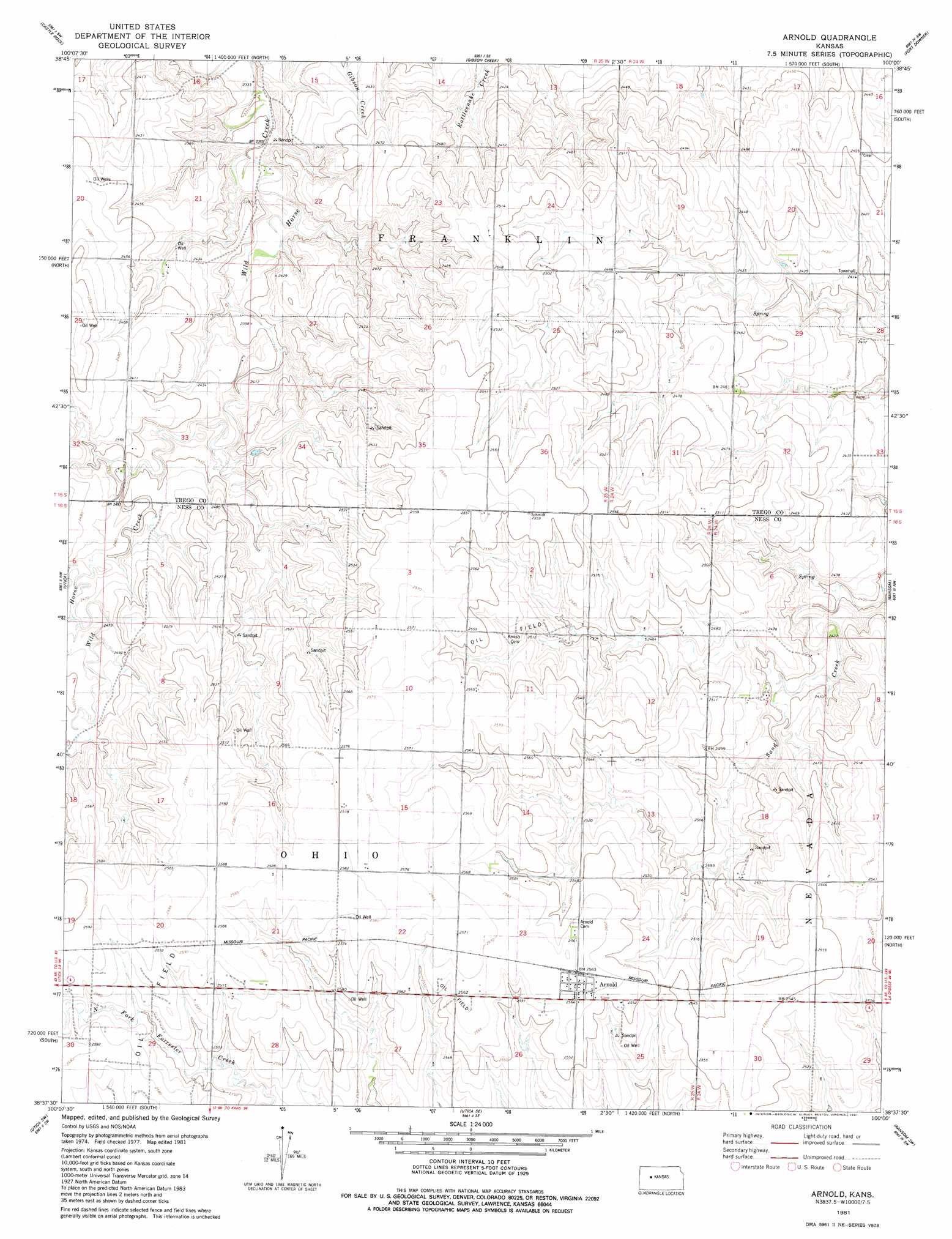
USGS Topo Quad 38100f1 - 1:24,000 scale
| Topo Map Name: | Arnold |
| USGS Topo Quad ID: | 38100f1 |
| Print Size: | ca. 21 1/4" wide x 27" high |
| Southeast Coordinates: | 38.625° N latitude / 100° W longitude |
| Map Center Coordinates: | 38.6875° N latitude / 100.0625° W longitude |
| U.S. State: | KS |
| Filename: | o38100f1.jpg |
| Download Map JPG Image: | Arnold topo map 1:24,000 scale |
| Map Type: | Topographic |
| Topo Series: | 7.5´ |
| Map Scale: | 1:24,000 |
| Source of Map Images: | United States Geological Survey (USGS) |
| Alternate Map Versions: |
Arnold KS 1981, updated 1981 Download PDF Buy paper map Arnold KS 2009 Download PDF Buy paper map Arnold KS 2012 Download PDF Buy paper map Arnold KS 2015 Download PDF Buy paper map |
1:24,000 Topo Quads surrounding Arnold
Gove Ne |
Castle Rock Nw |
Castle Rock Ne |
Trego Center |
Trego Center Ne |
Gove Se |
Castle Rock |
Gibson Creek |
Fort Downer |
Cedar Bluff |
Pendennis |
Utica |
Arnold |
Ransom |
Osgood |
Shields Se |
Utica Sw |
Utica Se |
Ransom Sw |
Ransom Se |
Alamota |
Beeler |
Laird |
Ness City |
Ness City Ne |
> Back to 38100e1 at 1:100,000 scale
> Back to 38100a1 at 1:250,000 scale
> Back to U.S. Topo Maps home
Arnold digital topo map on disk
Buy this Arnold topo map showing relief, roads, GPS coordinates and other geographical features, as a high-resolution digital map file on DVD: