Alamota Topo Map Kansas
To zoom in, hover over the map of Alamota
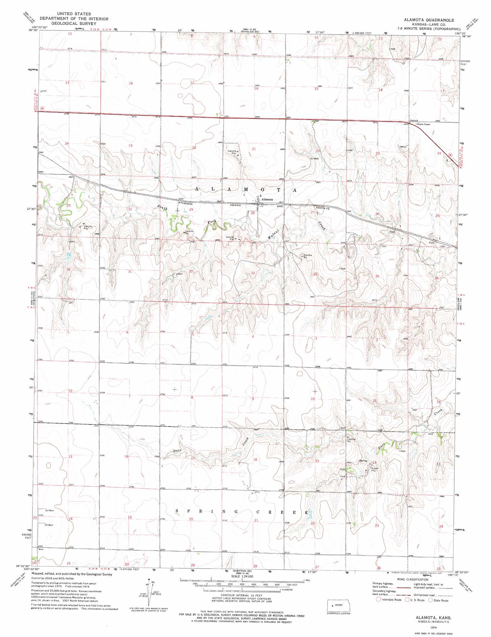
USGS Topo Quad 38100d3 - 1:24,000 scale
| Topo Map Name: | Alamota |
| USGS Topo Quad ID: | 38100d3 |
| Print Size: | ca. 21 1/4" wide x 27" high |
| Southeast Coordinates: | 38.375° N latitude / 100.25° W longitude |
| Map Center Coordinates: | 38.4375° N latitude / 100.3125° W longitude |
| U.S. State: | KS |
| Filename: | o38100d3.jpg |
| Download Map JPG Image: | Alamota topo map 1:24,000 scale |
| Map Type: | Topographic |
| Topo Series: | 7.5´ |
| Map Scale: | 1:24,000 |
| Source of Map Images: | United States Geological Survey (USGS) |
| Alternate Map Versions: |
Alamota KS 1974, updated 1976 Download PDF Buy paper map Alamota KS 2009 Download PDF Buy paper map Alamota KS 2012 Download PDF Buy paper map Alamota KS 2015 Download PDF Buy paper map |
1:24,000 Topo Quads surrounding Alamota
Cheyenne Creek |
Shields Nw |
Pendennis |
Utica |
Arnold |
Healy |
Shields |
Shields Se |
Utica Sw |
Utica Se |
Amy |
Dighton |
Alamota |
Beeler |
Laird |
Amy Se |
Dighton Sw |
Dighton Se |
Beeler Sw |
Beeler Se |
Scott City 4 Ne |
Ravanna |
Hay Canyon |
Horse Thief Canyon Nw |
Horse Thief Canyon Ne |
> Back to 38100a1 at 1:100,000 scale
> Back to 38100a1 at 1:250,000 scale
> Back to U.S. Topo Maps home
Alamota topo map: Gazetteer
Alamota: Populated Places
Alamota elevation 798m 2618′Alamota: Streams
Buffalo Creek elevation 807m 2647′Alamota digital topo map on disk
Buy this Alamota topo map showing relief, roads, GPS coordinates and other geographical features, as a high-resolution digital map file on DVD: