Madison Topo Map California
To zoom in, hover over the map of Madison
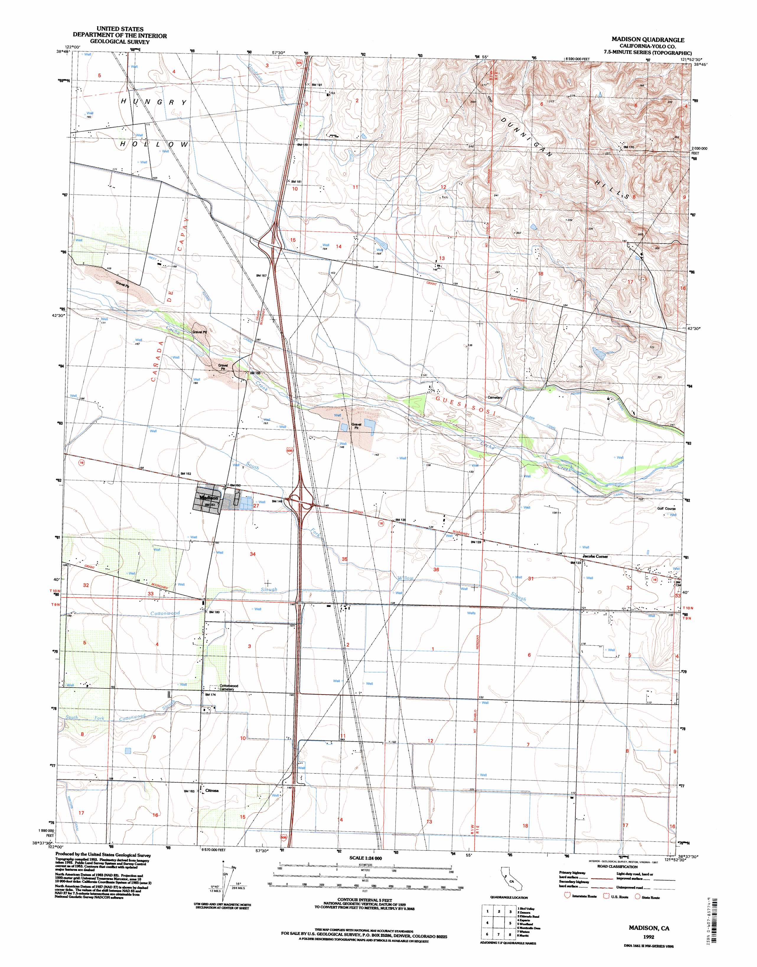
USGS Topo Quad 38121f8 - 1:24,000 scale
| Topo Map Name: | Madison |
| USGS Topo Quad ID: | 38121f8 |
| Print Size: | ca. 21 1/4" wide x 27" high |
| Southeast Coordinates: | 38.625° N latitude / 121.875° W longitude |
| Map Center Coordinates: | 38.6875° N latitude / 121.9375° W longitude |
| U.S. State: | CA |
| Filename: | o38121f8.jpg |
| Download Map JPG Image: | Madison topo map 1:24,000 scale |
| Map Type: | Topographic |
| Topo Series: | 7.5´ |
| Map Scale: | 1:24,000 |
| Source of Map Images: | United States Geological Survey (USGS) |
| Alternate Map Versions: |
Madison CA 1953, updated 1954 Download PDF Buy paper map Madison CA 1953, updated 1970 Download PDF Buy paper map Madison CA 1953, updated 1980 Download PDF Buy paper map Madison CA 1953, updated 1985 Download PDF Buy paper map Madison CA 1992, updated 1997 Download PDF Buy paper map Madison CA 2012 Download PDF Buy paper map Madison CA 2015 Download PDF Buy paper map |
1:24,000 Topo Quads surrounding Madison
Rumsey |
Wildwood School |
Dunnigan |
Kirkville |
Sutter Causeway |
Guinda |
Bird Valley |
Zamora |
Eldorado Bend |
Knights Landing |
Brooks |
Esparto |
Madison |
Woodland |
Grays Bend |
Lake Berryessa |
Monticello Dam |
Winters |
Merritt |
Davis |
Capell Valley |
Mount Vaca |
Allendale |
Dixon |
Saxon |
> Back to 38121e1 at 1:100,000 scale
> Back to 38120a1 at 1:250,000 scale
> Back to U.S. Topo Maps home
Madison topo map: Gazetteer
Madison: Canals
Alder Canal elevation 38m 124′Winters Canal elevation 59m 193′
Madison: Dams
Moore Dam elevation 35m 114′Moore Dam (historical) elevation 35m 114′
Madison: Guts
South Fork Cottonwood Slough elevation 56m 183′Madison: Populated Places
Citrona elevation 50m 164′Cottonwood elevation 50m 164′
Jacobs Corner elevation 39m 127′
Madison elevation 46m 150′
Madison: Post Offices
Madison Post Office elevation 46m 150′Madison: Streams
Cottonwood Slough elevation 40m 131′Goodnow Slough elevation 39m 127′
Madison: Valleys
Hungry Hollow elevation 44m 144′Madison digital topo map on disk
Buy this Madison topo map showing relief, roads, GPS coordinates and other geographical features, as a high-resolution digital map file on DVD: