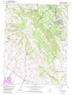
Glen Ellen Topo Map California
To zoom in, hover over the map of Glen Ellen
USGS Topo Quad 38122c5 - 1:24,000 scale
| Topo Map Name: | Glen Ellen |
| USGS Topo Quad ID: | 38122c5 |
| Print Size: | ca. 21 1/4" wide x 27" high |
| Southeast Coordinates: | 38.25° N latitude / 122.5° W longitude |
| Map Center Coordinates: | 38.3125° N latitude / 122.5625° W longitude |
| U.S. State: | CA |
| Filename: | o38122c5.jpg |
| Download Map JPG Image: | Glen Ellen topo map 1:24,000 scale |
| Map Type: | Topographic |
| Topo Series: | 7.5´ |
| Map Scale: | 1:24,000 |
| Source of Map Images: | United States Geological Survey (USGS) |
| Alternate Map Versions: |
Glen Ellen CA 1954, updated 1955 Download PDF Buy paper map Glen Ellen CA 1954, updated 1961 Download PDF Buy paper map Glen Ellen CA 1954, updated 1969 Download PDF Buy paper map Glen Ellen CA 1954, updated 1976 Download PDF Buy paper map Glen Ellen CA 1954, updated 1980 Download PDF Buy paper map Glen Ellen CA 1954, updated 1980 Download PDF Buy paper map Glen Ellen CA 2012 Download PDF Buy paper map Glen Ellen CA 2015 Download PDF Buy paper map |
1:24,000 Topo Quads surrounding Glen Ellen
> Back to 38122a1 at 1:100,000 scale
> Back to 38122a1 at 1:250,000 scale
> Back to U.S. Topo Maps home
Glen Ellen topo map: Gazetteer
Glen Ellen: Airports
Petaluma Municipal Airport elevation 21m 68′Glen Ellen: Dams
Fern Lake 1-013 Dam elevation 176m 577′Lawler 1014 Dam elevation 312m 1023′
Lowrey Number 1 1424 Dam elevation 604m 1981′
Suttenfield 1-018 Dam elevation 102m 334′
Glen Ellen: Flats
Mays Clearing elevation 333m 1092′Pine Tree Meadows elevation 385m 1263′
Woodcutters Meadow elevation 383m 1256′
Glen Ellen: Lakes
Lake Idell elevation 71m 232′Lake Josephine elevation 141m 462′
Glen Ellen: Parks
Bouverie Wildflower Preserve elevation 107m 351′Jack London State Historic Park elevation 221m 725′
Petaluma Adobe State Historic Park elevation 48m 157′
Prince Park elevation 28m 91′
Sonoma Valley Regional Park elevation 85m 278′
Glen Ellen: Populated Places
Diamond A Ranch Estates elevation 331m 1085′Eldridge elevation 54m 177′
Glen Ellen elevation 77m 252′
Madrone (historical) elevation 50m 164′
Sonoma Vista elevation 72m 236′
Waldrue Heights elevation 223m 731′
Yulupa (historical) elevation 50m 164′
Glen Ellen: Post Offices
Glen Ellen Post Office elevation 73m 239′Glen Ellen: Ranges
Sonoma Mountains elevation 414m 1358′Glen Ellen: Reservoirs
Fern Lake elevation 176m 577′Petaluma Reservoir elevation 312m 1023′
Suttonfield Lake elevation 91m 298′
Glen Ellen: Streams
Asbury Creek elevation 68m 223′Calabazas Creek elevation 72m 236′
Graham Creek elevation 86m 282′
Hooker Creek elevation 48m 157′
Lewis Creek elevation 58m 190′
Middle Graham Creek elevation 400m 1312′
Mill Creek elevation 49m 160′
North Asbury Creek elevation 307m 1007′
North Graham Creek elevation 306m 1003′
South Asbury Creek elevation 307m 1007′
South Graham Creek elevation 400m 1312′
Stuart Creek elevation 73m 239′
Wilson Creek elevation 48m 157′
Glen Ellen: Summits
Sonoma Mountain elevation 697m 2286′Stony Butte elevation 271m 889′
Glen Ellen: Trails
Cowan Meadow Trail elevation 545m 1788′Fallen Bridge Trail elevation 307m 1007′
Hayfields Trail elevation 612m 2007′
Lake Trail elevation 296m 971′
Mountain Trail elevation 463m 1519′
Quarry Trail elevation 277m 908′
State Hospital Orchard Trail elevation 267m 875′
Glen Ellen: Valleys
Stuart Canyon elevation 102m 334′Glen Ellen: Woods
Coppers Grove elevation 295m 967′Glen Ellen digital topo map on disk
Buy this Glen Ellen topo map showing relief, roads, GPS coordinates and other geographical features, as a high-resolution digital map file on DVD:


