Nicodemus Topo Map Kansas
To zoom in, hover over the map of Nicodemus
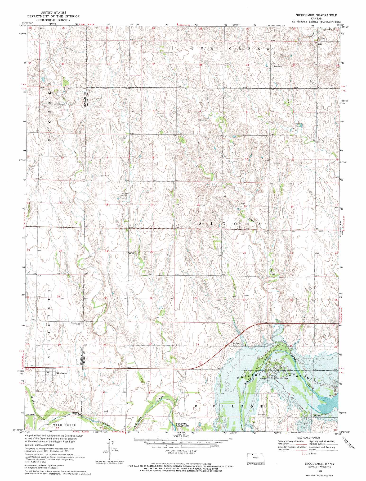
USGS Topo Quad 39099d5 - 1:24,000 scale
| Topo Map Name: | Nicodemus |
| USGS Topo Quad ID: | 39099d5 |
| Print Size: | ca. 21 1/4" wide x 27" high |
| Southeast Coordinates: | 39.375° N latitude / 99.5° W longitude |
| Map Center Coordinates: | 39.4375° N latitude / 99.5625° W longitude |
| U.S. State: | KS |
| Filename: | o39099d5.jpg |
| Download Map JPG Image: | Nicodemus topo map 1:24,000 scale |
| Map Type: | Topographic |
| Topo Series: | 7.5´ |
| Map Scale: | 1:24,000 |
| Source of Map Images: | United States Geological Survey (USGS) |
| Alternate Map Versions: |
Nicodemus KS 1969, updated 1971 Download PDF Buy paper map Nicodemus KS 2009 Download PDF Buy paper map Nicodemus KS 2012 Download PDF Buy paper map Nicodemus KS 2016 Download PDF Buy paper map |
1:24,000 Topo Quads surrounding Nicodemus
Edmond |
Densmore |
Logan |
Speed |
Phillipsburg South |
Edmond Se |
Logan Sw |
Logan Se |
Glade Sw |
Glade Se |
Hill City North |
Bogue Nw |
Nicodemus |
Webster Dam |
Stockton |
Hill City South |
Bogue |
Palco |
Stockton Sw |
Stockton Se |
Togo |
Hill City 4 Nw |
Wild Horse Creek |
Zurich |
Plainville |
> Back to 39099a1 at 1:100,000 scale
> Back to 39098a1 at 1:250,000 scale
> Back to U.S. Topo Maps home
Nicodemus topo map: Gazetteer
Nicodemus: Oilfields
La Sage Oil Field elevation 648m 2125′Nicodemus: Parks
Webster Wildlife Area elevation 579m 1899′Nicodemus: Populated Places
Nicodemus elevation 616m 2020′Nicodemus: Reservoirs
Webster Reservoir elevation 579m 1899′Nicodemus: Streams
Slate Creek elevation 579m 1899′Spring Creek elevation 597m 1958′
Nicodemus digital topo map on disk
Buy this Nicodemus topo map showing relief, roads, GPS coordinates and other geographical features, as a high-resolution digital map file on DVD: