Edmond Se Topo Map Kansas
To zoom in, hover over the map of Edmond Se
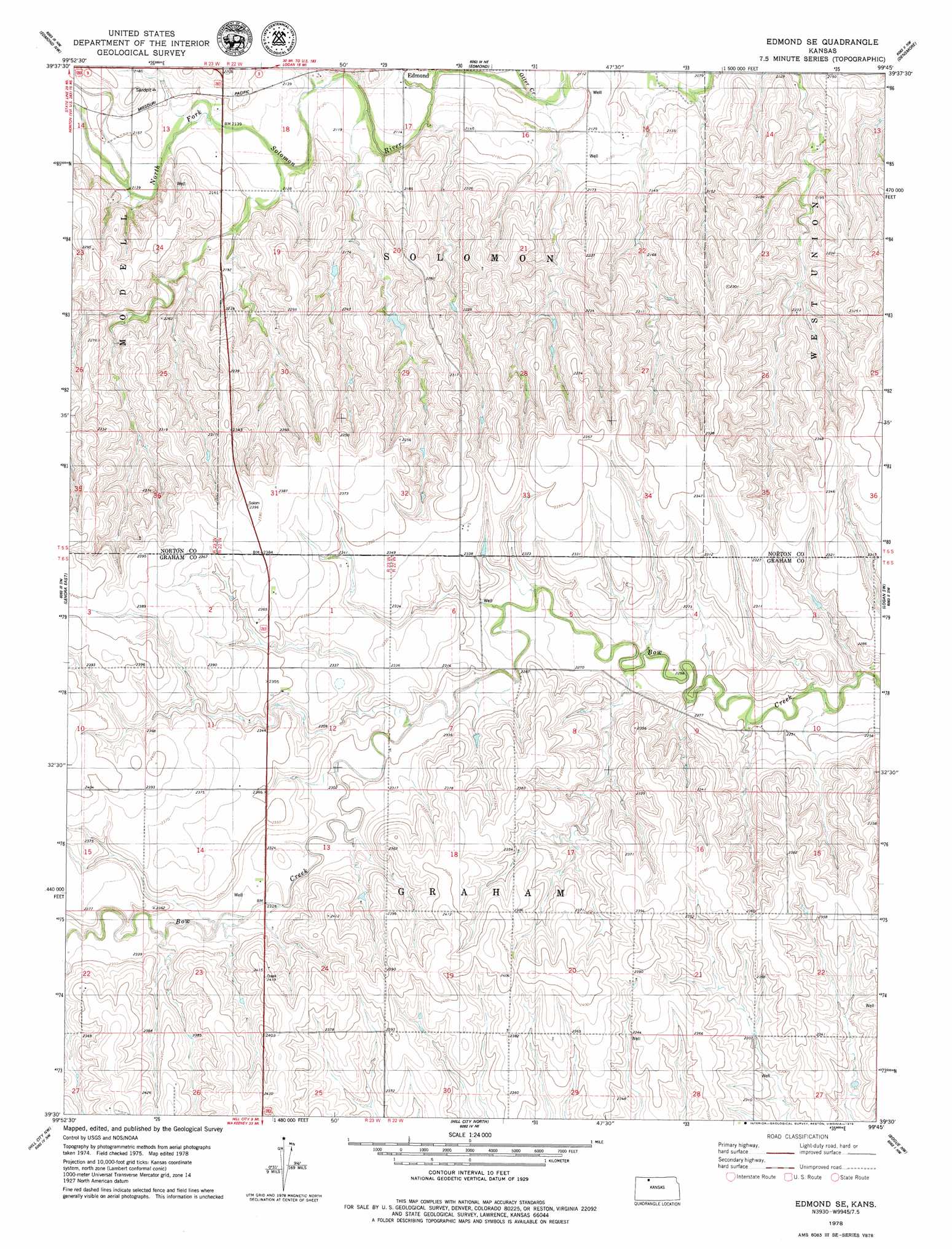
USGS Topo Quad 39099e7 - 1:24,000 scale
| Topo Map Name: | Edmond Se |
| USGS Topo Quad ID: | 39099e7 |
| Print Size: | ca. 21 1/4" wide x 27" high |
| Southeast Coordinates: | 39.5° N latitude / 99.75° W longitude |
| Map Center Coordinates: | 39.5625° N latitude / 99.8125° W longitude |
| U.S. State: | KS |
| Filename: | o39099e7.jpg |
| Download Map JPG Image: | Edmond Se topo map 1:24,000 scale |
| Map Type: | Topographic |
| Topo Series: | 7.5´ |
| Map Scale: | 1:24,000 |
| Source of Map Images: | United States Geological Survey (USGS) |
| Alternate Map Versions: |
Edmond SE KS 1978, updated 1979 Download PDF Buy paper map Edmond SE KS 2009 Download PDF Buy paper map Edmond SE KS 2012 Download PDF Buy paper map Edmond SE KS 2015 Download PDF Buy paper map |
1:24,000 Topo Quads surrounding Edmond Se
Reager |
Norton |
Calvert |
Almena Sw |
Prairie View |
Clayton Ne |
Edmond Nw |
Edmond |
Densmore |
Logan |
Lenora West |
Lenora East |
Edmond Se |
Logan Sw |
Logan Se |
Morland Ne |
Hill City Nw |
Hill City North |
Bogue Nw |
Nicodemus |
Morland |
Penokee |
Hill City South |
Bogue |
Palco |
> Back to 39099e1 at 1:100,000 scale
> Back to 39098a1 at 1:250,000 scale
> Back to U.S. Topo Maps home
Edmond Se topo map: Gazetteer
Edmond Se: Streams
Otter Creek elevation 636m 2086′Sand Creek elevation 650m 2132′
Edmond Se digital topo map on disk
Buy this Edmond Se topo map showing relief, roads, GPS coordinates and other geographical features, as a high-resolution digital map file on DVD: