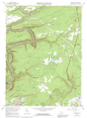
Christmans Topo Map Pennsylvania
To zoom in, hover over the map of Christmans
USGS Topo Quad 40075h6 - 1:24,000 scale
| Topo Map Name: | Christmans |
| USGS Topo Quad ID: | 40075h6 |
| Print Size: | ca. 21 1/4" wide x 27" high |
| Southeast Coordinates: | 40.875° N latitude / 75.625° W longitude |
| Map Center Coordinates: | 40.9375° N latitude / 75.6875° W longitude |
| U.S. State: | PA |
| Filename: | o40075h6.jpg |
| Download Map JPG Image: | Christmans topo map 1:24,000 scale |
| Map Type: | Topographic |
| Topo Series: | 7.5´ |
| Map Scale: | 1:24,000 |
| Source of Map Images: | United States Geological Survey (USGS) |
| Alternate Map Versions: |
Christmans PA 1960, updated 1962 Download PDF Buy paper map Christmans PA 1960, updated 1967 Download PDF Buy paper map Christmans PA 1960, updated 1972 Download PDF Buy paper map Christmans PA 1960, updated 1990 Download PDF Buy paper map Christmans PA 1960, updated 1992 Download PDF Buy paper map Christmans PA 1960, updated 1992 Download PDF Buy paper map Christmans PA 1997, updated 1999 Download PDF Buy paper map Christmans PA 2010 Download PDF Buy paper map Christmans PA 2013 Download PDF Buy paper map Christmans PA 2016 Download PDF Buy paper map |
1:24,000 Topo Quads surrounding Christmans
> Back to 40075e1 at 1:100,000 scale
> Back to 40074a1 at 1:250,000 scale
> Back to U.S. Topo Maps home
Christmans topo map: Gazetteer
Christmans: Airports
Penn Forest Heliport elevation 499m 1637′Christmans: Bends
Oxbow Bend elevation 216m 708′Christmans: Dams
Bear Creek Lake Dam elevation 501m 1643′Number One Dam elevation 276m 905′
Number Three Dam elevation 238m 780′
Number Three Dam elevation 282m 925′
Number Two Dam elevation 254m 833′
Christmans: Lakes
Little Beaver Lake elevation 486m 1594′Christmans: Parks
Lehigh Gorge State Park elevation 398m 1305′State Game Lands Number 141 elevation 470m 1541′
Christmans: Populated Places
Christmans elevation 472m 1548′Christmansville elevation 449m 1473′
Drakes Creek elevation 259m 849′
Jim Thorpe elevation 220m 721′
Leslie Run elevation 304m 997′
Mud Run elevation 316m 1036′
Penn Haven Junction elevation 218m 715′
Unionville elevation 475m 1558′
Christmans: Reservoirs
Bear Creek Lake elevation 501m 1643′Lehighton Reservoir elevation 281m 921′
Christmans: Springs
Penn Springs elevation 226m 741′Three O'Clock Spring (historical) elevation 470m 1541′
Christmans: Streams
Bear Creek elevation 197m 646′Black Creek elevation 260m 853′
Drakes Creek elevation 248m 813′
Leslie Run elevation 297m 974′
Little Bear Creek elevation 312m 1023′
Mud Run elevation 292m 958′
Penn Springs elevation 236m 774′
Stony Creek elevation 243m 797′
Yellow Run elevation 425m 1394′
Christmans: Summits
Bald Mountain elevation 489m 1604′Kettle Hill elevation 506m 1660′
Millstone Mountain elevation 543m 1781′
Pocono Mountain elevation 517m 1696′
Scrub Mountain elevation 543m 1781′
Summer Mountain elevation 515m 1689′
Christmans: Tunnels
Rockport Tunnel elevation 351m 1151′Christmans: Valleys
Butcher Hollow elevation 221m 725′Hinkles Valley elevation 266m 872′
Maple Hollow elevation 208m 682′
Tank Hollow elevation 256m 839′
Christmans digital topo map on disk
Buy this Christmans topo map showing relief, roads, GPS coordinates and other geographical features, as a high-resolution digital map file on DVD:
Atlantic Coast (NY, NJ, PA, DE, MD, VA, NC)
Buy digital topo maps: Atlantic Coast (NY, NJ, PA, DE, MD, VA, NC)


