Michigantown Topo Map Indiana
To zoom in, hover over the map of Michigantown
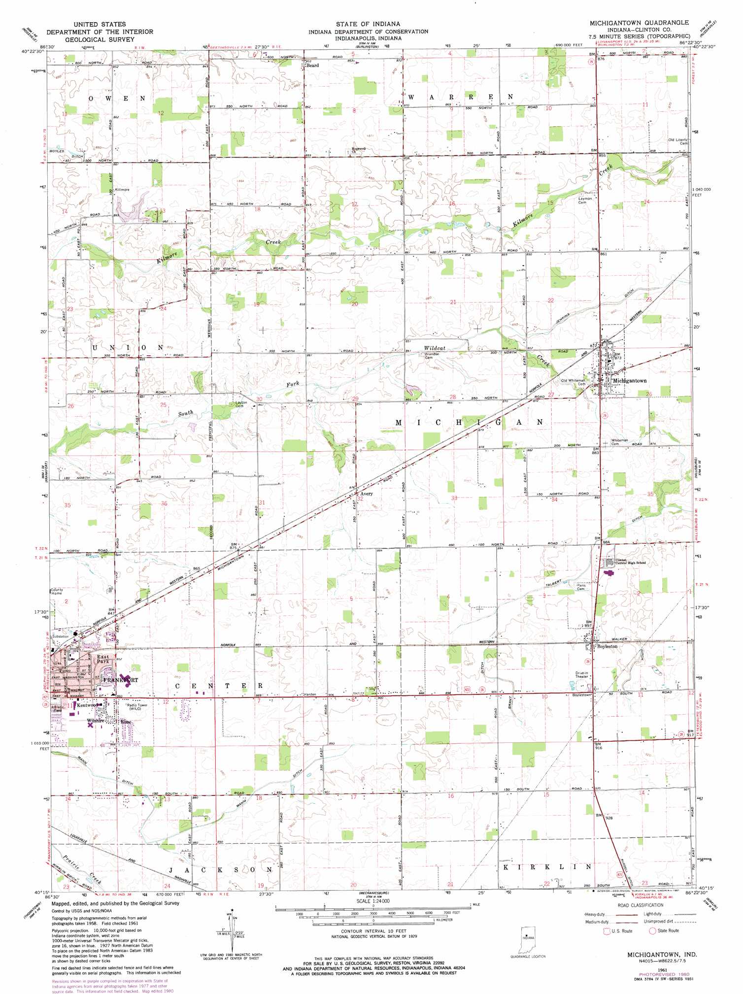
USGS Topo Quad 40086c4 - 1:24,000 scale
| Topo Map Name: | Michigantown |
| USGS Topo Quad ID: | 40086c4 |
| Print Size: | ca. 21 1/4" wide x 27" high |
| Southeast Coordinates: | 40.25° N latitude / 86.375° W longitude |
| Map Center Coordinates: | 40.3125° N latitude / 86.4375° W longitude |
| U.S. State: | IN |
| Filename: | o40086c4.jpg |
| Download Map JPG Image: | Michigantown topo map 1:24,000 scale |
| Map Type: | Topographic |
| Topo Series: | 7.5´ |
| Map Scale: | 1:24,000 |
| Source of Map Images: | United States Geological Survey (USGS) |
| Alternate Map Versions: |
Michigantown IN 1961, updated 1962 Download PDF Buy paper map Michigantown IN 1961, updated 1981 Download PDF Buy paper map Michigantown IN 2010 Download PDF Buy paper map Michigantown IN 2013 Download PDF Buy paper map Michigantown IN 2016 Download PDF Buy paper map |
1:24,000 Topo Quads surrounding Michigantown
Delphi |
Flora |
Deer Creek |
Young America |
Galveston |
Pyrmont |
Rossville |
Burlington |
Russiaville |
Kokomo West |
Mulberry |
Frankfort |
Michigantown |
Hillisburg |
Kempton |
Colfax |
Thorntown |
Mechanicsburg |
Kirklin |
Sheridan |
Shannondale |
Hazelrigg |
Lebanon |
Rosston |
Westfield |
> Back to 40086a1 at 1:100,000 scale
> Back to 40086a1 at 1:250,000 scale
> Back to U.S. Topo Maps home
Michigantown topo map: Gazetteer
Michigantown: Canals
Brant Ditch elevation 274m 898′Jenkins Ditch elevation 261m 856′
Mann Ditch elevation 266m 872′
Talbert Ditch elevation 269m 882′
Walker Ditch elevation 275m 902′
Michigantown: Dams
Little Lakes Estates Dam elevation 259m 849′Michigantown: Populated Places
Avery elevation 268m 879′Beard elevation 259m 849′
Boyleston elevation 276m 905′
East Park elevation 261m 856′
Kentwood elevation 263m 862′
Michigantown elevation 267m 875′
Risse elevation 263m 862′
Wilshire elevation 262m 859′
Michigantown: Reservoirs
Little Lake elevation 259m 849′Michigantown digital topo map on disk
Buy this Michigantown topo map showing relief, roads, GPS coordinates and other geographical features, as a high-resolution digital map file on DVD:
Northern Illinois, Northern Indiana & Southwestern Michigan
Buy digital topo maps: Northern Illinois, Northern Indiana & Southwestern Michigan