Shippee Topo Map Nebraska
To zoom in, hover over the map of Shippee
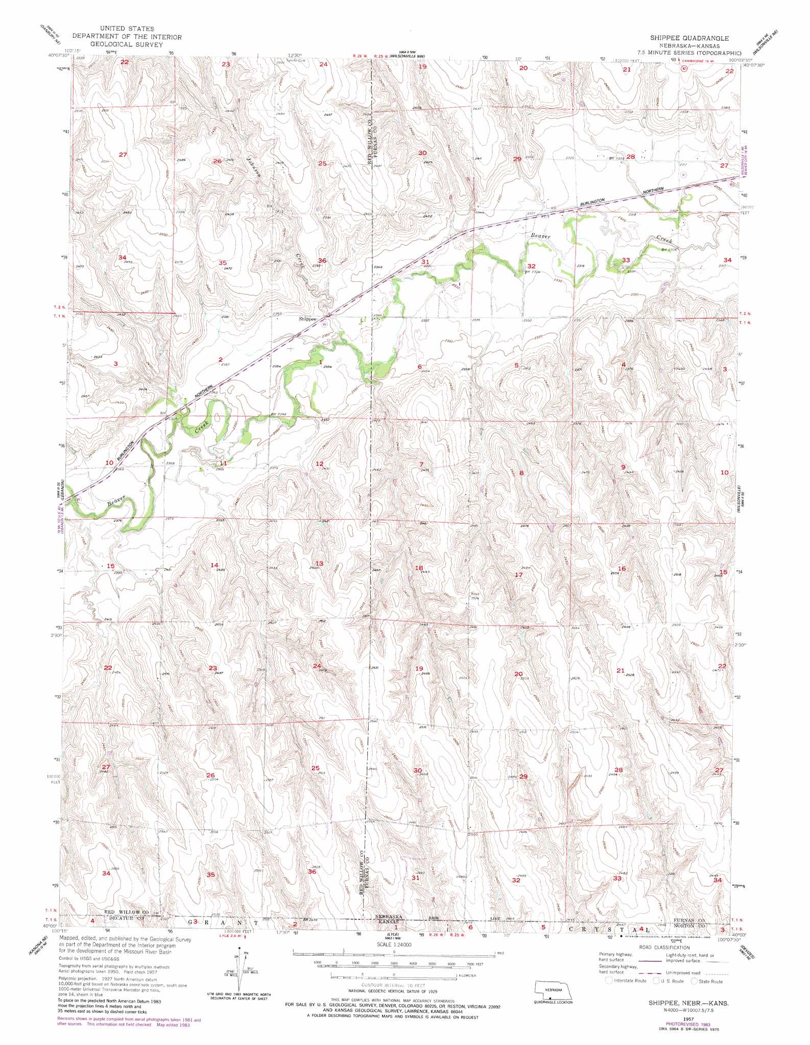
USGS Topo Quad 40100a2 - 1:24,000 scale
| Topo Map Name: | Shippee |
| USGS Topo Quad ID: | 40100a2 |
| Print Size: | ca. 21 1/4" wide x 27" high |
| Southeast Coordinates: | 40° N latitude / 100.125° W longitude |
| Map Center Coordinates: | 40.0625° N latitude / 100.1875° W longitude |
| U.S. States: | NE, KS |
| Filename: | O40100a2.jpg |
| Download Map JPG Image: | Shippee topo map 1:24,000 scale |
| Map Type: | Topographic |
| Topo Series: | 7.5´ |
| Map Scale: | 1:24,000 |
| Source of Map Images: | United States Geological Survey (USGS) |
| Alternate Map Versions: |
Shippee NE 1957, updated 1958 Download PDF Buy paper map Shippee NE 1957, updated 1983 Download PDF Buy paper map Shippee NE 2011 Download PDF Buy paper map Shippee NE 2014 Download PDF Buy paper map |
1:24,000 Topo Quads surrounding Shippee
Bartley Sw |
Bartley |
Cambridge |
Holbrook |
Arapahoe |
Indianola |
Danbury Ne |
Wilsonville Nw |
Wilsonville Ne |
Hendley |
Danbury |
Lebanon |
Shippee |
Wilsonville |
Beaver City Sw |
Kanona Nw |
Kanona Ne |
Lyle |
Devizes |
Norton Nw |
Kanona |
Kanona Se |
Norcatur |
Reager |
Norton |
> Back to 40100a1 at 1:100,000 scale
> Back to 40100a1 at 1:250,000 scale
> Back to U.S. Topo Maps home
Shippee topo map: Gazetteer
Shippee: Populated Places
Shippee elevation 738m 2421′Shippee: Post Offices
Shippee Post Office (historical) elevation 738m 2421′Shippee: Streams
Johnson Creek elevation 758m 2486′Shippee digital topo map on disk
Buy this Shippee topo map showing relief, roads, GPS coordinates and other geographical features, as a high-resolution digital map file on DVD: