Burger Canyon East Topo Map Nebraska
To zoom in, hover over the map of Burger Canyon East
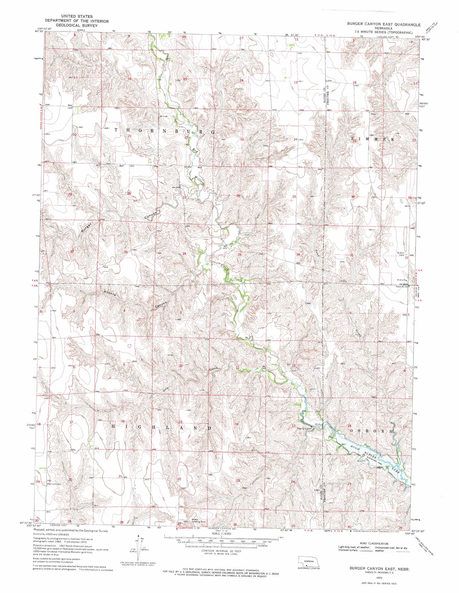
USGS Topo Quad 40100d7 - 1:24,000 scale
| Topo Map Name: | Burger Canyon East |
| USGS Topo Quad ID: | 40100d7 |
| Print Size: | ca. 21 1/4" wide x 27" high |
| Southeast Coordinates: | 40.375° N latitude / 100.75° W longitude |
| Map Center Coordinates: | 40.4375° N latitude / 100.8125° W longitude |
| U.S. State: | NE |
| Filename: | O40100d7.jpg |
| Download Map JPG Image: | Burger Canyon East topo map 1:24,000 scale |
| Map Type: | Topographic |
| Topo Series: | 7.5´ |
| Map Scale: | 1:24,000 |
| Source of Map Images: | United States Geological Survey (USGS) |
| Alternate Map Versions: |
Burger Canyon East NE 1970, updated 1975 Download PDF Buy paper map Burger Canyon East NE 2011 Download PDF Buy paper map Burger Canyon East NE 2014 Download PDF Buy paper map |
1:24,000 Topo Quads surrounding Burger Canyon East
Suttlers Canyon West |
Suttlers Canyon East |
Camp Hayes Lake Ne |
Curtis Nw |
Curtis |
Hayes Center |
Camp Hayes Lake |
Camp Hayes Lake Se |
Curtis Sw |
Curtis Se |
Palisade Ne |
Burger Canyon West |
Burger Canyon East |
Quick |
Quick Ne |
Palisade |
Beverly |
Burger Canyon Se |
Red Willow Dam |
Quick Se |
Trenton |
Culbertson Nw |
Culbertson |
Mccook West |
Mccook East |
> Back to 40100a1 at 1:100,000 scale
> Back to 40100a1 at 1:250,000 scale
> Back to U.S. Topo Maps home
Burger Canyon East topo map: Gazetteer
Burger Canyon East: Airports
Beebe Airport elevation 873m 2864′Burger Canyon East: Post Offices
Saint Ann Post Office (historical) elevation 869m 2851′Burger Canyon East: Streams
Dry Creek elevation 798m 2618′Sand Creek elevation 791m 2595′
Burger Canyon East: Valleys
Burger Canyon elevation 817m 2680′Kucera Canyon elevation 812m 2664′
Burger Canyon East digital topo map on disk
Buy this Burger Canyon East topo map showing relief, roads, GPS coordinates and other geographical features, as a high-resolution digital map file on DVD: