Max Topo Map Nebraska
To zoom in, hover over the map of Max
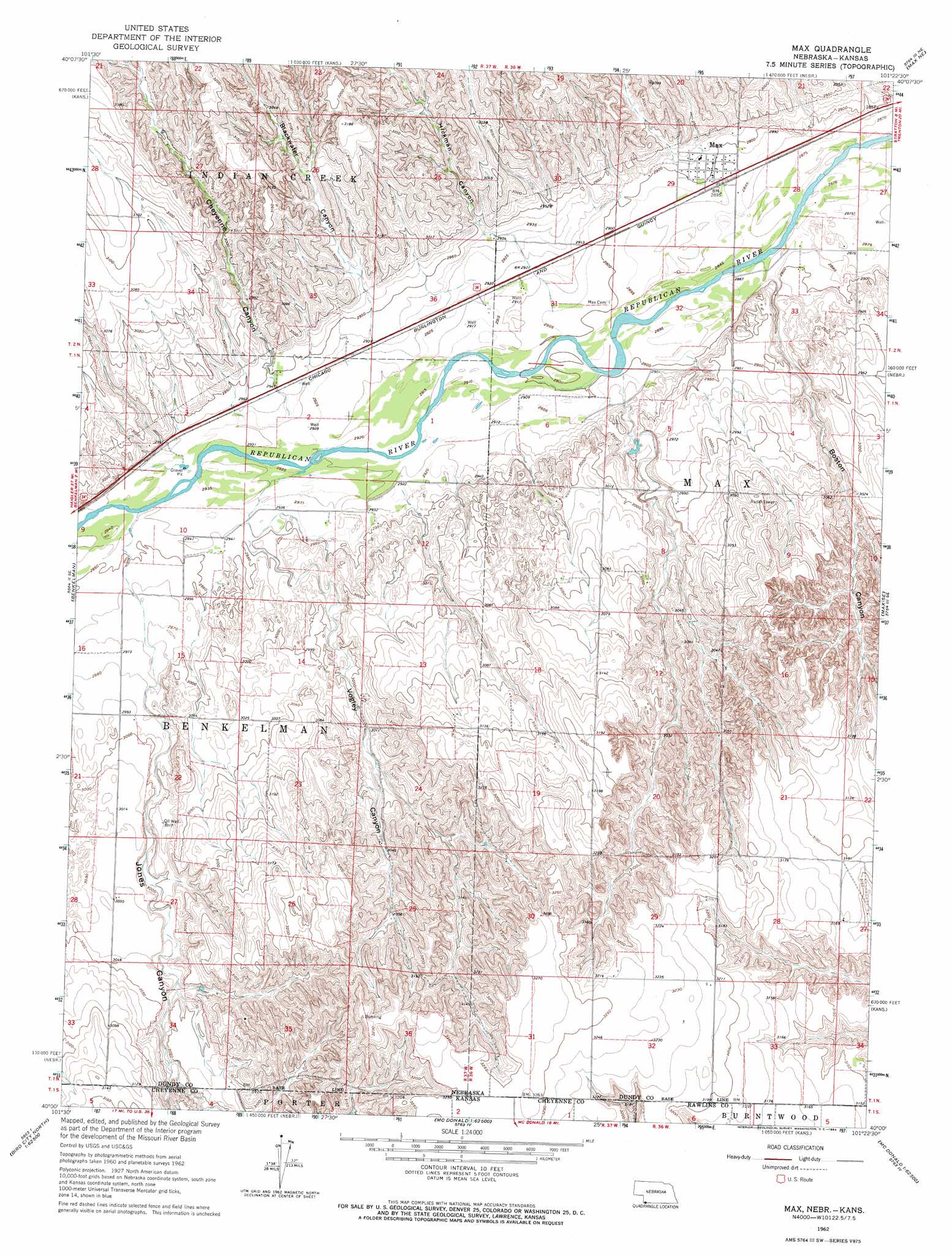
USGS Topo Quad 40101a4 - 1:24,000 scale
| Topo Map Name: | Max |
| USGS Topo Quad ID: | 40101a4 |
| Print Size: | ca. 21 1/4" wide x 27" high |
| Southeast Coordinates: | 40° N latitude / 101.375° W longitude |
| Map Center Coordinates: | 40.0625° N latitude / 101.4375° W longitude |
| U.S. States: | NE, KS |
| Filename: | O40101a4.jpg |
| Download Map JPG Image: | Max topo map 1:24,000 scale |
| Map Type: | Topographic |
| Topo Series: | 7.5´ |
| Map Scale: | 1:24,000 |
| Source of Map Images: | United States Geological Survey (USGS) |
| Alternate Map Versions: |
Max NE 1962, updated 1964 Download PDF Buy paper map Max NE 2011 Download PDF Buy paper map Max NE 2014 Download PDF Buy paper map |
1:24,000 Topo Quads surrounding Max
Champion Sw |
Ough |
Wauneta Sw |
Wauneta Se |
Palisade Sw |
Benkelman Nw |
Arrowhead Lake |
Rock Canyon |
Max Ne |
Stratton |
Parks |
Benkelman |
Max |
Max Se |
Trenton Sw |
Heinzelman Canyon |
Henkle Canyon |
Mcdonald Nw |
Mcdonald Ne |
Atwood Nw |
Wheeler |
Bird City North |
Mcdonald Sw |
Mcdonald |
Beardsley |
> Back to 40101a1 at 1:100,000 scale
> Back to 40100a1 at 1:250,000 scale
> Back to U.S. Topo Maps home
Max topo map: Gazetteer
Max: Populated Places
Max elevation 884m 2900′Max: Post Offices
Max Post Office elevation 884m 2900′Max: Streams
Jones Canyon Creek elevation 896m 2939′Max: Valleys
Blackwater Canyon elevation 903m 2962′Boston Canyon elevation 880m 2887′
Cheyenne Canyon elevation 902m 2959′
Hickman Canyon elevation 895m 2936′
Jones Canyon elevation 907m 2975′
Jones Canyon elevation 908m 2979′
Vogley Canyon elevation 899m 2949′
Max digital topo map on disk
Buy this Max topo map showing relief, roads, GPS coordinates and other geographical features, as a high-resolution digital map file on DVD: