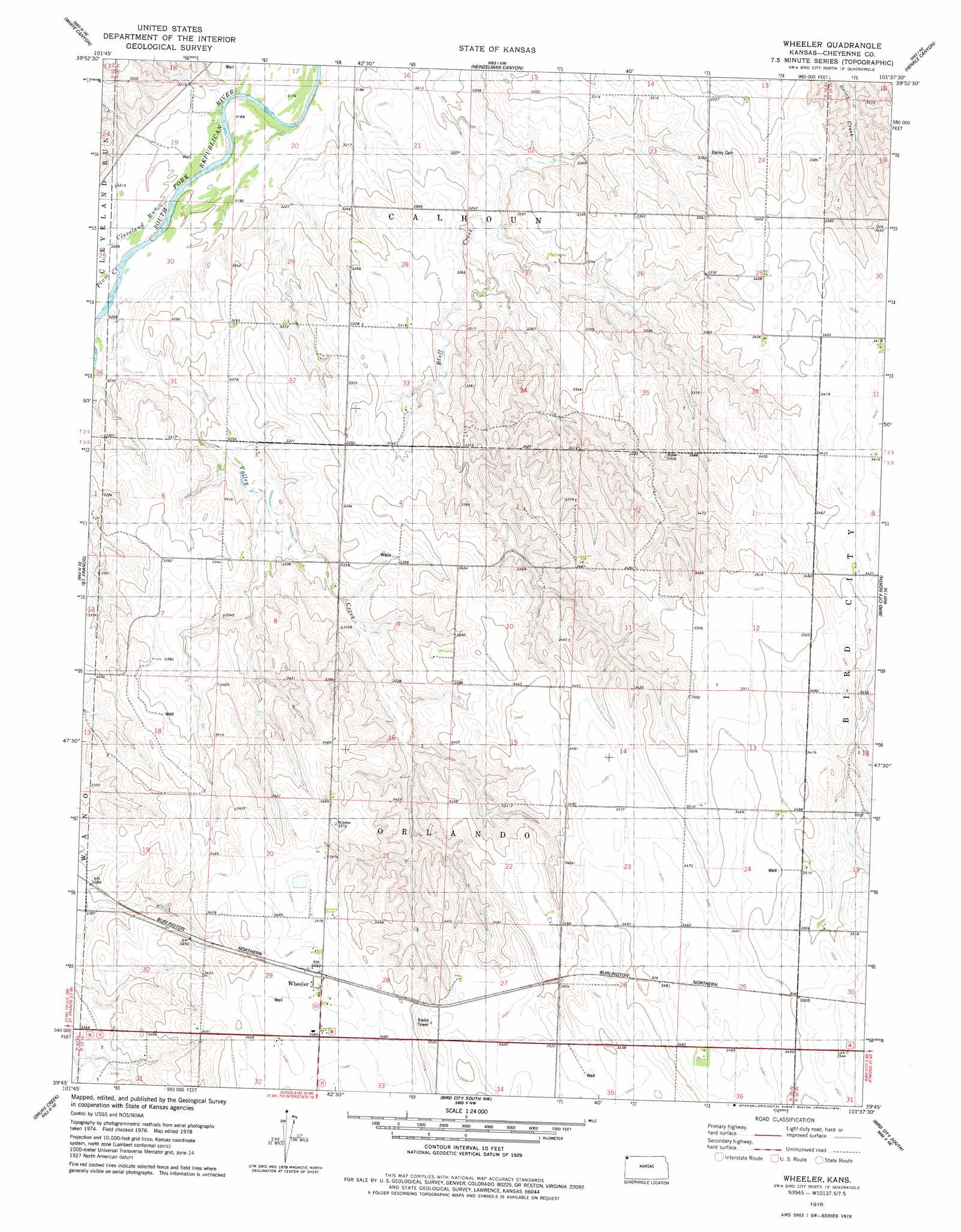
Wheeler Topo Map Kansas
To zoom in, hover over the map of Wheeler
USGS Topo Quad 39101g6 - 1:24,000 scale
| Topo Map Name: | Wheeler |
| USGS Topo Quad ID: | 39101g6 |
| Print Size: | ca. 21 1/4" wide x 27" high |
| Southeast Coordinates: | 39.75° N latitude / 101.625° W longitude |
| Map Center Coordinates: | 39.8125° N latitude / 101.6875° W longitude |
| U.S. State: | KS |
| Filename: | o39101g6.jpg |
| Download Map JPG Image: | Wheeler topo map 1:24,000 scale |
| Map Type: | Topographic |
| Topo Series: | 7.5´ |
| Map Scale: | 1:24,000 |
| Source of Map Images: | United States Geological Survey (USGS) |
| Alternate Map Versions: |
Wheeler KS 1978, updated 1978 Download PDF Buy paper map Wheeler KS 2009 Download PDF Buy paper map Wheeler KS 2012 Download PDF Buy paper map Wheeler KS 2015 Download PDF Buy paper map |
1:24,000 Topo Quads surrounding Wheeler
Haigler |
Rock Creek Lake |
Parks |
Benkelman |
Max |
Saint Francis Nw |
White Canyon |
Heinzelman Canyon |
Henkle Canyon |
Mcdonald Nw |
Saint Francis Sw |
Saint Francis |
Wheeler |
Bird City North |
Mcdonald Sw |
Crosby Creek |
Drury Creek |
Bird City South Nw |
Bird City South |
Dewey Ranch Nw |
Saint Francis 3 Sw |
Saint Francis 3 Se |
Bird City South Sw |
Bird City South Se |
Dewey Ranch Sw |
> Back to 39101e1 at 1:100,000 scale
> Back to 39100a1 at 1:250,000 scale
> Back to U.S. Topo Maps home
Wheeler topo map: Gazetteer
Wheeler: Lakes
Beaumaster Pond (historical) elevation 990m 3248′Leach Pond elevation 1049m 3441′
Wheeler: Populated Places
Wheeler elevation 1062m 3484′Wheeler: Streams
Cleveland Run elevation 977m 3205′Plum Creek elevation 978m 3208′
Valley Creek elevation 978m 3208′
Wheeler digital topo map on disk
Buy this Wheeler topo map showing relief, roads, GPS coordinates and other geographical features, as a high-resolution digital map file on DVD: