Sterling North Topo Map Colorado
To zoom in, hover over the map of Sterling North
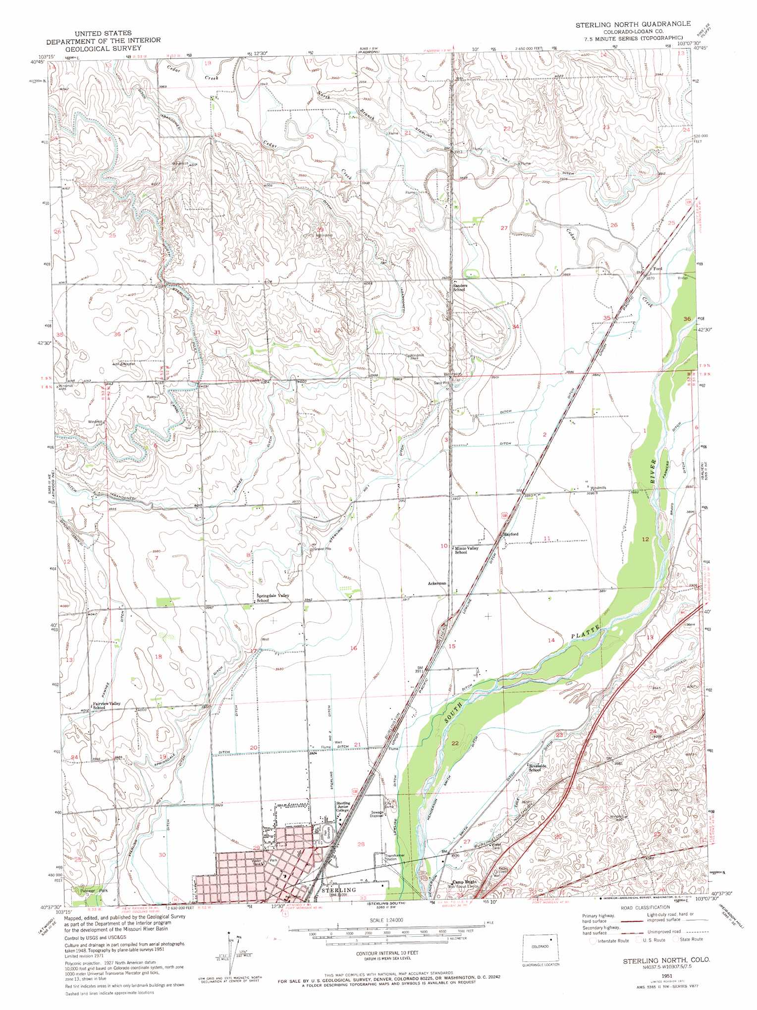
USGS Topo Quad 40103f2 - 1:24,000 scale
| Topo Map Name: | Sterling North |
| USGS Topo Quad ID: | 40103f2 |
| Print Size: | ca. 21 1/4" wide x 27" high |
| Southeast Coordinates: | 40.625° N latitude / 103.125° W longitude |
| Map Center Coordinates: | 40.6875° N latitude / 103.1875° W longitude |
| U.S. State: | CO |
| Filename: | o40103f2.jpg |
| Download Map JPG Image: | Sterling North topo map 1:24,000 scale |
| Map Type: | Topographic |
| Topo Series: | 7.5´ |
| Map Scale: | 1:24,000 |
| Source of Map Images: | United States Geological Survey (USGS) |
| Alternate Map Versions: |
Sterling North CO 1951, updated 1952 Download PDF Buy paper map Sterling North CO 1951, updated 1971 Download PDF Buy paper map Sterling North CO 1951, updated 1972 Download PDF Buy paper map Sterling North CO 2010 Download PDF Buy paper map Sterling North CO 2013 Download PDF Buy paper map Sterling North CO 2016 Download PDF Buy paper map |
1:24,000 Topo Quads surrounding Sterling North
Chimney Canyons |
Kirchnavy Butte |
Padroni Nw |
Peetz |
Haystack Butte |
Westplains |
North Sterling Reservoir |
Padroni |
Iliff |
Proctor |
Wild Horse Lake |
Atwood Ne |
Sterling North |
Galien |
Uhler Ranch |
Willard |
Atwood |
Sterling South |
Reiradon Hill |
Leroy |
Messex |
Merino |
Buffalo Springs Ranch Nw |
Buffalo Springs Ranch Ne |
Glacken Hill |
> Back to 40103e1 at 1:100,000 scale
> Back to 40102a1 at 1:250,000 scale
> Back to U.S. Topo Maps home
Sterling North topo map: Gazetteer
Sterling North: Canals
Cole Ditch elevation 1196m 3923′Henderson Smith Ditch elevation 1193m 3914′
Lowline Ditch elevation 1193m 3914′
Springdale Ditch elevation 1214m 3982′
Sterling Lateral Number 1 elevation 1199m 3933′
Sterling Number 2 Ditch elevation 1196m 3923′
Sterling North: Dams
C A Sherwin Number 1 Dam elevation 1199m 3933′C A Sherwin Number 2 Dam elevation 1203m 3946′
Sterling North: Parks
Pioneer Park elevation 1217m 3992′Sterling North: Populated Places
Sterling elevation 1200m 3937′Sterling North: Reservoirs
C A Sherwin Reservoir Number 1 elevation 1199m 3933′C A Sherwin Reservoir Number 2 elevation 1203m 3946′
Sterling North: Streams
Cedar Creek elevation 1177m 3861′North Branch Cedar Creek elevation 1191m 3907′
Sterling North digital topo map on disk
Buy this Sterling North topo map showing relief, roads, GPS coordinates and other geographical features, as a high-resolution digital map file on DVD: