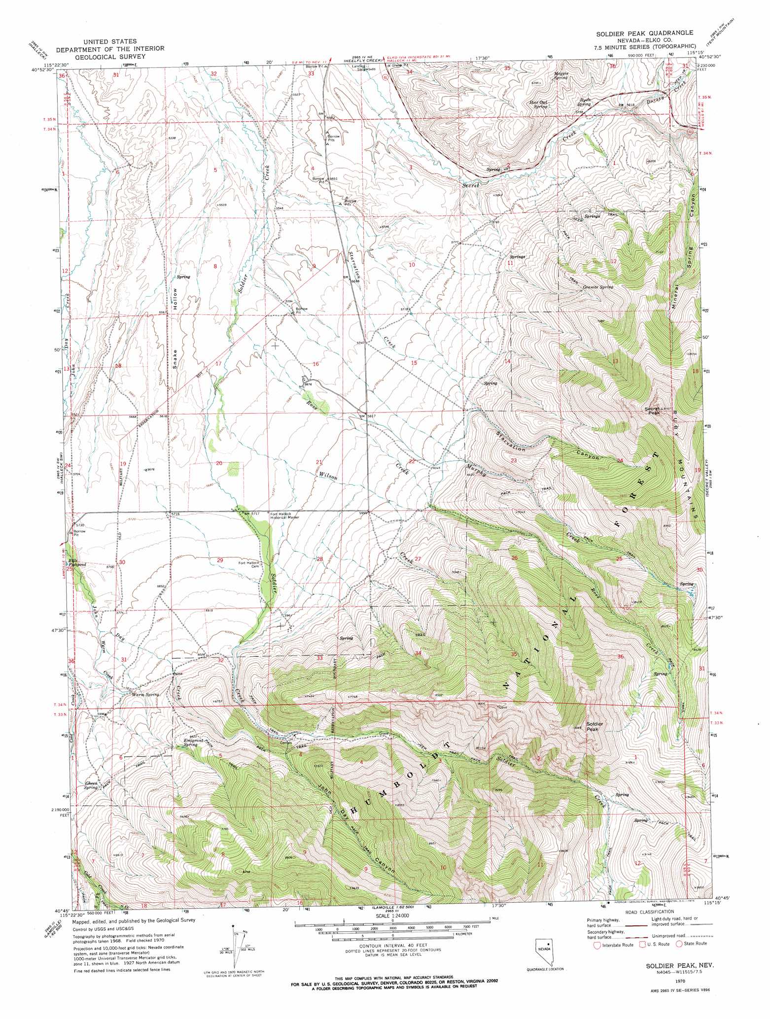
Soldier Peak Topo Map Nevada
To zoom in, hover over the map of Soldier Peak
USGS Topo Quad 40115g3 - 1:24,000 scale
| Topo Map Name: | Soldier Peak |
| USGS Topo Quad ID: | 40115g3 |
| Print Size: | ca. 21 1/4" wide x 27" high |
| Southeast Coordinates: | 40.75° N latitude / 115.25° W longitude |
| Map Center Coordinates: | 40.8125° N latitude / 115.3125° W longitude |
| U.S. State: | NV |
| Filename: | o40115g3.jpg |
| Download Map JPG Image: | Soldier Peak topo map 1:24,000 scale |
| Map Type: | Topographic |
| Topo Series: | 7.5´ |
| Map Scale: | 1:24,000 |
| Source of Map Images: | United States Geological Survey (USGS) |
| Alternate Map Versions: |
Soldier Peak NV 1970, updated 1973 Download PDF Buy paper map Soldier Peak NV 2012 Download PDF Buy paper map Soldier Peak NV 2014 Download PDF Buy paper map |
| FStopo: | US Forest Service topo Soldier Peak is available: Download FStopo PDF Download FStopo TIF |
1:24,000 Topo Quads surrounding Soldier Peak
Coal Mine Canyon Se |
Morgan Hill |
Deeth |
Herder Creek |
Welcome |
Ryndon |
Halleck |
Heelfly Creek |
Tent Mountain |
Humboldt Peak |
Boyd Reservoir |
Halleck Sw |
Soldier Peak |
Secret Valley |
Gordon Creek |
Noon Rock |
Lamoille |
Verdi Peak |
Ruby City Creek |
Arizona Spring |
Lee |
Ruby Dome |
Ruby Valley School |
Smith Well |
Valley Mountain |
> Back to 40115e1 at 1:100,000 scale
> Back to 40114a1 at 1:250,000 scale
> Back to U.S. Topo Maps home
Soldier Peak topo map: Gazetteer
Soldier Peak: Parks
Fort Halleck Historical Marker elevation 1751m 5744′Soldier Peak: Post Offices
Fort Halleck Post Office (historical) elevation 1756m 5761′Soldier Peak: Springs
Emigrant Spring elevation 1989m 6525′Gheen Spring elevation 1916m 6286′
Granite Spring elevation 2011m 6597′
Hoot Owl Spring elevation 1822m 5977′
Magpie Spring elevation 1902m 6240′
Ryan Spring elevation 1764m 5787′
Warm Spring elevation 1817m 5961′
Soldier Peak: Streams
Campbell Creek elevation 1939m 6361′Dorsey Creek elevation 1762m 5780′
Middle Fork Cold Creek elevation 1985m 6512′
Mineral Springs Creek elevation 1788m 5866′
Murphy Creek elevation 1755m 5757′
North Fork Cold Creek elevation 1985m 6512′
Ross Creek elevation 1695m 5561′
South Fork Cold Creek elevation 1961m 6433′
Starvation Creek elevation 1669m 5475′
Warm Creek elevation 1767m 5797′
Wilson Creek elevation 1708m 5603′
Soldier Peak: Summits
Secret Peak elevation 2772m 9094′Soldier Peak elevation 3072m 10078′
Soldier Peak: Valleys
John Day Canyon elevation 1956m 6417′Mineral Spring Canyon elevation 1779m 5836′
Secret Canyon elevation 1771m 5810′
Snake Hollow elevation 1685m 5528′
Starvation Canyon elevation 1859m 6099′
Soldier Peak digital topo map on disk
Buy this Soldier Peak topo map showing relief, roads, GPS coordinates and other geographical features, as a high-resolution digital map file on DVD: