Home Station Ranch Topo Map Nevada
To zoom in, hover over the map of Home Station Ranch
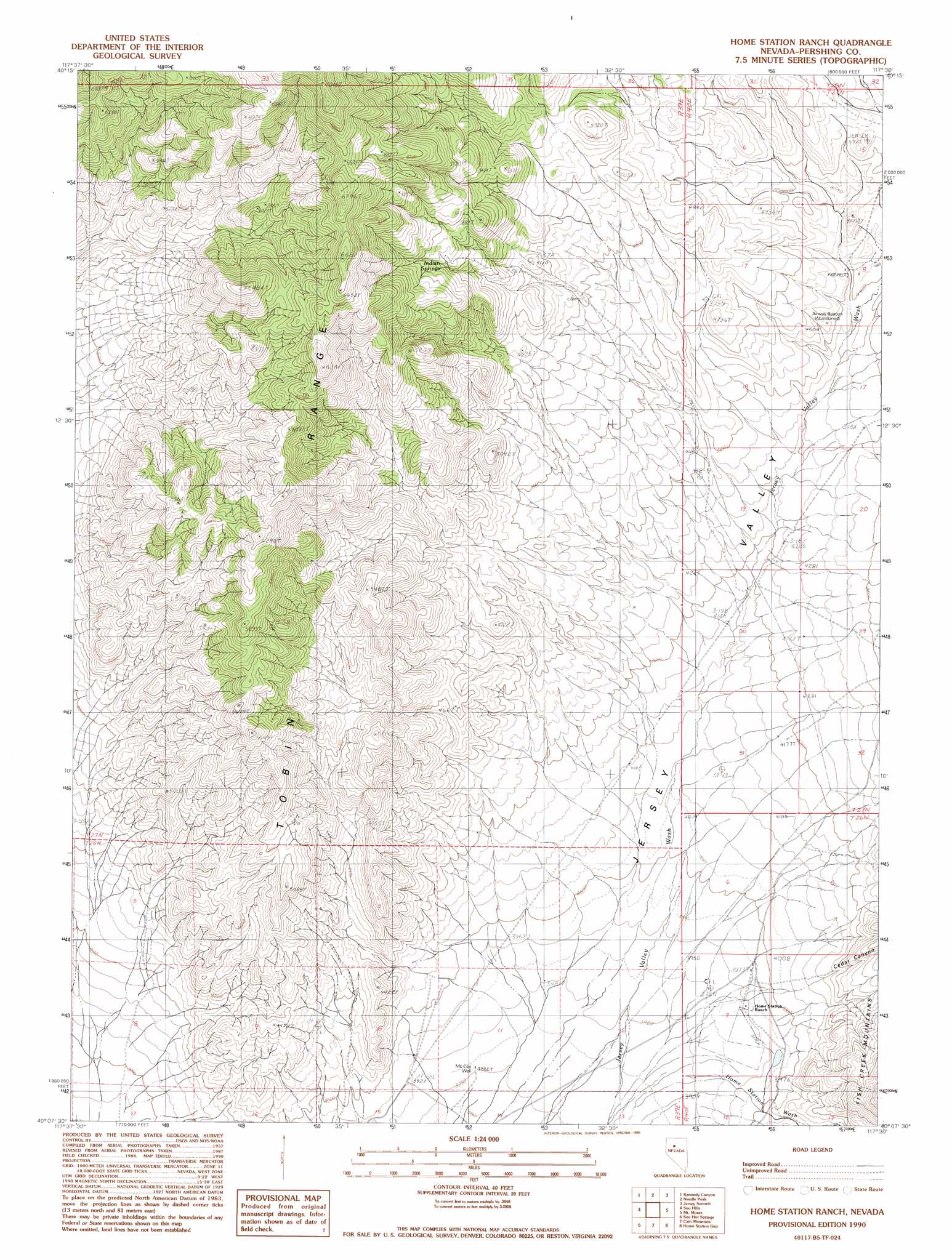
USGS Topo Quad 40117b5 - 1:24,000 scale
| Topo Map Name: | Home Station Ranch |
| USGS Topo Quad ID: | 40117b5 |
| Print Size: | ca. 21 1/4" wide x 27" high |
| Southeast Coordinates: | 40.125° N latitude / 117.5° W longitude |
| Map Center Coordinates: | 40.1875° N latitude / 117.5625° W longitude |
| U.S. State: | NV |
| Filename: | o40117b5.jpg |
| Download Map JPG Image: | Home Station Ranch topo map 1:24,000 scale |
| Map Type: | Topographic |
| Topo Series: | 7.5´ |
| Map Scale: | 1:24,000 |
| Source of Map Images: | United States Geological Survey (USGS) |
| Alternate Map Versions: |
Home Station Ranch NV 1990, updated 1990 Download PDF Buy paper map Home Station Ranch NV 2011 Download PDF Buy paper map Home Station Ranch NV 2014 Download PDF Buy paper map |
1:24,000 Topo Quads surrounding Home Station Ranch
Bartomes Spring |
Goldbanks Hills |
Mount Tobin |
Buffalo Springs |
Buffalo Springs Ne |
Granite Mountain |
Kennedy Canyon |
Needle Peak |
Jersey Summit |
Wild Range Canyon |
Mckinney Pass |
Sou Hills |
Home Station Ranch |
Mount Moses |
Fish Creek Basin |
Fencemaker Pass |
Sou Hot Springs |
Cain Mountain |
Home Station Gap |
Mount Moses Se |
Boyer Ranch |
Hole In The Wall |
Shoshone Meadows Ne |
Gilbert Creek Nw |
Gilbert Creek Ne |
> Back to 40117a1 at 1:100,000 scale
> Back to 40116a1 at 1:250,000 scale
> Back to U.S. Topo Maps home
Home Station Ranch topo map: Gazetteer
Home Station Ranch: Mines
Southern Zeolite Mine elevation 1362m 4468′Home Station Ranch: Springs
Indian Springs elevation 1661m 5449′Home Station Ranch: Streams
Home Station Wash elevation 1199m 3933′Jersey Creek Wash elevation 1214m 3982′
Home Station Ranch: Valleys
Cedar Canyon elevation 1248m 4094′Home Station Ranch: Wells
McCoy Well elevation 1185m 3887′Home Station Ranch digital topo map on disk
Buy this Home Station Ranch topo map showing relief, roads, GPS coordinates and other geographical features, as a high-resolution digital map file on DVD: