Dead Horse Canyon Ne Topo Map Nevada
To zoom in, hover over the map of Dead Horse Canyon Ne
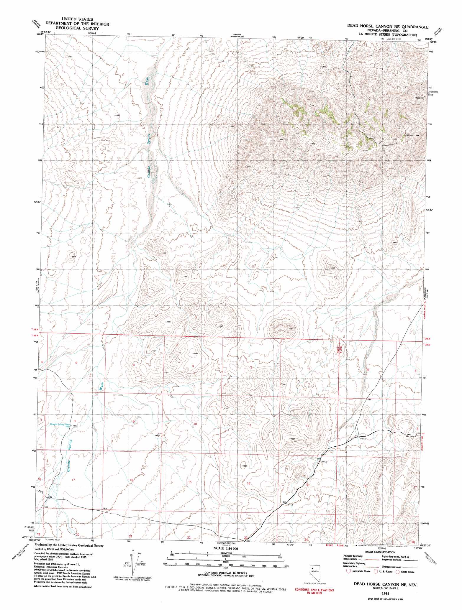
USGS Topo Quad 40118f7 - 1:24,000 scale
| Topo Map Name: | Dead Horse Canyon Ne |
| USGS Topo Quad ID: | 40118f7 |
| Print Size: | ca. 21 1/4" wide x 27" high |
| Southeast Coordinates: | 40.625° N latitude / 118.75° W longitude |
| Map Center Coordinates: | 40.6875° N latitude / 118.8125° W longitude |
| U.S. State: | NV |
| Filename: | o40118f7.jpg |
| Download Map JPG Image: | Dead Horse Canyon Ne topo map 1:24,000 scale |
| Map Type: | Topographic |
| Topo Series: | 7.5´ |
| Map Scale: | 1:24,000 |
| Source of Map Images: | United States Geological Survey (USGS) |
| Alternate Map Versions: |
Dead Horse Canyon NE NV 1981, updated 1981 Download PDF Buy paper map Dead Horse Canyon NE NV 1981, updated 1984 Download PDF Buy paper map Dead Horse Canyon NE NV 2011 Download PDF Buy paper map Dead Horse Canyon NE NV 2014 Download PDF Buy paper map |
1:24,000 Topo Quads surrounding Dead Horse Canyon Ne
Black Rock Point West |
Black Rock Point East |
Rabbithole Ne |
Floka |
Sugarloaf Knob |
Trego Hot Springs |
Cholona |
Rabbithole |
Sulphur |
Sawtooth Knob |
Dry Mountain |
Sheep Spring |
Dead Horse Canyon Ne |
Placerites |
Scossa |
Eagle Rock Spring |
Dead Horse Canyon |
Juniper Canyon |
Rocky Canyon |
Poker Brown Gap |
Twin Buttes Well |
Seven Troughs Nw |
Seven Troughs |
Trinity Pass Nw |
Natchez Spring |
> Back to 40118e1 at 1:100,000 scale
> Back to 40118a1 at 1:250,000 scale
> Back to U.S. Topo Maps home
Dead Horse Canyon Ne topo map: Gazetteer
Dead Horse Canyon Ne: Wells
Granite Spring Wash Well elevation 1423m 4668′Dead Horse Canyon Ne digital topo map on disk
Buy this Dead Horse Canyon Ne topo map showing relief, roads, GPS coordinates and other geographical features, as a high-resolution digital map file on DVD: