Pronto Topo Map Nevada
To zoom in, hover over the map of Pronto
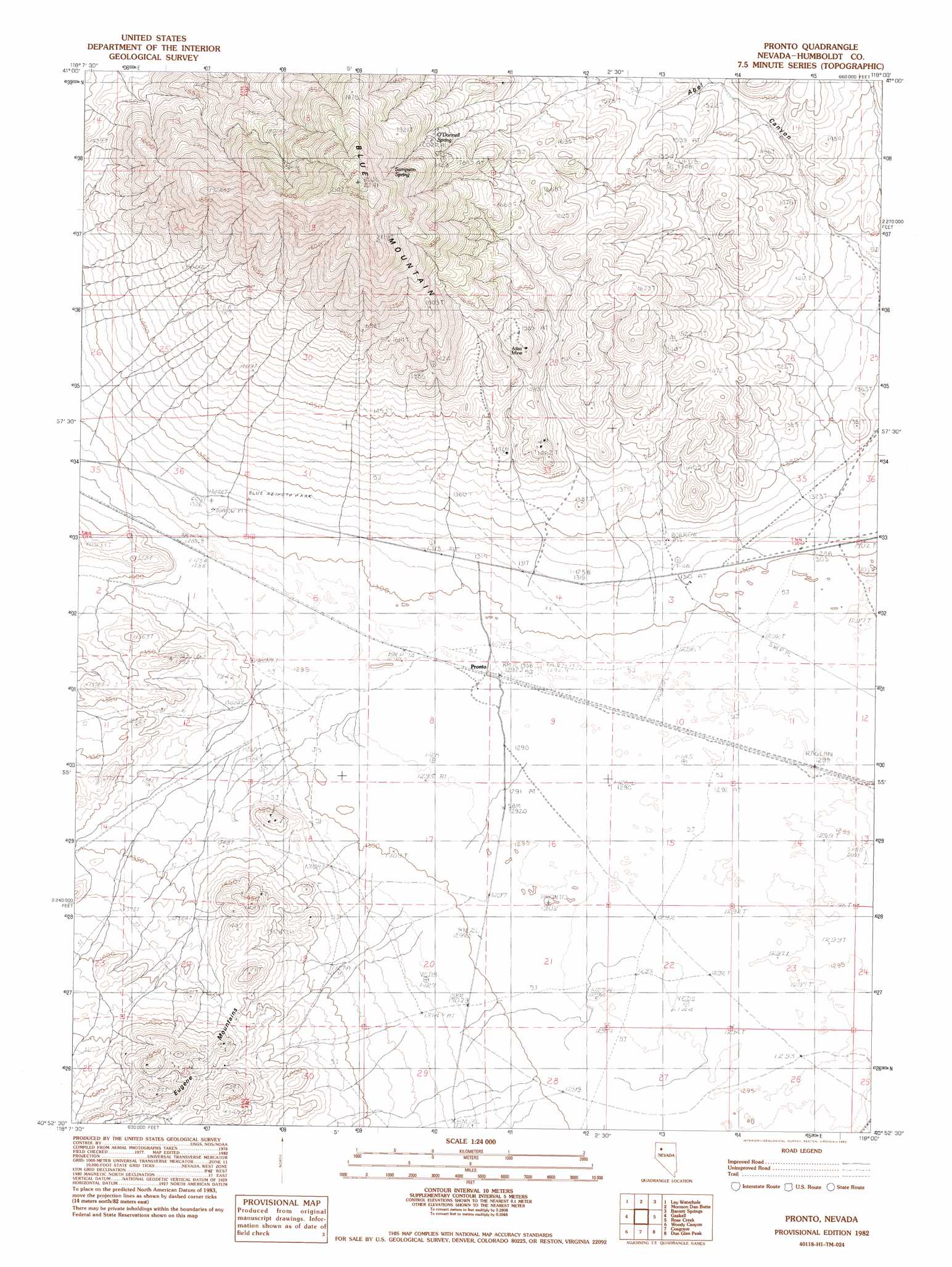
USGS Topo Quad 40118h1 - 1:24,000 scale
| Topo Map Name: | Pronto |
| USGS Topo Quad ID: | 40118h1 |
| Print Size: | ca. 21 1/4" wide x 27" high |
| Southeast Coordinates: | 40.875° N latitude / 118° W longitude |
| Map Center Coordinates: | 40.9375° N latitude / 118.0625° W longitude |
| U.S. State: | NV |
| Filename: | o40118h1.jpg |
| Download Map JPG Image: | Pronto topo map 1:24,000 scale |
| Map Type: | Topographic |
| Topo Series: | 7.5´ |
| Map Scale: | 1:24,000 |
| Source of Map Images: | United States Geological Survey (USGS) |
| Alternate Map Versions: |
Pronto NV 1982, updated 1982 Download PDF Buy paper map Pronto NV 2011 Download PDF Buy paper map Pronto NV 2014 Download PDF Buy paper map |
1:24,000 Topo Quads surrounding Pronto
Dry Hills |
Presnel Well |
Sombrero Peak |
Silver State Draw |
Bloody Run Peak |
Donna Schee Peak |
Lay Waterhole |
Mormon Dan Butte |
Barrett Springs |
Winnemucca Mountain |
Jungo Ne |
Gaskell |
Pronto |
Rose Creek |
Winnemucca West |
Alpha Mountain |
Woody Canyon |
Cosgrave |
Dun Glen Peak |
Rose Creek Mountain |
Rye Patch Res North |
Imlay |
Mill City |
Dun Glen |
Natchez Pass |
> Back to 40118e1 at 1:100,000 scale
> Back to 40118a1 at 1:250,000 scale
> Back to U.S. Topo Maps home
Pronto topo map: Gazetteer
Pronto: Mines
Atlas Mine elevation 1586m 5203′Dutchman Mine elevation 1356m 4448′
Pronto: Populated Places
Pronto elevation 1295m 4248′Pronto: Springs
O'Donnell Spring elevation 1815m 5954′Sampson Spring elevation 1962m 6437′
Pronto: Summits
Blue Mountain elevation 2177m 7142′Pronto: Valleys
Abel Canyon elevation 1399m 4589′Pronto digital topo map on disk
Buy this Pronto topo map showing relief, roads, GPS coordinates and other geographical features, as a high-resolution digital map file on DVD: