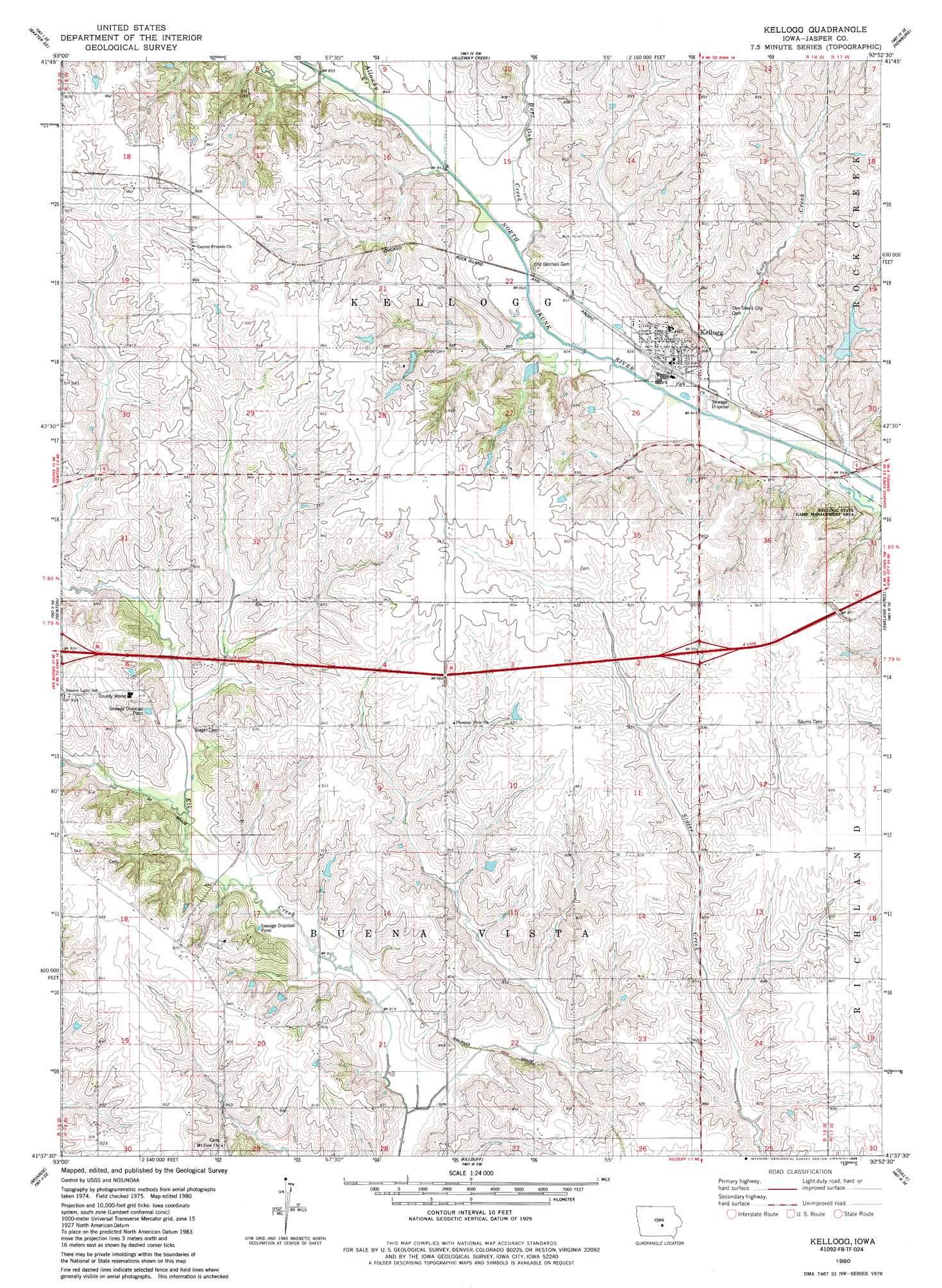
Kellogg Topo Map Iowa
To zoom in, hover over the map of Kellogg
USGS Topo Quad 41092f8 - 1:24,000 scale
| Topo Map Name: | Kellogg |
| USGS Topo Quad ID: | 41092f8 |
| Print Size: | ca. 21 1/4" wide x 27" high |
| Southeast Coordinates: | 41.625° N latitude / 92.875° W longitude |
| Map Center Coordinates: | 41.6875° N latitude / 92.9375° W longitude |
| U.S. State: | IA |
| Filename: | o41092f8.jpg |
| Download Map JPG Image: | Kellogg topo map 1:24,000 scale |
| Map Type: | Topographic |
| Topo Series: | 7.5´ |
| Map Scale: | 1:24,000 |
| Source of Map Images: | United States Geological Survey (USGS) |
| Alternate Map Versions: |
Kellogg IA 1980, updated 1980 Download PDF Buy paper map Kellogg IA 1980, updated 1986 Download PDF Buy paper map Kellogg IA 2010 Download PDF Buy paper map Kellogg IA 2013 Download PDF Buy paper map Kellogg IA 2015 Download PDF Buy paper map |
1:24,000 Topo Quads surrounding Kellogg
Rhodes |
Melbourne |
Laurel |
Gilman |
Montour |
Baxter |
Baxter Se |
Alloway Creek |
Newburg |
Grinnell North |
Colfax |
Newton |
Kellogg |
Oakland Acres |
Grinnell South |
Prairie City |
Monroe |
Killduff |
Sully |
Searsboro |
Knoxville Nw |
Otley |
Pella |
Peoria |
New Sharon |
> Back to 41092e1 at 1:100,000 scale
> Back to 41092a1 at 1:250,000 scale
> Back to U.S. Topo Maps home
Kellogg topo map: Gazetteer
Kellogg: Crossings
Interchange 168 elevation 281m 921′Interchange 173 elevation 288m 944′
Kellogg: Parks
Kellogg State Game Management Area elevation 252m 826′Kellogg: Populated Places
Kellogg elevation 273m 895′Murphy elevation 253m 830′
Kellogg: Post Offices
Adamsonville Post Office (historical) elevation 283m 928′Amboy Post Office (historical) elevation 294m 964′
Kellogg Post Office elevation 273m 895′
Murphy Post Office (historical) elevation 253m 830′
Pleasant View Post Office (historical) elevation 282m 925′
Kellogg: Streams
Alloway Creek elevation 256m 839′Burr Oak Creek elevation 257m 843′
Coon Creek elevation 253m 830′
Kellogg digital topo map on disk
Buy this Kellogg topo map showing relief, roads, GPS coordinates and other geographical features, as a high-resolution digital map file on DVD: