Anita Sw Topo Map Iowa
To zoom in, hover over the map of Anita Sw
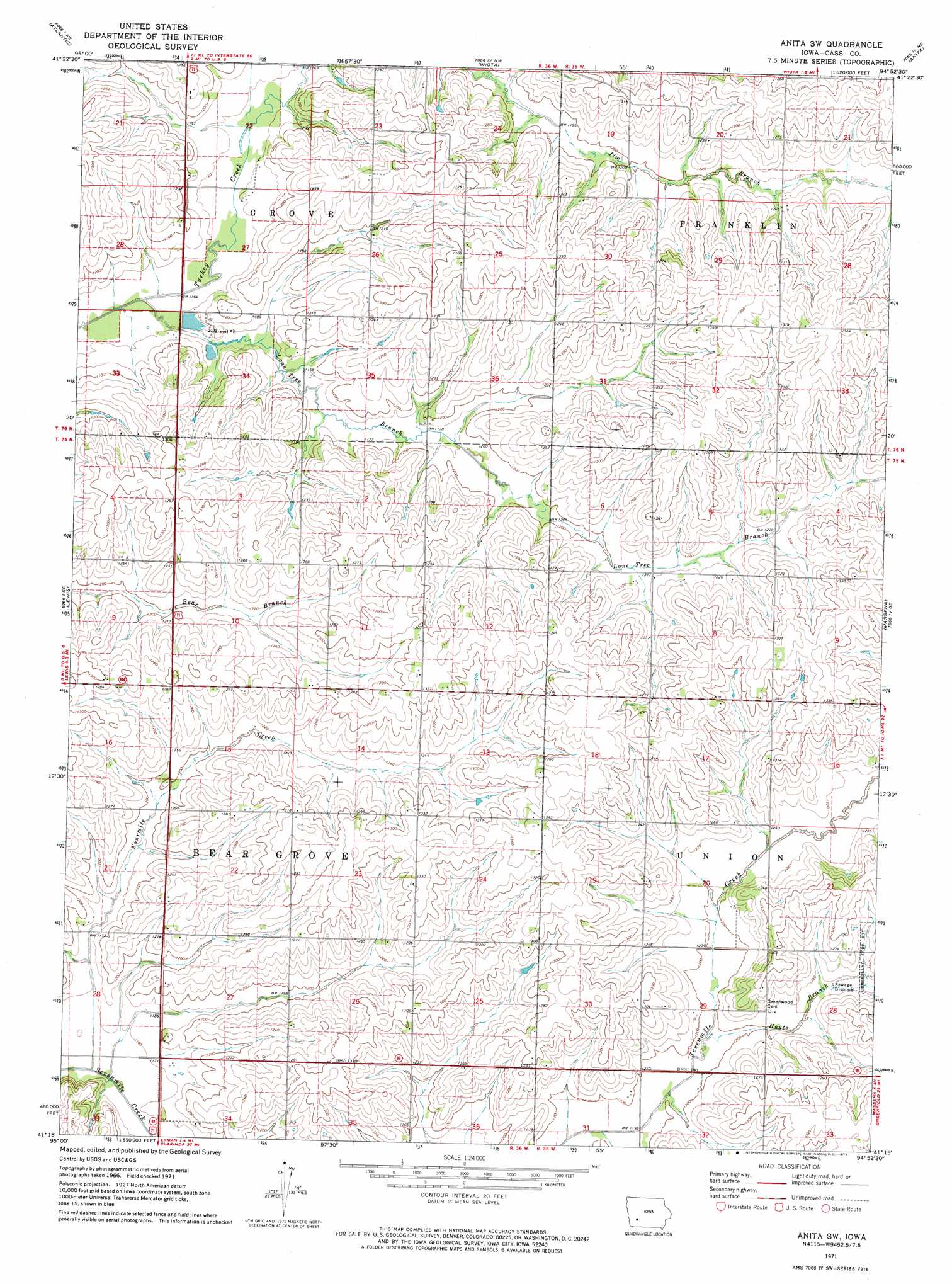
USGS Topo Quad 41094c8 - 1:24,000 scale
| Topo Map Name: | Anita Sw |
| USGS Topo Quad ID: | 41094c8 |
| Print Size: | ca. 21 1/4" wide x 27" high |
| Southeast Coordinates: | 41.25° N latitude / 94.875° W longitude |
| Map Center Coordinates: | 41.3125° N latitude / 94.9375° W longitude |
| U.S. State: | IA |
| Filename: | o41094c8.jpg |
| Download Map JPG Image: | Anita Sw topo map 1:24,000 scale |
| Map Type: | Topographic |
| Topo Series: | 7.5´ |
| Map Scale: | 1:24,000 |
| Source of Map Images: | United States Geological Survey (USGS) |
| Alternate Map Versions: |
Anita SW IA 1971, updated 1973 Download PDF Buy paper map Anita SW IA 2010 Download PDF Buy paper map Anita SW IA 2013 Download PDF Buy paper map Anita SW IA 2015 Download PDF Buy paper map |
1:24,000 Topo Quads surrounding Anita Sw
Prairie Rose Lake |
Elk Horn |
Exira West |
Exira East |
Adair North |
Walnut |
Atlantic |
Wiota |
Anita |
Adair South |
Atlantic Sw |
Lewis |
Anita Sw |
Massena |
Fontanelle Sw |
Griswold |
Griswold Ne |
Grant |
Dewey |
Bridgewater |
Red Oak North |
Wallin |
Morton Mills |
Carbon |
Corning North |
> Back to 41094a1 at 1:100,000 scale
> Back to 41094a1 at 1:250,000 scale
> Back to U.S. Topo Maps home
Anita Sw topo map: Gazetteer
Anita Sw: Post Offices
Cass Centre Post Office (historical) elevation 386m 1266′Galion Post Office (historical) elevation 370m 1213′
Anita Sw: Streams
Fourmile Creek elevation 349m 1145′Hoyts Branch elevation 360m 1181′
Lone Tree Branch elevation 347m 1138′
Anita Sw digital topo map on disk
Buy this Anita Sw topo map showing relief, roads, GPS coordinates and other geographical features, as a high-resolution digital map file on DVD: