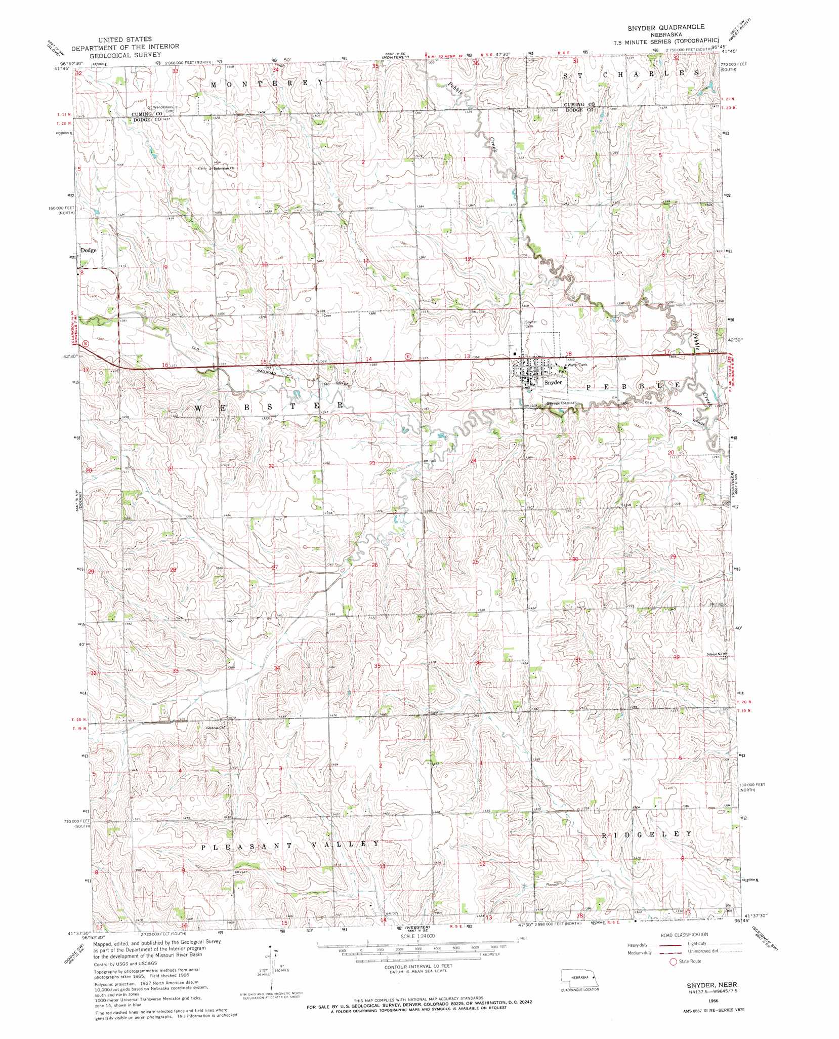
Snyder Topo Map Nebraska
To zoom in, hover over the map of Snyder
USGS Topo Quad 41096f7 - 1:24,000 scale
| Topo Map Name: | Snyder |
| USGS Topo Quad ID: | 41096f7 |
| Print Size: | ca. 21 1/4" wide x 27" high |
| Southeast Coordinates: | 41.625° N latitude / 96.75° W longitude |
| Map Center Coordinates: | 41.6875° N latitude / 96.8125° W longitude |
| U.S. State: | NE |
| Filename: | O41096F7.jpg |
| Download Map JPG Image: | Snyder topo map 1:24,000 scale |
| Map Type: | Topographic |
| Topo Series: | 7.5´ |
| Map Scale: | 1:24,000 |
| Source of Map Images: | United States Geological Survey (USGS) |
| Alternate Map Versions: |
Snyder NE 1966, updated 1967 Download PDF Buy paper map Snyder NE 2011 Download PDF Buy paper map Snyder NE 2014 Download PDF Buy paper map |
1:24,000 Topo Quads surrounding Snyder
Stanton Ne |
Wisner |
Beemer |
West Point Nw |
West Point Ne |
Stanton Se |
Aloys |
Monterey |
West Point |
West Point Se |
Clarkson |
Dodge |
Snyder |
Scribner |
Uehling |
Clarkson Se |
Dodge Sw |
Webster |
Scribner Sw |
Hooper |
Schuyler |
Rogers |
North Bend |
Malmo Nw |
Fremont West |
> Back to 41096e1 at 1:100,000 scale
> Back to 41096a1 at 1:250,000 scale
> Back to U.S. Topo Maps home
Snyder topo map: Gazetteer
Snyder: Parks
Fireman Park elevation 406m 1332′Snyder: Populated Places
Glencoe (historical) elevation 437m 1433′Snyder elevation 409m 1341′
Snyder: Post Offices
Glencoe Post Office (historical) elevation 437m 1433′Snyder Post Office elevation 405m 1328′
Snyder digital topo map on disk
Buy this Snyder topo map showing relief, roads, GPS coordinates and other geographical features, as a high-resolution digital map file on DVD: