Spalding Topo Map Nebraska
To zoom in, hover over the map of Spalding
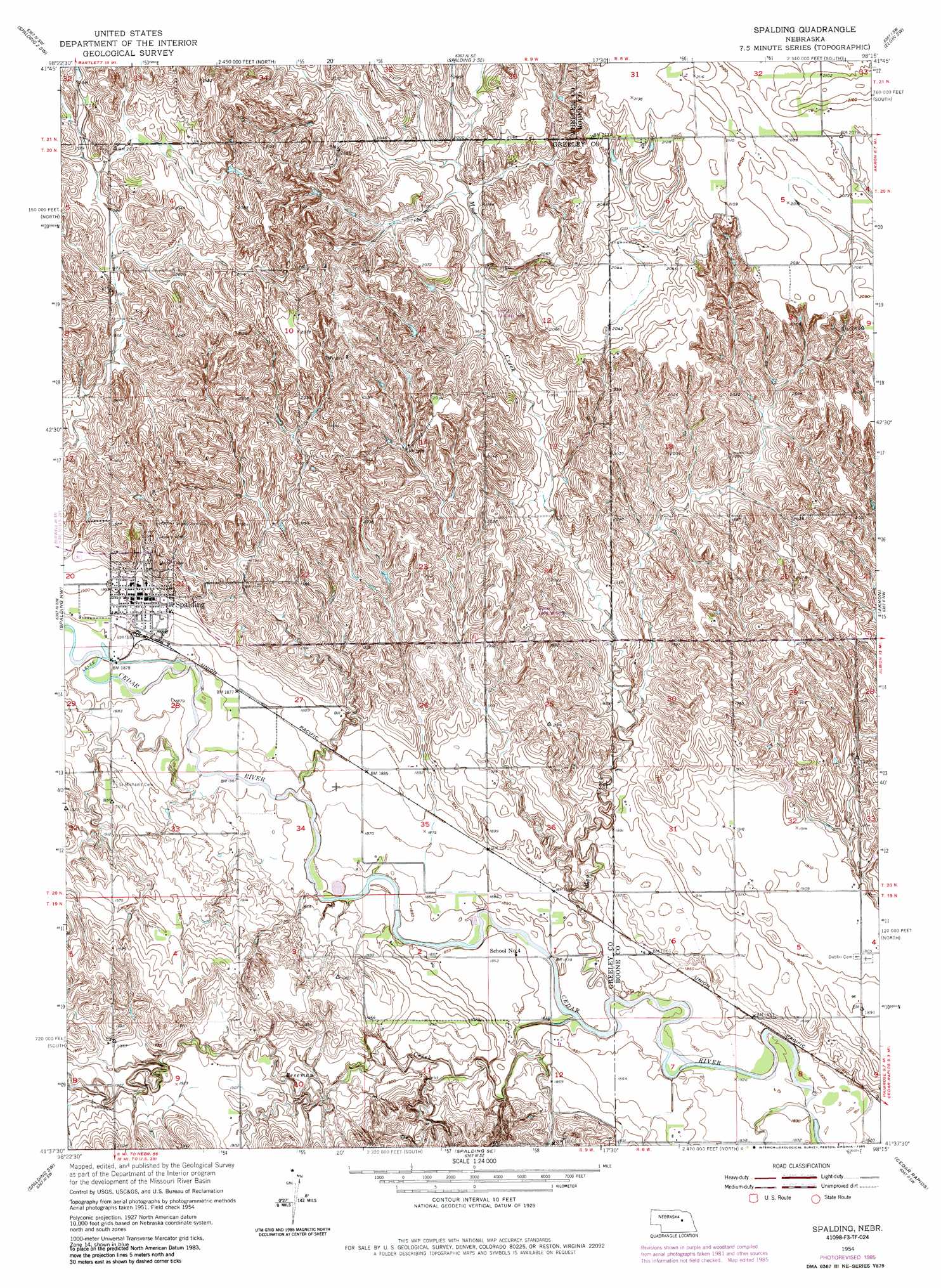
USGS Topo Quad 41098f3 - 1:24,000 scale
| Topo Map Name: | Spalding |
| USGS Topo Quad ID: | 41098f3 |
| Print Size: | ca. 21 1/4" wide x 27" high |
| Southeast Coordinates: | 41.625° N latitude / 98.25° W longitude |
| Map Center Coordinates: | 41.6875° N latitude / 98.3125° W longitude |
| U.S. State: | NE |
| Filename: | O41098F3.jpg |
| Download Map JPG Image: | Spalding topo map 1:24,000 scale |
| Map Type: | Topographic |
| Topo Series: | 7.5´ |
| Map Scale: | 1:24,000 |
| Source of Map Images: | United States Geological Survey (USGS) |
| Alternate Map Versions: |
Spalding NE 1954, updated 1956 Download PDF Buy paper map Spalding NE 1954, updated 1978 Download PDF Buy paper map Spalding NE 1954, updated 1985 Download PDF Buy paper map Spalding NE 2011 Download PDF Buy paper map Spalding NE 2014 Download PDF Buy paper map |
1:24,000 Topo Quads surrounding Spalding
Bartlett |
Spalding 2 Nw |
Spalding 2 Ne |
Elgin Nw |
Elgin |
Bartlett Se |
Spalding 2 Sw |
Spalding 2 Se |
Elgin Sw |
Petersburg |
Greeley Ne |
Spalding Nw |
Spalding |
Akron |
Albion West |
Greeley |
Spalding Sw |
Spalding Se |
Cedar Rapids |
Cedar Rapids Se |
Scotia Ne |
Wolbach |
Wolbach Ne |
Belgrade Nw |
Belgrade |
> Back to 41098e1 at 1:100,000 scale
> Back to 41098a1 at 1:250,000 scale
> Back to U.S. Topo Maps home
Spalding topo map: Gazetteer
Spalding: Airports
Glaser Airport elevation 618m 2027′McKay Airport elevation 601m 1971′
Spalding: Parks
Spalding City Park elevation 582m 1909′Spalding: Populated Places
Spalding elevation 582m 1909′Spalding: Post Offices
Spalding Post Office elevation 582m 1909′Spalding: Streams
Freeman Creek elevation 558m 1830′Mud Creek elevation 557m 1827′
Spalding digital topo map on disk
Buy this Spalding topo map showing relief, roads, GPS coordinates and other geographical features, as a high-resolution digital map file on DVD: