Albion West Topo Map Nebraska
To zoom in, hover over the map of Albion West
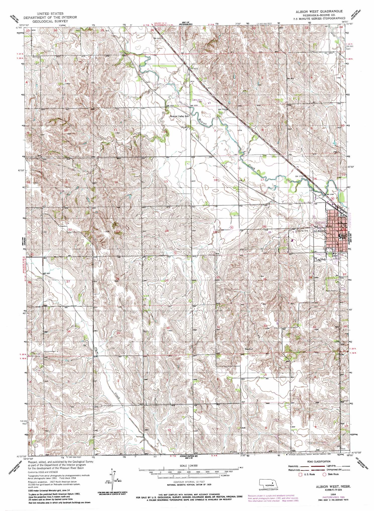
USGS Topo Quad 41098f1 - 1:24,000 scale
| Topo Map Name: | Albion West |
| USGS Topo Quad ID: | 41098f1 |
| Print Size: | ca. 21 1/4" wide x 27" high |
| Southeast Coordinates: | 41.625° N latitude / 98° W longitude |
| Map Center Coordinates: | 41.6875° N latitude / 98.0625° W longitude |
| U.S. State: | NE |
| Filename: | O41098F1.jpg |
| Download Map JPG Image: | Albion West topo map 1:24,000 scale |
| Map Type: | Topographic |
| Topo Series: | 7.5´ |
| Map Scale: | 1:24,000 |
| Source of Map Images: | United States Geological Survey (USGS) |
| Alternate Map Versions: |
Albion West NE 1954, updated 1956 Download PDF Buy paper map Albion West NE 1954, updated 1985 Download PDF Buy paper map Albion West NE 2011 Download PDF Buy paper map Albion West NE 2014 Download PDF Buy paper map |
1:24,000 Topo Quads surrounding Albion West
Spalding 2 Ne |
Elgin Nw |
Elgin |
Closter |
Closter Ne |
Spalding 2 Se |
Elgin Sw |
Petersburg |
Closter Sw |
Closter Se |
Spalding |
Akron |
Albion West |
Albion East |
Newman Grove |
Spalding Se |
Cedar Rapids |
Cedar Rapids Se |
Saint Edward Sw |
Saint Edward |
Wolbach Ne |
Belgrade Nw |
Belgrade |
Merchiston |
Fullerton Ne |
> Back to 41098e1 at 1:100,000 scale
> Back to 41098a1 at 1:250,000 scale
> Back to U.S. Topo Maps home
Albion West topo map: Gazetteer
Albion West: Airports
Albion Municipal Airport elevation 546m 1791′Albion West: Dams
Kohtz-City of Albion Dam elevation 556m 1824′Koinzan Dam elevation 573m 1879′
Albion West: Parks
Albion City Park elevation 540m 1771′Fuller Park elevation 551m 1807′
Albion West: Populated Places
Albion elevation 540m 1771′Albion West: Post Offices
Albion Post Office elevation 535m 1755′Albion West: Reservoirs
Kohtz-City of Albion Reservoir elevation 556m 1824′Koinzan Reservoir elevation 573m 1879′
Albion West digital topo map on disk
Buy this Albion West topo map showing relief, roads, GPS coordinates and other geographical features, as a high-resolution digital map file on DVD: