Spring Valley Topo Map Nebraska
To zoom in, hover over the map of Spring Valley
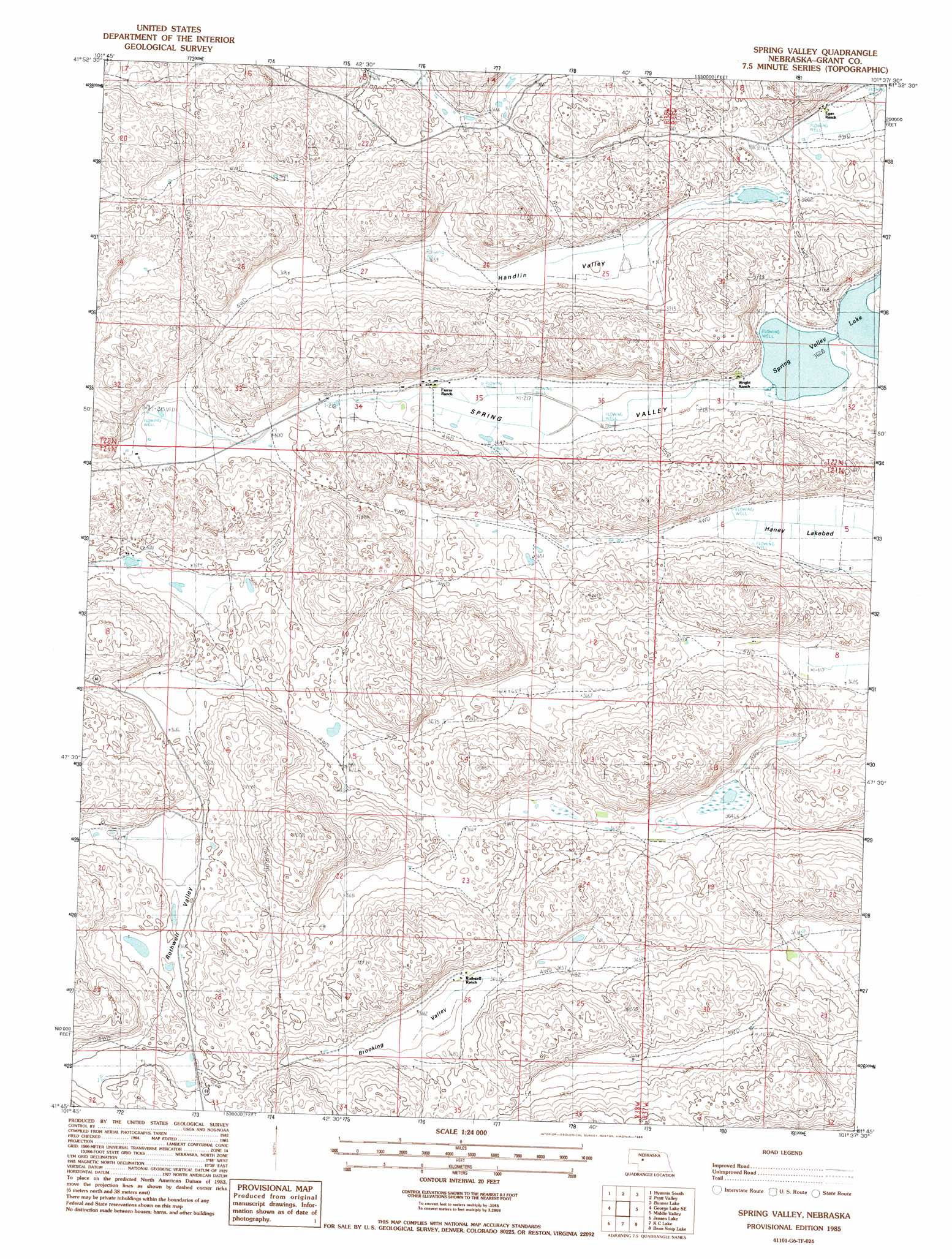
USGS Topo Quad 41101g6 - 1:24,000 scale
| Topo Map Name: | Spring Valley |
| USGS Topo Quad ID: | 41101g6 |
| Print Size: | ca. 21 1/4" wide x 27" high |
| Southeast Coordinates: | 41.75° N latitude / 101.625° W longitude |
| Map Center Coordinates: | 41.8125° N latitude / 101.6875° W longitude |
| U.S. State: | NE |
| Filename: | O41101g6.jpg |
| Download Map JPG Image: | Spring Valley topo map 1:24,000 scale |
| Map Type: | Topographic |
| Topo Series: | 7.5´ |
| Map Scale: | 1:24,000 |
| Source of Map Images: | United States Geological Survey (USGS) |
| Alternate Map Versions: |
Spring Valley NE 1985, updated 1986 Download PDF Buy paper map Spring Valley NE 2011 Download PDF Buy paper map Spring Valley NE 2014 Download PDF Buy paper map |
1:24,000 Topo Quads surrounding Spring Valley
Ashby |
Hyannis North |
Frye Lake |
Whitman |
Hire Sw |
Wild Horse Hill |
Hyannis South |
Moran Lake |
Bunner Lake |
Carr Lake |
Long Valley |
George Lake Se |
Spring Valley |
Rothwell Lake |
Haney Lake |
Bourquim Hill |
Jensen Lake |
K C Lake |
Cheyenne Lake |
Lena |
Velma Sw |
Hulbert Lake |
Arthur |
Lightning Valley |
Bucktail |
> Back to 41101e1 at 1:100,000 scale
> Back to 41100a1 at 1:250,000 scale
> Back to U.S. Topo Maps home
Spring Valley topo map: Gazetteer
Spring Valley: Basins
Brooking Valley elevation 1114m 3654′Handlin Valley elevation 1114m 3654′
Rothwell Valley elevation 1122m 3681′
Spring Valley elevation 1111m 3645′
Spring Valley: Lakes
Haney Lake elevation 1108m 3635′Spring Valley digital topo map on disk
Buy this Spring Valley topo map showing relief, roads, GPS coordinates and other geographical features, as a high-resolution digital map file on DVD: