Toms Cabin Spring Topo Map Utah
To zoom in, hover over the map of Toms Cabin Spring
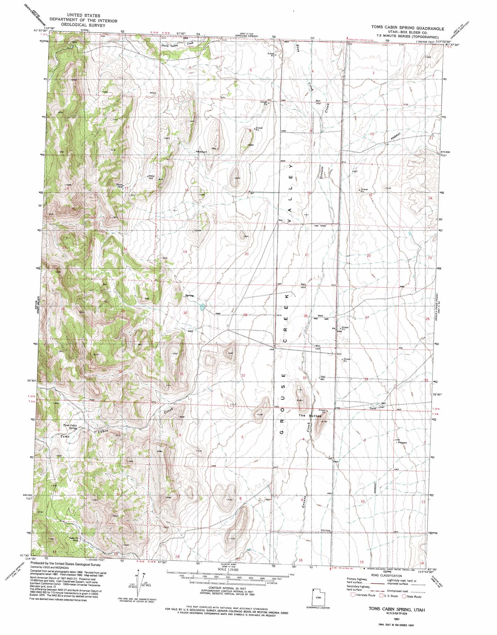
USGS Topo Quad 41113e8 - 1:24,000 scale
| Topo Map Name: | Toms Cabin Spring |
| USGS Topo Quad ID: | 41113e8 |
| Print Size: | ca. 21 1/4" wide x 27" high |
| Southeast Coordinates: | 41.5° N latitude / 113.875° W longitude |
| Map Center Coordinates: | 41.5625° N latitude / 113.9375° W longitude |
| U.S. State: | UT |
| Filename: | o41113e8.jpg |
| Download Map JPG Image: | Toms Cabin Spring topo map 1:24,000 scale |
| Map Type: | Topographic |
| Topo Series: | 7.5´ |
| Map Scale: | 1:24,000 |
| Source of Map Images: | United States Geological Survey (USGS) |
| Alternate Map Versions: |
Toms Cabin Spring UT 1971, updated 1974 Download PDF Buy paper map Toms Cabin Spring UT 1971, updated 1984 Download PDF Buy paper map Toms Cabin Spring UT 1991, updated 1992 Download PDF Buy paper map Toms Cabin Spring UT 2011 Download PDF Buy paper map Toms Cabin Spring UT 2014 Download PDF Buy paper map |
1:24,000 Topo Quads surrounding Toms Cabin Spring
Cedar Mountain Draw |
Judd Mountain |
Dry Canyon Mountain |
Kimbell Creek |
Lynn Reservoir |
The Baldies |
Death Creek Reservoir |
Grouse Creek |
Ingham Canyon |
Potters Creek |
Crittenden Springs |
Dairy Valley |
Toms Cabin Spring |
Rocky Pass Peak |
Emigrant Pass |
Twelvemile Ranch |
Jackson Spring |
Lucin Nw |
Lucin Ne |
Bovine |
Montello |
Tecoma |
Lucin |
Pigeon Mountain |
Jackson |
> Back to 41113e1 at 1:100,000 scale
> Back to 41112a1 at 1:250,000 scale
> Back to U.S. Topo Maps home
Toms Cabin Spring topo map: Gazetteer
Toms Cabin Spring: Springs
Toms Cabin Spring elevation 1634m 5360′Toms Cabin Spring: Streams
Dairy Valley Creek elevation 1546m 5072′Dairy Valley Creek elevation 1546m 5072′
Etna Creek elevation 1531m 5022′
Toms Cabin Creek elevation 1526m 5006′
Toms Cabin Spring: Summits
The Buttes elevation 1564m 5131′Toms Cabin Spring digital topo map on disk
Buy this Toms Cabin Spring topo map showing relief, roads, GPS coordinates and other geographical features, as a high-resolution digital map file on DVD: