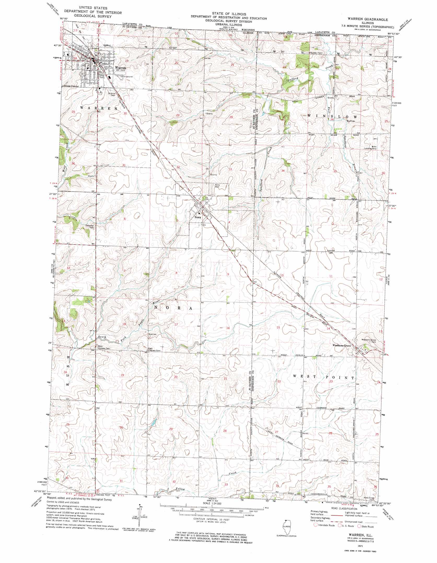
Warren Topo Map Illinois
To zoom in, hover over the map of Warren
USGS Topo Quad 42089d8 - 1:24,000 scale
| Topo Map Name: | Warren |
| USGS Topo Quad ID: | 42089d8 |
| Print Size: | ca. 21 1/4" wide x 27" high |
| Southeast Coordinates: | 42.375° N latitude / 89.875° W longitude |
| Map Center Coordinates: | 42.4375° N latitude / 89.9375° W longitude |
| U.S. State: | IL |
| Filename: | o42089d8.jpg |
| Download Map JPG Image: | Warren topo map 1:24,000 scale |
| Map Type: | Topographic |
| Topo Series: | 7.5´ |
| Map Scale: | 1:24,000 |
| Source of Map Images: | United States Geological Survey (USGS) |
| Alternate Map Versions: |
Warren IL 1971, updated 1974 Download PDF Buy paper map Warren IL 2012 Download PDF Buy paper map Warren IL 2015 Download PDF Buy paper map |
1:24,000 Topo Quads surrounding Warren
Calamine |
Darlington |
Wiota |
Argyle |
Monroe Nw |
Shullsburg |
Apple River |
South Wayne |
Browntown |
Monroe |
Scales Mound East |
Elizabeth Ne |
Warren |
Lena |
Orangeville |
Elizabeth |
Stockton |
Kent |
Pearl City |
Freeport West |
Blackhawk |
Pleasant Valley |
Loran |
Boone Branch |
Shannon |
> Back to 42089a1 at 1:100,000 scale
> Back to 42088a1 at 1:250,000 scale
> Back to U.S. Topo Maps home
Warren topo map: Gazetteer
Warren: Populated Places
Nora elevation 309m 1013′Waddams Grove elevation 315m 1033′
Warren elevation 299m 980′
Warren: Streams
East Spafford Branch elevation 250m 820′Warren digital topo map on disk
Buy this Warren topo map showing relief, roads, GPS coordinates and other geographical features, as a high-resolution digital map file on DVD:
Northern Illinois, Northern Indiana & Southwestern Michigan
Buy digital topo maps: Northern Illinois, Northern Indiana & Southwestern Michigan