Buckeye West Topo Map Iowa
To zoom in, hover over the map of Buckeye West
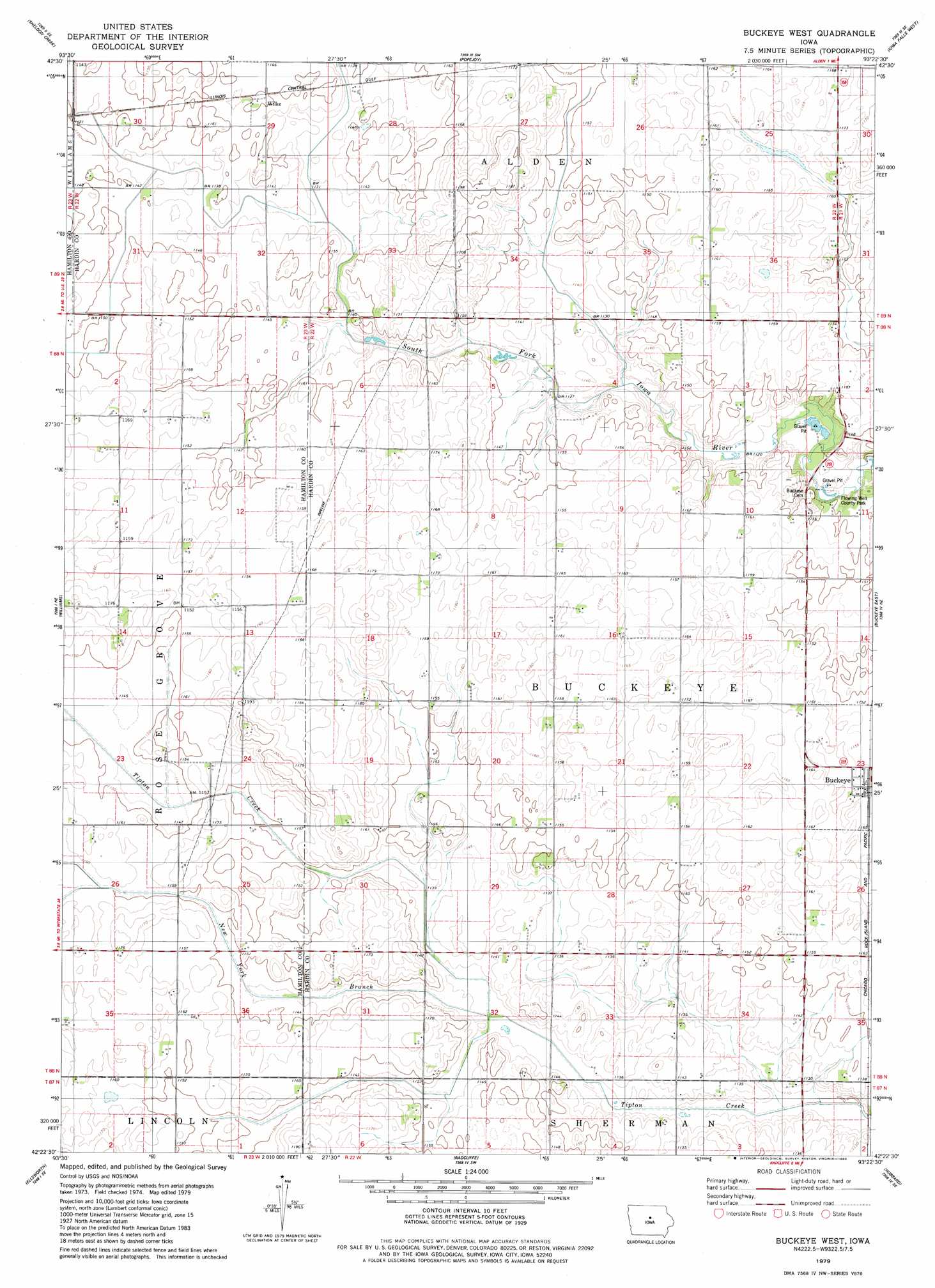
USGS Topo Quad 42093d4 - 1:24,000 scale
| Topo Map Name: | Buckeye West |
| USGS Topo Quad ID: | 42093d4 |
| Print Size: | ca. 21 1/4" wide x 27" high |
| Southeast Coordinates: | 42.375° N latitude / 93.375° W longitude |
| Map Center Coordinates: | 42.4375° N latitude / 93.4375° W longitude |
| U.S. State: | IA |
| Filename: | o42093d4.jpg |
| Download Map JPG Image: | Buckeye West topo map 1:24,000 scale |
| Map Type: | Topographic |
| Topo Series: | 7.5´ |
| Map Scale: | 1:24,000 |
| Source of Map Images: | United States Geological Survey (USGS) |
| Alternate Map Versions: |
Buckeye West IA 1979, updated 1980 Download PDF Buy paper map Buckeye West IA 2010 Download PDF Buy paper map Buckeye West IA 2013 Download PDF Buy paper map Buckeye West IA 2015 Download PDF Buy paper map |
1:24,000 Topo Quads surrounding Buckeye West
Clarion |
Dows West |
Dows East |
Coulter |
Hampton South |
Clarion Sw |
Sheldon Creek |
Popejoy |
Iowa Falls West |
Iowa Falls East |
Blairsburg |
Williams |
Buckeye West |
Buckeye East |
Owasa |
Jewell |
Ellsworth |
Radcliffe |
Hubbard |
New Providence |
Ames Nw |
Story City |
Mccallsburg |
Zearing |
State Center Nw |
> Back to 42093a1 at 1:100,000 scale
> Back to 42092a1 at 1:250,000 scale
> Back to U.S. Topo Maps home
Buckeye West topo map: Gazetteer
Buckeye West: Canals
Big 4 Drainage Ditch elevation 345m 1131′Buckeye West: Parks
Flowing Well County Park elevation 337m 1105′Buckeye West: Populated Places
Wilke elevation 351m 1151′Buckeye West: Post Offices
Wilke Post Office (historical) elevation 351m 1151′Buckeye West: Streams
New York Branch elevation 341m 1118′Buckeye West digital topo map on disk
Buy this Buckeye West topo map showing relief, roads, GPS coordinates and other geographical features, as a high-resolution digital map file on DVD: