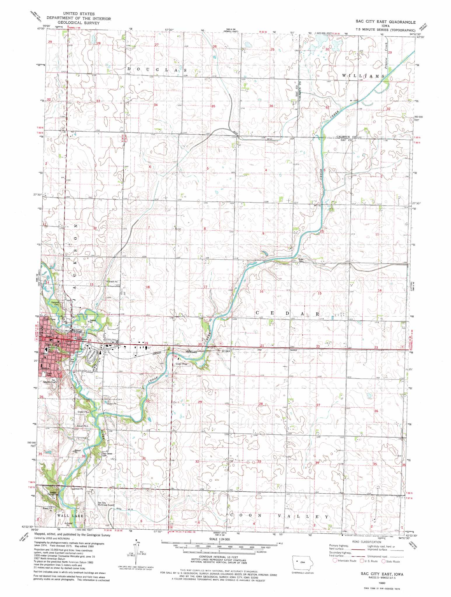
Sac City East Topo Map Iowa
To zoom in, hover over the map of Sac City East
USGS Topo Quad 42094d8 - 1:24,000 scale
| Topo Map Name: | Sac City East |
| USGS Topo Quad ID: | 42094d8 |
| Print Size: | ca. 21 1/4" wide x 27" high |
| Southeast Coordinates: | 42.375° N latitude / 94.875° W longitude |
| Map Center Coordinates: | 42.4375° N latitude / 94.9375° W longitude |
| U.S. State: | IA |
| Filename: | o42094d8.jpg |
| Download Map JPG Image: | Sac City East topo map 1:24,000 scale |
| Map Type: | Topographic |
| Topo Series: | 7.5´ |
| Map Scale: | 1:24,000 |
| Source of Map Images: | United States Geological Survey (USGS) |
| Alternate Map Versions: |
Sac City East IA 1980, updated 1980 Download PDF Buy paper map Sac City East IA 2010 Download PDF Buy paper map Sac City East IA 2013 Download PDF Buy paper map Sac City East IA 2015 Download PDF Buy paper map |
1:24,000 Topo Quads surrounding Sac City East
Storm Lake |
Storm Lake Ne |
Varina |
Fonda Ne |
Pocahontas |
Lakeside |
Newell West |
Newell East |
Fonda |
Pomeroy |
Early |
Sac City West |
Sac City East |
Lytton |
Rockwell City |
Odebolt East |
Lake View |
Grant City |
Yetter |
Lake City |
Boyer |
Vail Ne |
Breda |
Carroll Ne |
Lanesboro |
> Back to 42094a1 at 1:100,000 scale
> Back to 42094a1 at 1:250,000 scale
> Back to U.S. Topo Maps home
Sac City East topo map: Gazetteer
Sac City East: Airports
Sac City Municipal Airport elevation 379m 1243′Sac City East: Parks
Hagge County Park elevation 382m 1253′Lions Park elevation 365m 1197′
Sac City Park elevation 360m 1181′
Soldier Monument elevation 368m 1207′
South Park elevation 385m 1263′
Tolan Field elevation 362m 1187′
Sac City East: Populated Places
Sac City elevation 371m 1217′Sac City East: Post Offices
Sac City Post Office elevation 371m 1217′Schoharie Post Office (historical) elevation 388m 1272′
Sac City East: Streams
Cedar Creek elevation 356m 1167′Prairie Creek elevation 364m 1194′
Sac City East digital topo map on disk
Buy this Sac City East topo map showing relief, roads, GPS coordinates and other geographical features, as a high-resolution digital map file on DVD: