Spencer Creek Topo Map Oregon
To zoom in, hover over the map of Spencer Creek
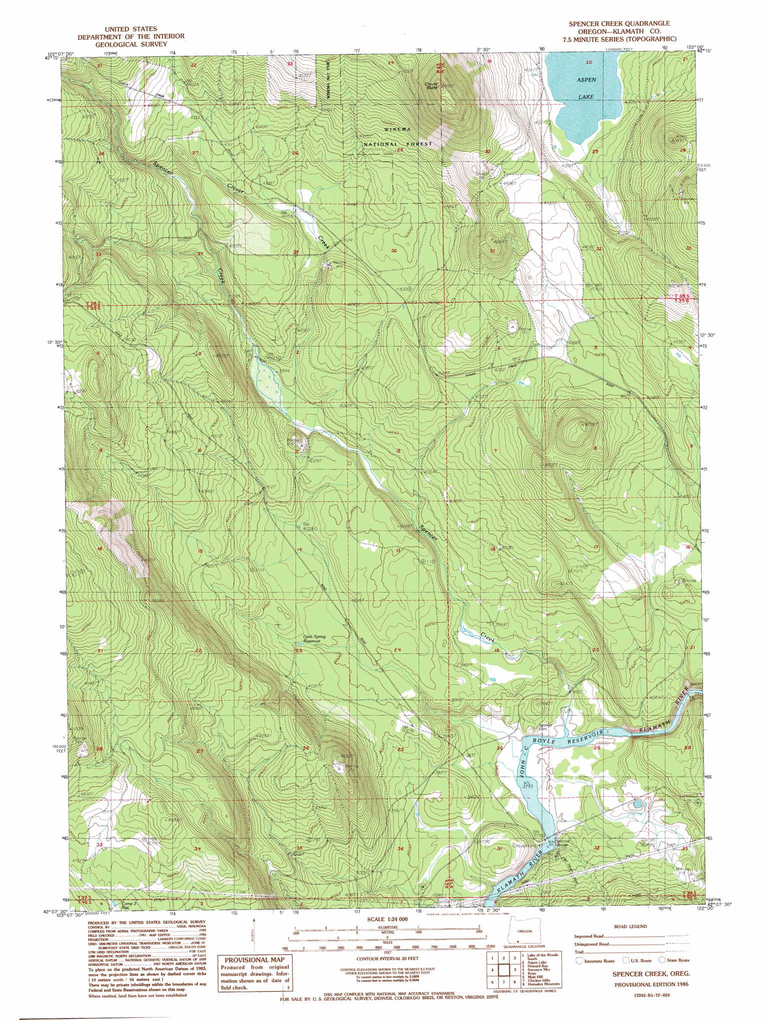
USGS Topo Quad 42122b1 - 1:24,000 scale
| Topo Map Name: | Spencer Creek |
| USGS Topo Quad ID: | 42122b1 |
| Print Size: | ca. 21 1/4" wide x 27" high |
| Southeast Coordinates: | 42.125° N latitude / 122° W longitude |
| Map Center Coordinates: | 42.1875° N latitude / 122.0625° W longitude |
| U.S. State: | OR |
| Filename: | o42122b1.jpg |
| Download Map JPG Image: | Spencer Creek topo map 1:24,000 scale |
| Map Type: | Topographic |
| Topo Series: | 7.5´ |
| Map Scale: | 1:24,000 |
| Source of Map Images: | United States Geological Survey (USGS) |
| Alternate Map Versions: |
Spencer Creek OR 1986, updated 1986 Download PDF Buy paper map Spencer Creek OR 1998, updated 2000 Download PDF Buy paper map Spencer Creek OR 2011 Download PDF Buy paper map Spencer Creek OR 2014 Download PDF Buy paper map |
| FStopo: | US Forest Service topo Spencer Creek is available: Download FStopo PDF Download FStopo TIF |
1:24,000 Topo Quads surrounding Spencer Creek
Mount Mcloughlin |
Lake Of The Woods North |
Pelican Bay |
Shoalwater Bay |
Modoc Point |
Brown Mountain |
Lake Of The Woods South |
Aspen Lake |
Howard Bay |
Wocus |
Little Chinquapin Mountain |
Surveyor Mountain |
Spencer Creek |
Keno |
Klamath Falls |
Parker Mountain |
Mule Hill |
Chicken Hills |
Hamaker Mountain |
Worden |
Copco |
Secret Spring Mountain |
Sams Neck |
Dorris |
Sheepy Lake |
> Back to 42122a1 at 1:100,000 scale
> Back to 42122a1 at 1:250,000 scale
> Back to U.S. Topo Maps home
Spencer Creek topo map: Gazetteer
Spencer Creek: Bridges
Spencer Bridge elevation 1157m 3795′Spencer Creek: Parks
Klamath River Recreation Site elevation 1164m 3818′Spencer Creek: Populated Places
Chase (historical) elevation 1222m 4009′Clover Station (historical) elevation 1257m 4124′
Spencer Creek: Post Offices
Forest Post Office (historical) elevation 1159m 3802′Spencer Creek: Reservoirs
Camp Three Reservoir elevation 1439m 4721′Grub Spring Reservoir elevation 1224m 4015′
Spencer Creek: Streams
Clover Creek elevation 1215m 3986′Spencer Creek elevation 1157m 3795′
Spencer Creek: Summits
Clover Butte elevation 1646m 5400′Spencer Creek digital topo map on disk
Buy this Spencer Creek topo map showing relief, roads, GPS coordinates and other geographical features, as a high-resolution digital map file on DVD: