Wesley Topo Map Iowa
To zoom in, hover over the map of Wesley
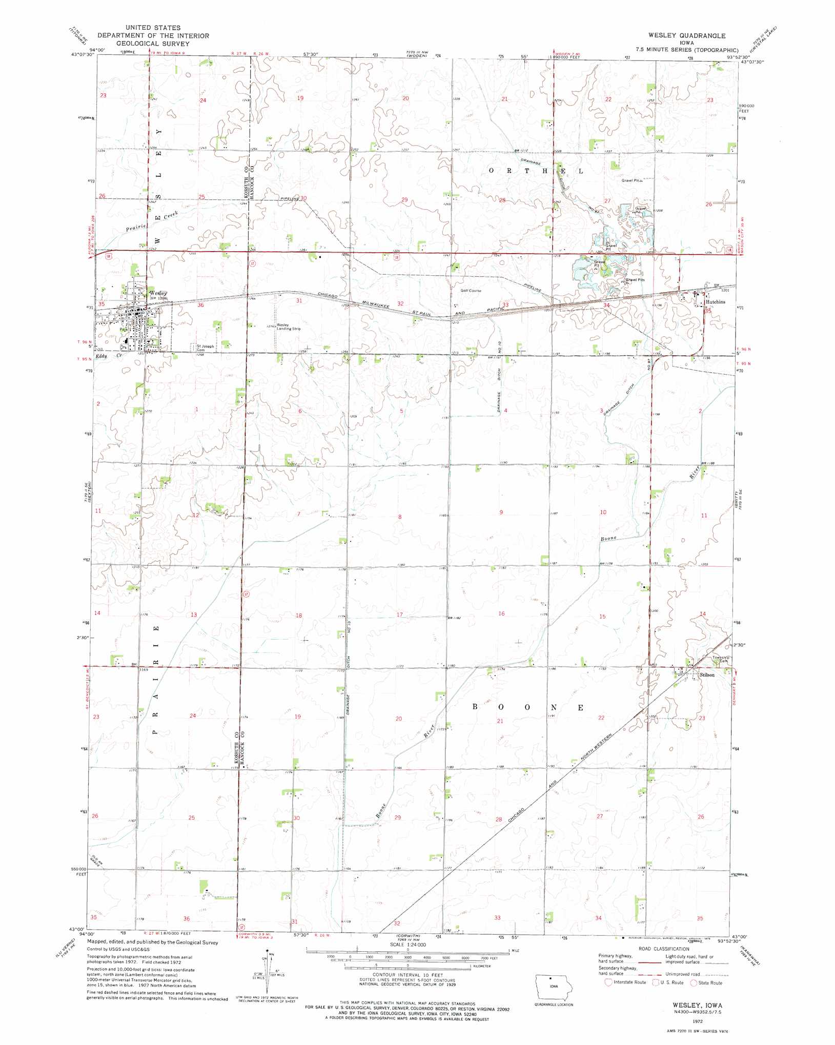
USGS Topo Quad 43093a8 - 1:24,000 scale
| Topo Map Name: | Wesley |
| USGS Topo Quad ID: | 43093a8 |
| Print Size: | ca. 21 1/4" wide x 27" high |
| Southeast Coordinates: | 43° N latitude / 93.875° W longitude |
| Map Center Coordinates: | 43.0625° N latitude / 93.9375° W longitude |
| U.S. State: | IA |
| Filename: | o43093a8.jpg |
| Download Map JPG Image: | Wesley topo map 1:24,000 scale |
| Map Type: | Topographic |
| Topo Series: | 7.5´ |
| Map Scale: | 1:24,000 |
| Source of Map Images: | United States Geological Survey (USGS) |
| Alternate Map Versions: |
Wesley IA 1972, updated 1975 Download PDF Buy paper map Wesley IA 2010 Download PDF Buy paper map Wesley IA 2013 Download PDF Buy paper map Wesley IA 2015 Download PDF Buy paper map |
1:24,000 Topo Quads surrounding Wesley
Bancroft |
German Valley |
Buffalo Center Sw |
Thompson |
Forest City |
Burt |
Titonka |
Woden |
Crystal Lake |
Hayfield |
Algona |
Sexton |
Wesley |
Britt |
Duncan |
Saint Joseph |
Lu Verne |
Corwith |
Kanawha |
Olaf |
Livermore |
Hardy |
Renwick |
Kanawha Se |
Cornelia |
> Back to 43093a1 at 1:100,000 scale
> Back to 43092a1 at 1:250,000 scale
> Back to U.S. Topo Maps home
Wesley topo map: Gazetteer
Wesley: Airports
Newbrough Airport elevation 363m 1190′Wesley Landing Strip elevation 387m 1269′
Wesley: Canals
Drainage Ditch Number 10 elevation 360m 1181′Wesley: Populated Places
Hutchins elevation 366m 1200′Stilson elevation 367m 1204′
Wesley elevation 381m 1250′
Wesley: Post Offices
Hutchins Post Office (historical) elevation 366m 1200′Stilson Post Office (historical) elevation 367m 1204′
Wesley Post Office elevation 381m 1250′
Wesley digital topo map on disk
Buy this Wesley topo map showing relief, roads, GPS coordinates and other geographical features, as a high-resolution digital map file on DVD: