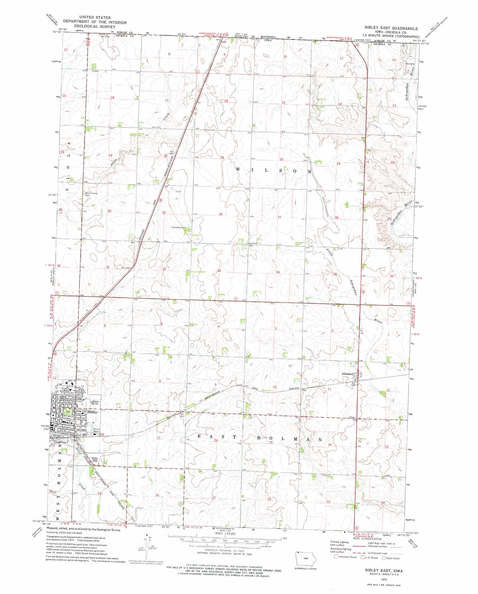
Sibley East Topo Map Iowa
To zoom in, hover over the map of Sibley East
USGS Topo Quad 43095d6 - 1:24,000 scale
| Topo Map Name: | Sibley East |
| USGS Topo Quad ID: | 43095d6 |
| Print Size: | ca. 21 1/4" wide x 27" high |
| Southeast Coordinates: | 43.375° N latitude / 95.625° W longitude |
| Map Center Coordinates: | 43.4375° N latitude / 95.6875° W longitude |
| U.S. States: | IA, MN |
| Filename: | o43095d6.jpg |
| Download Map JPG Image: | Sibley East topo map 1:24,000 scale |
| Map Type: | Topographic |
| Topo Series: | 7.5´ |
| Map Scale: | 1:24,000 |
| Source of Map Images: | United States Geological Survey (USGS) |
| Alternate Map Versions: |
Sibley East IA 1972, updated 1975 Download PDF Buy paper map Sibley East IA 2010 Download PDF Buy paper map Sibley East IA 2013 Download PDF Buy paper map Sibley East IA 2015 Download PDF Buy paper map |
1:24,000 Topo Quads surrounding Sibley East
Adrian |
Adrian Ne |
Reading |
Worthington North |
Brewster |
Adrian Sw |
Rushmore |
Bigelow |
Worthington South |
Round Lake |
Little Rock |
Sibley West |
Sibley East |
Ocheyedan |
Harris |
George East |
Ashton |
Cloverdale |
Melvin |
May City |
Matlock |
Sheldon |
Sanborn |
Plessis |
Hartley |
> Back to 43095a1 at 1:100,000 scale
> Back to 43094a1 at 1:250,000 scale
> Back to U.S. Topo Maps home
Sibley East topo map: Gazetteer
Sibley East: Airports
Osceola Community Hospital Heliport elevation 471m 1545′Sibley East: Parks
Central Park elevation 468m 1535′Johnson Wilderness Area elevation 484m 1587′
Ransom Wildlife Management Area elevation 498m 1633′
Robinson Park elevation 460m 1509′
Sharbondy Park elevation 489m 1604′
Sibley East: Populated Places
Allendorf elevation 486m 1594′Sibley East: Post Offices
Allendorf Post Office (historical) elevation 486m 1594′Holman Post Office (historical) elevation 487m 1597′
Sibley Post Office elevation 462m 1515′
Sibley East: Summits
Hawkeye Point elevation 509m 1669′Sibley East: Swamps
Wasmund Slough elevation 503m 1650′Sibley East: Trails
Winkel Memorial Trail elevation 484m 1587′Sibley East digital topo map on disk
Buy this Sibley East topo map showing relief, roads, GPS coordinates and other geographical features, as a high-resolution digital map file on DVD: