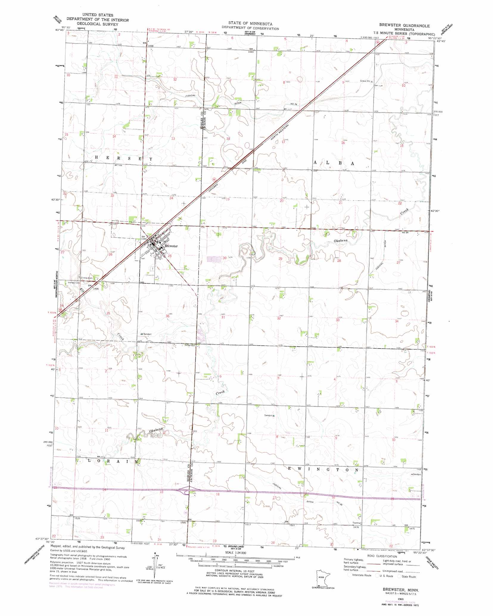
Brewster Topo Map Minnesota
To zoom in, hover over the map of Brewster
USGS Topo Quad 43095f4 - 1:24,000 scale
| Topo Map Name: | Brewster |
| USGS Topo Quad ID: | 43095f4 |
| Print Size: | ca. 21 1/4" wide x 27" high |
| Southeast Coordinates: | 43.625° N latitude / 95.375° W longitude |
| Map Center Coordinates: | 43.6875° N latitude / 95.4375° W longitude |
| U.S. State: | MN |
| Filename: | o43095f4.jpg |
| Download Map JPG Image: | Brewster topo map 1:24,000 scale |
| Map Type: | Topographic |
| Topo Series: | 7.5´ |
| Map Scale: | 1:24,000 |
| Source of Map Images: | United States Geological Survey (USGS) |
| Alternate Map Versions: |
Brewster MN 1960, updated 1961 Download PDF Buy paper map Brewster MN 1960, updated 1977 Download PDF Buy paper map Brewster MN 2010 Download PDF Buy paper map Brewster MN 2013 Download PDF Buy paper map Brewster MN 2016 Download PDF Buy paper map |
1:24,000 Topo Quads surrounding Brewster
Avoca |
Lime Creek |
Heron Lake Nw |
Heron Lake Ne |
Harder Lake |
Fulda Sw |
Fulda |
Dundee |
Heron Lake |
Wilder |
Reading |
Worthington North |
Brewster |
Okabena |
Lakefield |
Bigelow |
Worthington South |
Round Lake |
Sioux Valley |
Lakefield Sw |
Sibley East |
Ocheyedan |
Harris |
Lake Park |
Okoboji |
> Back to 43095e1 at 1:100,000 scale
> Back to 43094a1 at 1:250,000 scale
> Back to U.S. Topo Maps home
Brewster topo map: Gazetteer
Brewster: Canals
Judicial Ditch Number Eightyfive elevation 436m 1430′Judicial Ditch Number Seventysix elevation 436m 1430′
Brewster: Crossings
Interchange 50 elevation 466m 1528′Brewster: Parks
Brewster City Park elevation 453m 1486′Brewster: Populated Places
Brewster elevation 454m 1489′Brewster: Post Offices
Brewster Post Office elevation 453m 1486′Brewster: Streams
Elk Creek elevation 445m 1459′Brewster digital topo map on disk
Buy this Brewster topo map showing relief, roads, GPS coordinates and other geographical features, as a high-resolution digital map file on DVD: