Burlington Lake Topo Map Wyoming
To zoom in, hover over the map of Burlington Lake
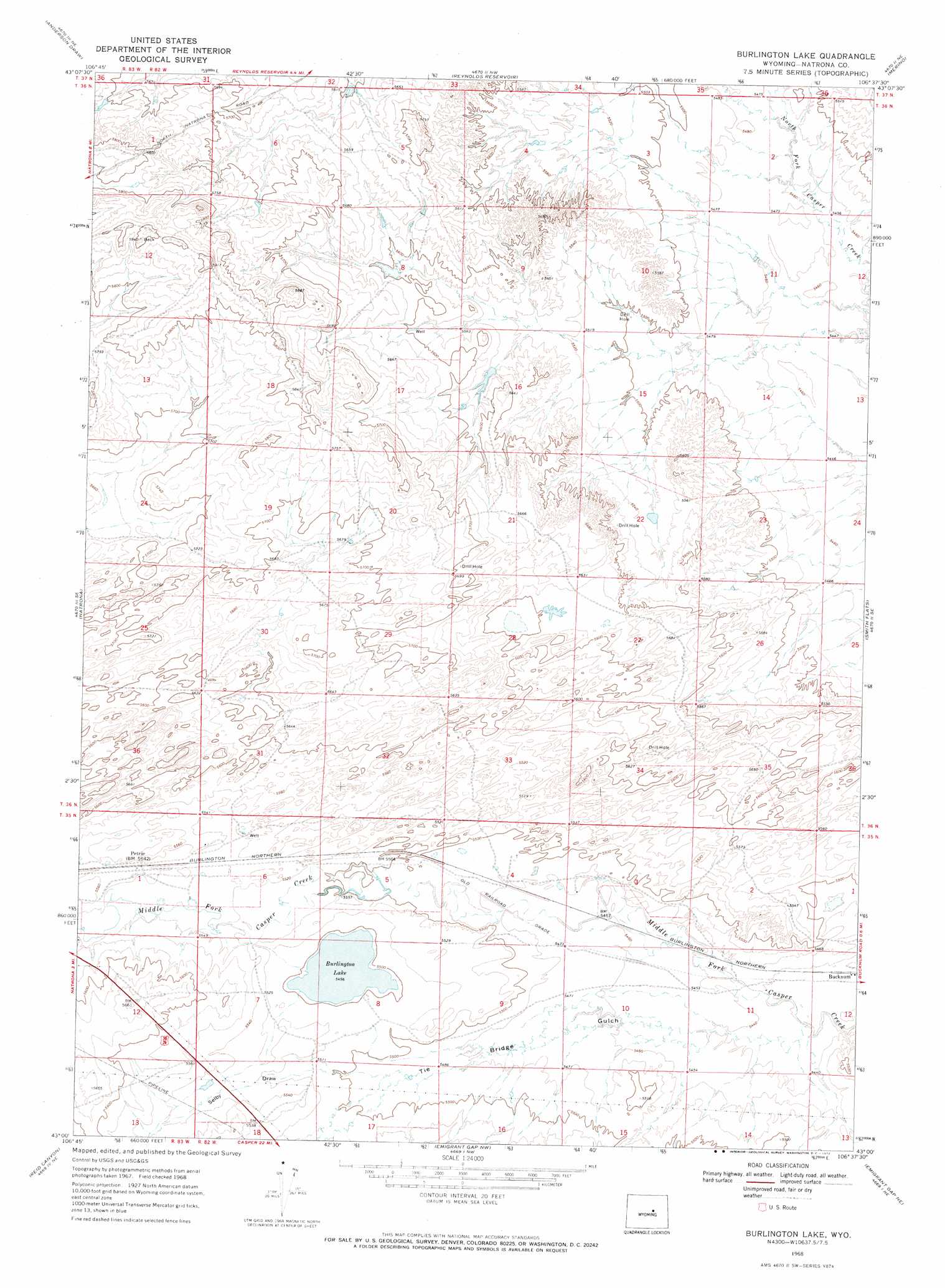
USGS Topo Quad 43106a6 - 1:24,000 scale
| Topo Map Name: | Burlington Lake |
| USGS Topo Quad ID: | 43106a6 |
| Print Size: | ca. 21 1/4" wide x 27" high |
| Southeast Coordinates: | 43° N latitude / 106.625° W longitude |
| Map Center Coordinates: | 43.0625° N latitude / 106.6875° W longitude |
| U.S. State: | WY |
| Filename: | o43106a6.jpg |
| Download Map JPG Image: | Burlington Lake topo map 1:24,000 scale |
| Map Type: | Topographic |
| Topo Series: | 7.5´ |
| Map Scale: | 1:24,000 |
| Source of Map Images: | United States Geological Survey (USGS) |
| Alternate Map Versions: |
Burlington Lake WY 1968, updated 1972 Download PDF Buy paper map Burlington Lake WY 2012 Download PDF Buy paper map Burlington Lake WY 2015 Download PDF Buy paper map |
1:24,000 Topo Quads surrounding Burlington Lake
Flat Top Hill |
Big Sulfur Draw |
Fiftymile Flat |
Camel Hump Reservoir |
Big Gulch |
Cave Gulch Reservoir |
Anderson Draw |
Reynolds Reservoir |
Merino |
Statzer Point |
Powder River |
Natrona |
Burlington Lake |
Smith Flats |
Illco |
Square Top Butte |
Reid Canyon |
Emigrant Gap Nw |
Emigrant Gap Ne |
Bishop |
Pine Mountain Sw |
Poison Spider |
Oil Mountain |
Emigrant Gap |
Goose Egg |
> Back to 43106a1 at 1:100,000 scale
> Back to 43106a1 at 1:250,000 scale
> Back to U.S. Topo Maps home
Burlington Lake topo map: Gazetteer
Burlington Lake: Dams
Johnson Number 1 Dam elevation 1679m 5508′Roseberry Number 1 Dam elevation 1677m 5501′
Roseberry Number 2 Dam elevation 1672m 5485′
Burlington Lake: Lakes
Burlington Lake elevation 1676m 5498′Burlington Lake: Populated Places
Bucknum elevation 1658m 5439′Petrie elevation 1689m 5541′
Burlington Lake: Reservoirs
Johnson Reservoir Number 1 elevation 1679m 5508′Roseberry Reservoir Number 1 elevation 1677m 5501′
Roseberry Reservoir Number 2 elevation 1672m 5485′
Burlington Lake: Valleys
Selby Draw elevation 1677m 5501′Tie Bridge Gulch elevation 1654m 5426′
Burlington Lake digital topo map on disk
Buy this Burlington Lake topo map showing relief, roads, GPS coordinates and other geographical features, as a high-resolution digital map file on DVD:
Eastern Wyoming & Western South Dakota
Buy digital topo maps: Eastern Wyoming & Western South Dakota