Reynolds Reservoir Topo Map Wyoming
To zoom in, hover over the map of Reynolds Reservoir
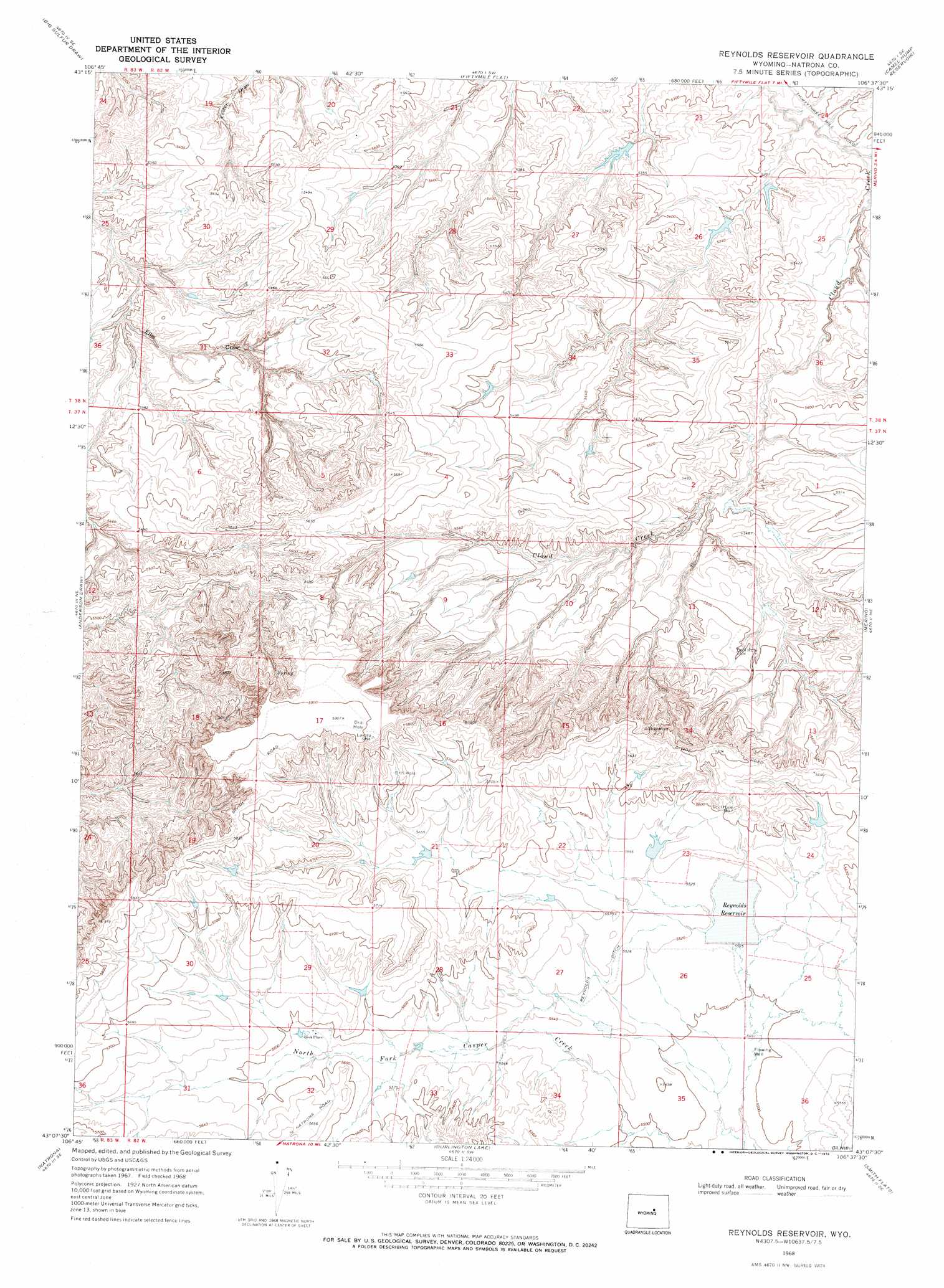
USGS Topo Quad 43106b6 - 1:24,000 scale
| Topo Map Name: | Reynolds Reservoir |
| USGS Topo Quad ID: | 43106b6 |
| Print Size: | ca. 21 1/4" wide x 27" high |
| Southeast Coordinates: | 43.125° N latitude / 106.625° W longitude |
| Map Center Coordinates: | 43.1875° N latitude / 106.6875° W longitude |
| U.S. State: | WY |
| Filename: | o43106b6.jpg |
| Download Map JPG Image: | Reynolds Reservoir topo map 1:24,000 scale |
| Map Type: | Topographic |
| Topo Series: | 7.5´ |
| Map Scale: | 1:24,000 |
| Source of Map Images: | United States Geological Survey (USGS) |
| Alternate Map Versions: |
Reynolds Reservoir WY 1968, updated 1972 Download PDF Buy paper map Reynolds Reservoir WY 2012 Download PDF Buy paper map Reynolds Reservoir WY 2015 Download PDF Buy paper map |
1:24,000 Topo Quads surrounding Reynolds Reservoir
Roughlock Hill |
Willow Creek School |
Broken Horn Creek |
Salt Canyon |
Government Creek |
Flat Top Hill |
Big Sulfur Draw |
Fiftymile Flat |
Camel Hump Reservoir |
Big Gulch |
Cave Gulch Reservoir |
Anderson Draw |
Reynolds Reservoir |
Merino |
Statzer Point |
Powder River |
Natrona |
Burlington Lake |
Smith Flats |
Illco |
Square Top Butte |
Reid Canyon |
Emigrant Gap Nw |
Emigrant Gap Ne |
Bishop |
> Back to 43106a1 at 1:100,000 scale
> Back to 43106a1 at 1:250,000 scale
> Back to U.S. Topo Maps home
Reynolds Reservoir topo map: Gazetteer
Reynolds Reservoir: Canals
Reynolds Ditch elevation 1687m 5534′Reynolds Reservoir: Dams
Reynolds Number 1 Dam elevation 1689m 5541′Reynolds Number 2 Dam elevation 1681m 5515′
Reynolds Reservoir: Populated Places
Beck Place elevation 1707m 5600′Reynolds Reservoir: Reservoirs
Reynolds Reservoir elevation 1683m 5521′Reynolds Reservoir Number 1 elevation 1689m 5541′
Reynolds Reservoir Number 2 elevation 1681m 5515′
Reynolds Reservoir digital topo map on disk
Buy this Reynolds Reservoir topo map showing relief, roads, GPS coordinates and other geographical features, as a high-resolution digital map file on DVD:
Eastern Wyoming & Western South Dakota
Buy digital topo maps: Eastern Wyoming & Western South Dakota