Taber Topo Map Idaho
To zoom in, hover over the map of Taber
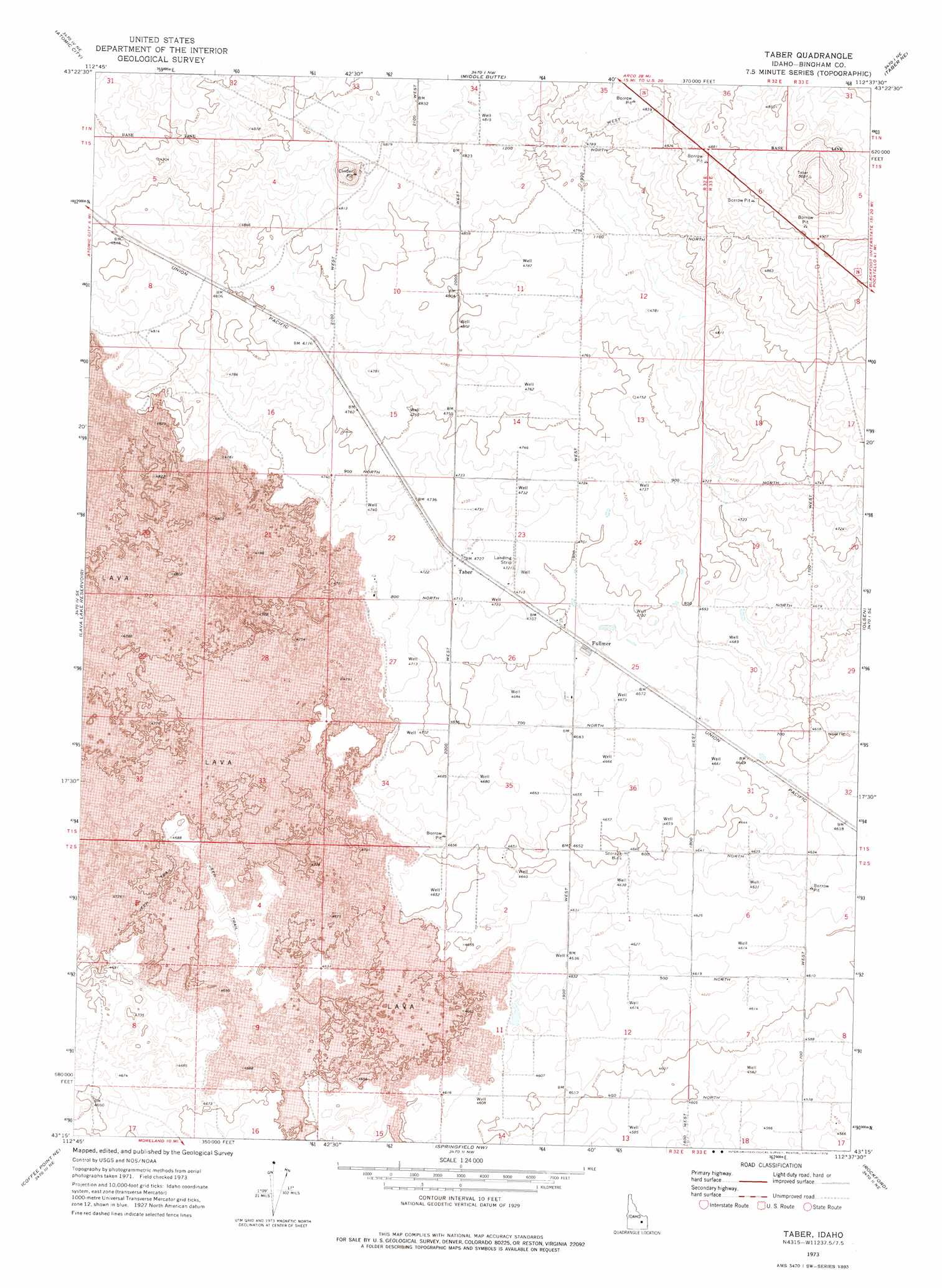
USGS Topo Quad 43112c6 - 1:24,000 scale
| Topo Map Name: | Taber |
| USGS Topo Quad ID: | 43112c6 |
| Print Size: | ca. 21 1/4" wide x 27" high |
| Southeast Coordinates: | 43.25° N latitude / 112.625° W longitude |
| Map Center Coordinates: | 43.3125° N latitude / 112.6875° W longitude |
| U.S. State: | ID |
| Filename: | o43112c6.jpg |
| Download Map JPG Image: | Taber topo map 1:24,000 scale |
| Map Type: | Topographic |
| Topo Series: | 7.5´ |
| Map Scale: | 1:24,000 |
| Source of Map Images: | United States Geological Survey (USGS) |
| Alternate Map Versions: |
Taber ID 1973, updated 1976 Download PDF Buy paper map Taber ID 2010 Download PDF Buy paper map Taber ID 2013 Download PDF Buy paper map |
1:24,000 Topo Quads surrounding Taber
Circular Butte 3 Sw |
Circular Butte 3 Se |
Little Butte Sw |
Little Butte |
Kettle Butte |
Scoville |
Atomic City |
Middle Butte |
Taber Ne |
Morgans Pasture Nw |
Rock Butte |
Lava Lake Reservoir |
Taber |
Olsen |
Baldy Knoll |
Coffee Point |
Coffee Point Ne |
Springfield Nw |
Rockford |
Moreland |
Coffee Point Sw |
Big Fill Reservoir |
Springfield |
Pingree |
Fort Hall |
> Back to 43112a1 at 1:100,000 scale
> Back to 43112a1 at 1:250,000 scale
> Back to U.S. Topo Maps home
Taber topo map: Gazetteer
Taber: Craters
Cinder Pit elevation 1482m 4862′Taber: Populated Places
Fullmer elevation 1431m 4694′Taber elevation 1439m 4721′
Taber digital topo map on disk
Buy this Taber topo map showing relief, roads, GPS coordinates and other geographical features, as a high-resolution digital map file on DVD: