Little Joe Butte Topo Map Idaho
To zoom in, hover over the map of Little Joe Butte
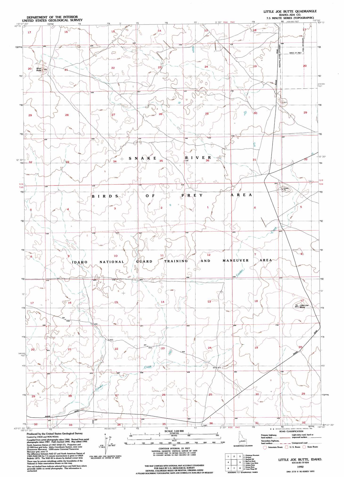
USGS Topo Quad 43116b1 - 1:24,000 scale
| Topo Map Name: | Little Joe Butte |
| USGS Topo Quad ID: | 43116b1 |
| Print Size: | ca. 21 1/4" wide x 27" high |
| Southeast Coordinates: | 43.125° N latitude / 116° W longitude |
| Map Center Coordinates: | 43.1875° N latitude / 116.0625° W longitude |
| U.S. State: | ID |
| Filename: | o43116b1.jpg |
| Download Map JPG Image: | Little Joe Butte topo map 1:24,000 scale |
| Map Type: | Topographic |
| Topo Series: | 7.5´ |
| Map Scale: | 1:24,000 |
| Source of Map Images: | United States Geological Survey (USGS) |
| Alternate Map Versions: |
Little Joe Butte ID 1948, updated 1976 Download PDF Buy paper map Little Joe Butte ID 1949 Download PDF Buy paper map Little Joe Butte ID 1992, updated 1992 Download PDF Buy paper map Little Joe Butte ID 2010 Download PDF Buy paper map Little Joe Butte ID 2013 Download PDF Buy paper map |
1:24,000 Topo Quads surrounding Little Joe Butte
Mora |
Owyhee |
Indian Creek Reservoir |
Mayfield |
Braves Creek |
Coyote Butte |
Christmas Mountain |
Orchard |
Mayfield Sw |
Mayfield Se |
Wild Horse Butte |
Big Foot Butte |
Little Joe Butte |
Cinder Cone Butte |
Crater Rings |
Castle Butte |
Jackass Butte |
Dorsey Butte |
Crater Rings Sw |
Crater Rings Se |
Rough Mountain Ne |
Vinson Wash |
Grand View |
C J Strike Dam |
Bruneau |
> Back to 43116a1 at 1:100,000 scale
> Back to 43116a1 at 1:250,000 scale
> Back to U.S. Topo Maps home
Little Joe Butte topo map: Gazetteer
Little Joe Butte: Summits
Little Joe Butte elevation 977m 3205′Wind Butte elevation 1036m 3398′
Little Joe Butte digital topo map on disk
Buy this Little Joe Butte topo map showing relief, roads, GPS coordinates and other geographical features, as a high-resolution digital map file on DVD: