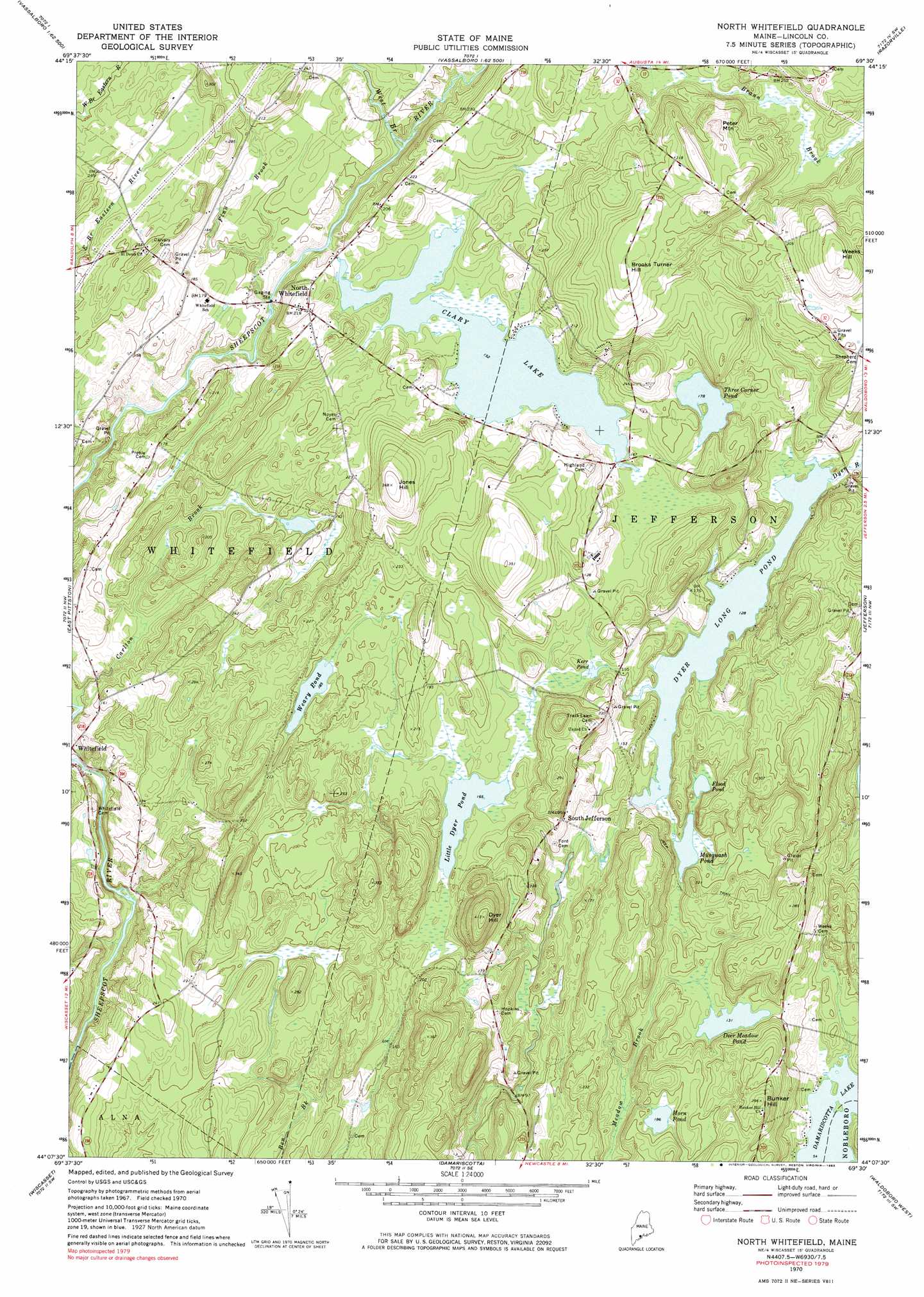
North Whitefield Topo Map Maine
To zoom in, hover over the map of North Whitefield
USGS Topo Quad 44069b5 - 1:24,000 scale
| Topo Map Name: | North Whitefield |
| USGS Topo Quad ID: | 44069b5 |
| Print Size: | ca. 21 1/4" wide x 27" high |
| Southeast Coordinates: | 44.125° N latitude / 69.5° W longitude |
| Map Center Coordinates: | 44.1875° N latitude / 69.5625° W longitude |
| U.S. State: | ME |
| Filename: | o44069b5.jpg |
| Download Map JPG Image: | North Whitefield topo map 1:24,000 scale |
| Map Type: | Topographic |
| Topo Series: | 7.5´ |
| Map Scale: | 1:24,000 |
| Source of Map Images: | United States Geological Survey (USGS) |
| Alternate Map Versions: |
North Whitefield ME 1970, updated 1974 Download PDF Buy paper map North Whitefied ME 1970, updated 1983 Download PDF Buy paper map North Whitefied ME 1970, updated 1983 Download PDF Buy paper map North Whitefield ME 2011 Download PDF Buy paper map North Whitefield ME 2014 Download PDF Buy paper map |
1:24,000 Topo Quads surrounding North Whitefield
Belgrade |
Vassalboro |
China Lake |
Palermo |
Liberty |
Augusta |
Togus Pond |
Weeks Mills |
Razorville |
Washington |
Gardiner |
East Pittston |
North Whitefield |
Jefferson |
Union |
Richmond |
Wiscasset |
Damariscotta |
Waldoboro West |
Waldoboro East |
Bath |
Westport |
Bristol |
Louds Island |
Friendship |
> Back to 44069a1 at 1:100,000 scale
> Back to 44068a1 at 1:250,000 scale
> Back to U.S. Topo Maps home
North Whitefield topo map: Gazetteer
North Whitefield: Dams
Boynton-Trask Dam elevation 39m 127′Clary Saw Mill Dam elevation 46m 150′
Three Corner Pond Dam elevation 54m 177′
North Whitefield: Lakes
Deer Meadow Pond elevation 40m 131′Flood Pond elevation 39m 127′
Horn Pond elevation 56m 183′
Kerr Pond elevation 49m 160′
Little Dyer Pond elevation 50m 164′
Musquash Pond elevation 39m 127′
Weary Pond elevation 56m 183′
North Whitefield: Populated Places
North Whitefield elevation 64m 209′South Jefferson elevation 61m 200′
North Whitefield: Reservoirs
Clary Lake elevation 46m 150′Dyer Long Pond elevation 39m 127′
Prestile Stream elevation 72m 236′
Three Corner Pond elevation 54m 177′
North Whitefield: Streams
Carlton Brook elevation 26m 85′Finn Brook elevation 31m 101′
West Branch Sheepscot River elevation 32m 104′
North Whitefield: Summits
Brooks Turner Hill elevation 113m 370′Bunker Hill elevation 89m 291′
Dyer Hill elevation 125m 410′
Jones Hill elevation 111m 364′
Peter Mountain elevation 112m 367′
North Whitefield digital topo map on disk
Buy this North Whitefield topo map showing relief, roads, GPS coordinates and other geographical features, as a high-resolution digital map file on DVD:
Maine, New Hampshire, Rhode Island & Eastern Massachusetts
Buy digital topo maps: Maine, New Hampshire, Rhode Island & Eastern Massachusetts