Clements Topo Map Minnesota
To zoom in, hover over the map of Clements
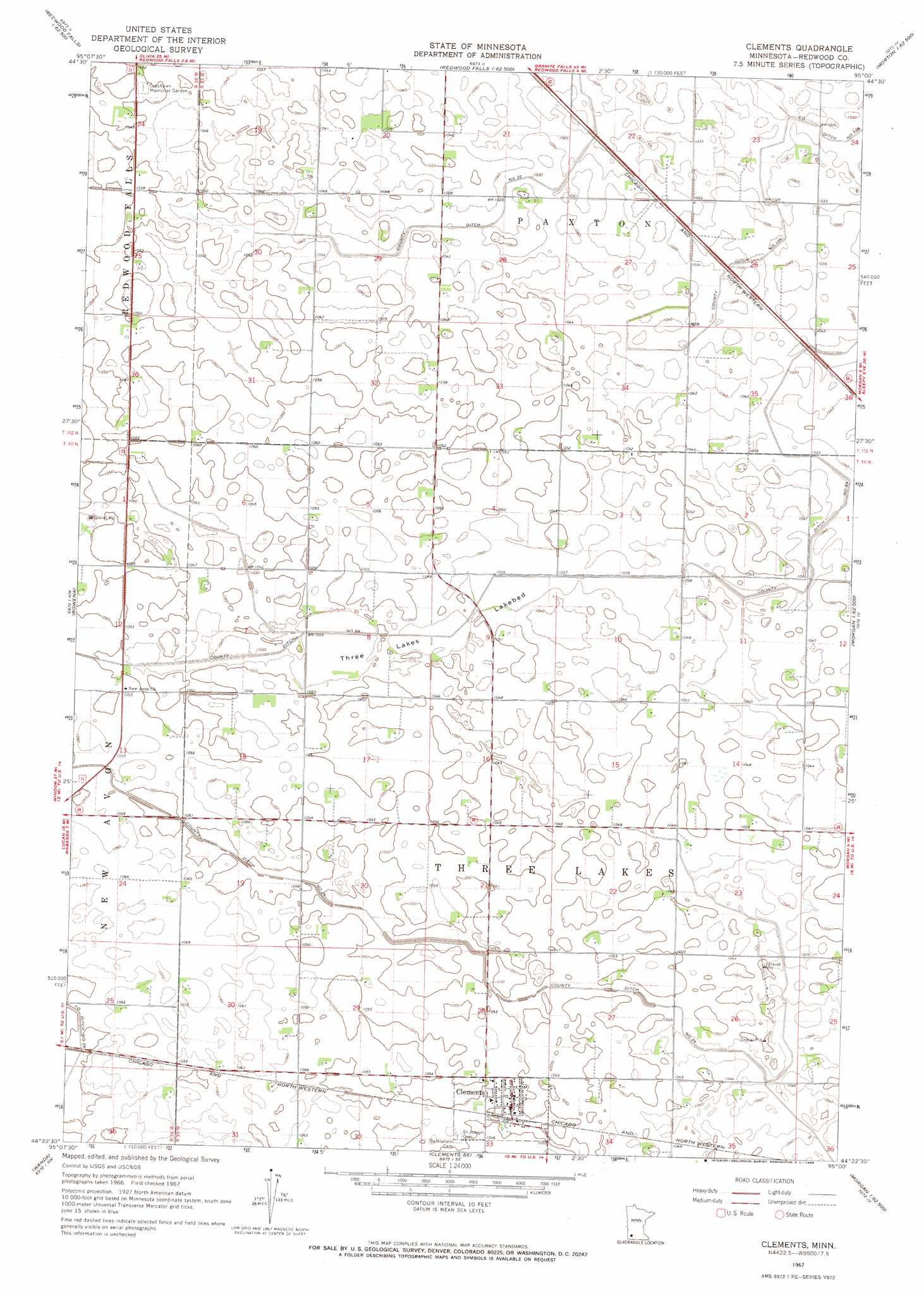
USGS Topo Quad 44095d1 - 1:24,000 scale
| Topo Map Name: | Clements |
| USGS Topo Quad ID: | 44095d1 |
| Print Size: | ca. 21 1/4" wide x 27" high |
| Southeast Coordinates: | 44.375° N latitude / 95° W longitude |
| Map Center Coordinates: | 44.4375° N latitude / 95.0625° W longitude |
| U.S. State: | MN |
| Filename: | o44095d1.jpg |
| Download Map JPG Image: | Clements topo map 1:24,000 scale |
| Map Type: | Topographic |
| Topo Series: | 7.5´ |
| Map Scale: | 1:24,000 |
| Source of Map Images: | United States Geological Survey (USGS) |
| Alternate Map Versions: |
Clements MN 1967, updated 1968 Download PDF Buy paper map Clements MN 2010 Download PDF Buy paper map Clements MN 2013 Download PDF Buy paper map Clements MN 2016 Download PDF Buy paper map |
1:24,000 Topo Quads surrounding Clements
Iverson Lake |
Vicksburg |
Bechyn |
Morton Nw |
Morton Ne |
Belview |
Delhi |
Redwood Falls |
Morton |
Morton Se |
Wabasso |
Rowena |
Clements |
Morgan |
Morgan Ne |
Wabasso Se |
Wanda |
Clements Se |
Boise Lake |
Evan |
Lamberton |
Sanborn |
Sanborn Ne |
Springfield |
Leavenworth |
> Back to 44095a1 at 1:100,000 scale
> Back to 44094a1 at 1:250,000 scale
> Back to U.S. Topo Maps home
Clements topo map: Gazetteer
Clements: Canals
County Ditch Number One Hundred Six elevation 311m 1020′County Ditch Number Sixtyfour elevation 317m 1040′
County Ditch Number Twentyfour elevation 320m 1049′
County Ditch Number Twentytwo elevation 315m 1033′
Clements: Flats
Three Lakes Lakebed elevation 317m 1040′Clements: Populated Places
Clements elevation 320m 1049′Clements: Post Offices
Clements Post Office elevation 321m 1053′Clements digital topo map on disk
Buy this Clements topo map showing relief, roads, GPS coordinates and other geographical features, as a high-resolution digital map file on DVD: