Clarkfield Ne Topo Map Minnesota
To zoom in, hover over the map of Clarkfield Ne
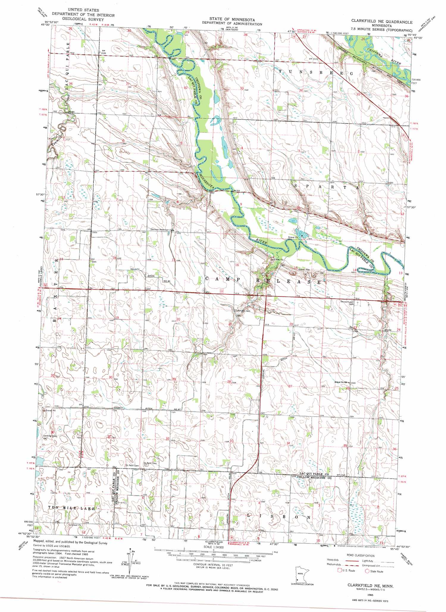
USGS Topo Quad 44095h7 - 1:24,000 scale
| Topo Map Name: | Clarkfield Ne |
| USGS Topo Quad ID: | 44095h7 |
| Print Size: | ca. 21 1/4" wide x 27" high |
| Southeast Coordinates: | 44.875° N latitude / 95.75° W longitude |
| Map Center Coordinates: | 44.9375° N latitude / 95.8125° W longitude |
| U.S. State: | MN |
| Filename: | o44095h7.jpg |
| Download Map JPG Image: | Clarkfield Ne topo map 1:24,000 scale |
| Map Type: | Topographic |
| Topo Series: | 7.5´ |
| Map Scale: | 1:24,000 |
| Source of Map Images: | United States Geological Survey (USGS) |
| Alternate Map Versions: |
Clarkfield NE MN 1965, updated 1966 Download PDF Buy paper map Clarkfield NE MN 2010 Download PDF Buy paper map Clarkfield NE MN 2013 Download PDF Buy paper map Clarkfield NE MN 2016 Download PDF Buy paper map |
1:24,000 Topo Quads surrounding Clarkfield Ne
Appleton |
Milan Nw |
Big Bend City |
Gracelock Nw |
Gracelock Ne |
Cerro Gordo |
Milan |
Watson |
Gracelock Sw |
Gracelock |
Dawson |
Tenmile Lake |
Clarkfield Ne |
Montevideo |
Asbury |
Providence |
Boyd |
Clarkfield |
Hazel Run |
Granite Falls |
Saint Leo |
Minneota Nw |
Normania |
Wood Lake Nw |
Wood Lake |
> Back to 44095e1 at 1:100,000 scale
> Back to 44094a1 at 1:250,000 scale
> Back to U.S. Topo Maps home
Clarkfield Ne topo map: Gazetteer
Clarkfield Ne: Canals
County Ditch Number Eightyseven elevation 311m 1020′County Ditch Number Ninty elevation 309m 1013′
Judicial Ditch Number Twentythree elevation 315m 1033′
Clarkfield Ne: Dams
Handeen-Jahn Group Pond Dam elevation 284m 931′Clarkfield Ne digital topo map on disk
Buy this Clarkfield Ne topo map showing relief, roads, GPS coordinates and other geographical features, as a high-resolution digital map file on DVD: