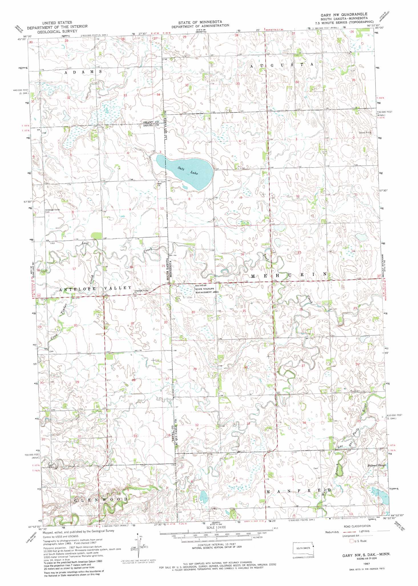
Gary Nw Topo Map Minnesota
To zoom in, hover over the map of Gary Nw
USGS Topo Quad 44096h4 - 1:24,000 scale
| Topo Map Name: | Gary Nw |
| USGS Topo Quad ID: | 44096h4 |
| Print Size: | ca. 21 1/4" wide x 27" high |
| Southeast Coordinates: | 44.875° N latitude / 96.375° W longitude |
| Map Center Coordinates: | 44.9375° N latitude / 96.4375° W longitude |
| U.S. States: | MN, SD |
| Filename: | o44096h4.jpg |
| Download Map JPG Image: | Gary Nw topo map 1:24,000 scale |
| Map Type: | Topographic |
| Topo Series: | 7.5´ |
| Map Scale: | 1:24,000 |
| Source of Map Images: | United States Geological Survey (USGS) |
| Alternate Map Versions: |
Gary NW MN 1967, updated 1968 Download PDF Buy paper map Gary NW MN 1967, updated 1981 Download PDF Buy paper map Gary NW MN 1967, updated 1982 Download PDF Buy paper map Gary NW MN 1967, updated 1988 Download PDF Buy paper map Gary NW MN 2010 Download PDF Buy paper map Gary NW MN 2013 Download PDF Buy paper map Gary NW MN 2016 Download PDF Buy paper map |
1:24,000 Topo Quads surrounding Gary Nw
Milbank West |
Milbank East |
Rosen |
Bellingham |
Correll |
La Bolt |
Revillo |
Marietta |
Haydenville |
Madison |
Tunerville |
Clear Lake Ne |
Gary Nw |
Mount Wickham |
Dawson Nw |
Clear Lake North |
Lake Francis |
Gary |
Gary Se |
Dawson Sw |
Clear Lake South |
Brandt |
Canby Nw |
Canby |
Porter |
> Back to 44096e1 at 1:100,000 scale
> Back to 44096a1 at 1:250,000 scale
> Back to U.S. Topo Maps home
Gary Nw topo map: Gazetteer
Gary Nw: Airports
Lundin Airstrip elevation 354m 1161′Wallace Jewett Airstrip elevation 354m 1161′
Gary Nw: Lakes
Salt Lake elevation 348m 1141′Salt Lake elevation 348m 1141′
Gary Nw: Parks
Dacotah State Wildlife Management Area elevation 357m 1171′State Line Wayside Park elevation 357m 1171′
State Line Wayside Park elevation 357m 1171′
Gary Nw: Streams
Crow Creek elevation 342m 1122′Crow Timber Creek elevation 360m 1181′
Gary Nw digital topo map on disk
Buy this Gary Nw topo map showing relief, roads, GPS coordinates and other geographical features, as a high-resolution digital map file on DVD:
Eastern North Dakota & Eastern South Dakota
Buy digital topo maps: Eastern North Dakota & Eastern South Dakota