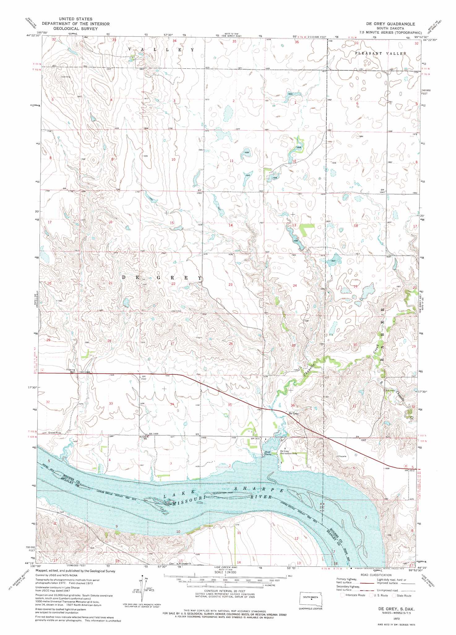
De Grey Topo Map South Dakota
To zoom in, hover over the map of De Grey
USGS Topo Quad 44099c8 - 1:24,000 scale
| Topo Map Name: | De Grey |
| USGS Topo Quad ID: | 44099c8 |
| Print Size: | ca. 21 1/4" wide x 27" high |
| Southeast Coordinates: | 44.25° N latitude / 99.875° W longitude |
| Map Center Coordinates: | 44.3125° N latitude / 99.9375° W longitude |
| U.S. State: | SD |
| Filename: | o44099c8.jpg |
| Download Map JPG Image: | De Grey topo map 1:24,000 scale |
| Map Type: | Topographic |
| Topo Series: | 7.5´ |
| Map Scale: | 1:24,000 |
| Source of Map Images: | United States Geological Survey (USGS) |
| Alternate Map Versions: |
De Grey SD 1973, updated 1976 Download PDF Buy paper map De Grey SD 2012 Download PDF Buy paper map De Grey SD 2015 Download PDF Buy paper map |
1:24,000 Topo Quads surrounding De Grey
Onida Sw |
Onida Se |
Blunt |
Blunt Se |
Harrold |
Canning Nw |
Canning |
De Grey Nw |
De Grey Ne |
Chapelle Lake Nw |
Antelope Island |
Rousseau |
De Grey |
De Grey Se |
Chapelle Lake Sw |
Fort George Butte Nw |
Fort George Butte |
Joe Creek Nw |
Joe Creek |
Lower Brule Nw |
Fort George Butte Sw |
Fort George Butte Se |
Joe Creek Sw |
Joe Creek Se |
Lower Brule Sw |
> Back to 44099a1 at 1:100,000 scale
> Back to 44098a1 at 1:250,000 scale
> Back to U.S. Topo Maps home
De Grey topo map: Gazetteer
De Grey: Dams
Bennett Martin Dam elevation 500m 1640′Etzkorn Dam elevation 471m 1545′
H C Calhoun Dam elevation 511m 1676′
De Grey: Parks
De Grey Recreation Area elevation 435m 1427′De Grey: Populated Places
De Grey elevation 439m 1440′De Grey: Post Offices
De Grey Post Office (historical) elevation 434m 1423′De Grey: Streams
Chapelle Creek elevation 433m 1420′South Chapelle Creek elevation 447m 1466′
De Grey digital topo map on disk
Buy this De Grey topo map showing relief, roads, GPS coordinates and other geographical features, as a high-resolution digital map file on DVD:
Eastern North Dakota & Eastern South Dakota
Buy digital topo maps: Eastern North Dakota & Eastern South Dakota