Moenville Topo Map South Dakota
To zoom in, hover over the map of Moenville
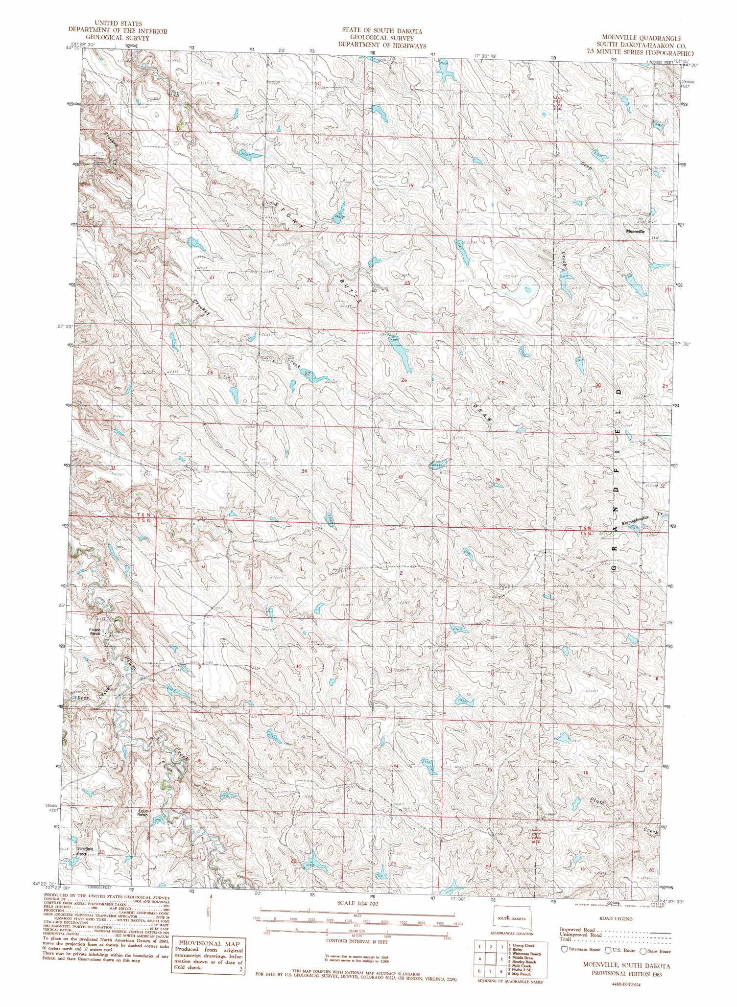
USGS Topo Quad 44101d3 - 1:24,000 scale
| Topo Map Name: | Moenville |
| USGS Topo Quad ID: | 44101d3 |
| Print Size: | ca. 21 1/4" wide x 27" high |
| Southeast Coordinates: | 44.375° N latitude / 101.25° W longitude |
| Map Center Coordinates: | 44.4375° N latitude / 101.3125° W longitude |
| U.S. State: | SD |
| Filename: | o44101d3.jpg |
| Download Map JPG Image: | Moenville topo map 1:24,000 scale |
| Map Type: | Topographic |
| Topo Series: | 7.5´ |
| Map Scale: | 1:24,000 |
| Source of Map Images: | United States Geological Survey (USGS) |
| Alternate Map Versions: |
Moenville SD 1983, updated 1984 Download PDF Buy paper map Moenville SD 2012 Download PDF Buy paper map Moenville SD 2015 Download PDF Buy paper map |
1:24,000 Topo Quads surrounding Moenville
Rattlesnake Lake Ne |
Cherry Creek Nw |
Carlin Flat |
Alleman Station |
Sansarc Ne |
Rattlesnake Lake Se |
Cherry Creek |
Kirley |
Whiteman Ranch |
Sansarc |
Murray Draw |
Middle Draw |
Moenville |
Bentley Ranch |
Hayes North |
Tornado Ranch |
Mule Creek |
Pheba 2 Se |
May Ranch |
Hayes South |
Lucerne |
Powell Nw |
Ottumwa |
Midland Nw |
Midland Ne |
> Back to 44101a1 at 1:100,000 scale
> Back to 44100a1 at 1:250,000 scale
> Back to U.S. Topo Maps home
Moenville topo map: Gazetteer
Moenville: Populated Places
Moenville elevation 708m 2322′Moenville: Streams
Deer Creek elevation 647m 2122′Deer Creek elevation 649m 2129′
Moenville digital topo map on disk
Buy this Moenville topo map showing relief, roads, GPS coordinates and other geographical features, as a high-resolution digital map file on DVD:
Eastern North Dakota & Eastern South Dakota
Buy digital topo maps: Eastern North Dakota & Eastern South Dakota