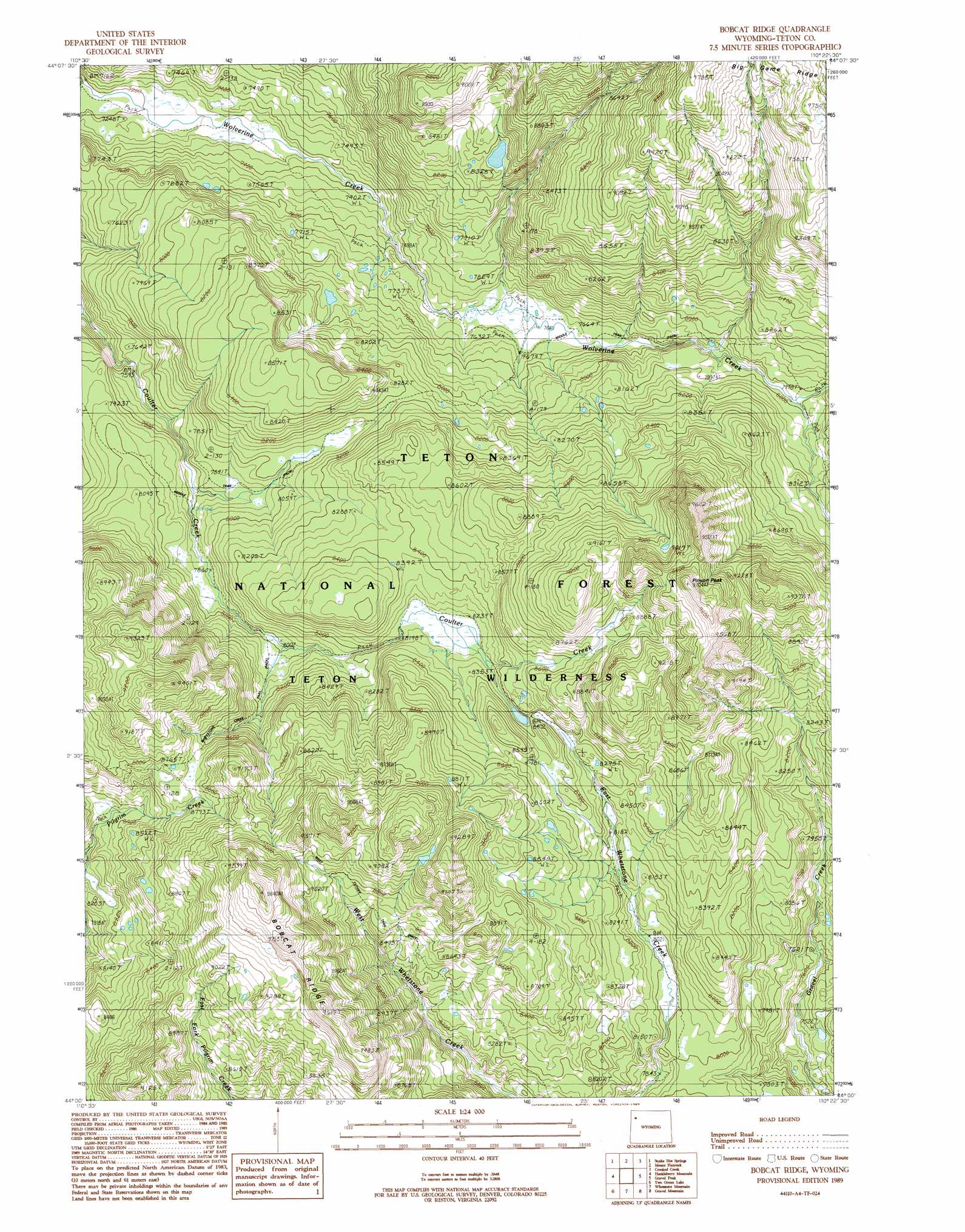
Bobcat Ridge Topo Map Wyoming
To zoom in, hover over the map of Bobcat Ridge
USGS Topo Quad 44110a4 - 1:24,000 scale
| Topo Map Name: | Bobcat Ridge |
| USGS Topo Quad ID: | 44110a4 |
| Print Size: | ca. 21 1/4" wide x 27" high |
| Southeast Coordinates: | 44° N latitude / 110.375° W longitude |
| Map Center Coordinates: | 44.0625° N latitude / 110.4375° W longitude |
| U.S. State: | WY |
| Filename: | o44110a4.jpg |
| Download Map JPG Image: | Bobcat Ridge topo map 1:24,000 scale |
| Map Type: | Topographic |
| Topo Series: | 7.5´ |
| Map Scale: | 1:24,000 |
| Source of Map Images: | United States Geological Survey (USGS) |
| Alternate Map Versions: |
Bobcat Ridge WY 1989, updated 1989 Download PDF Buy paper map Bobcat Ridge WY 1996, updated 1998 Download PDF Buy paper map Bobcat Ridge WY 2012 Download PDF Buy paper map Bobcat Ridge WY 2015 Download PDF Buy paper map |
| FStopo: | US Forest Service topo Bobcat Ridge is available: Download FStopo PDF Download FStopo TIF |
1:24,000 Topo Quads surrounding Bobcat Ridge
Lewis Falls |
Mount Sheridan |
Heart Lake |
Alder Lake |
Trail Lake |
Lewis Canyon |
Snake Hot Springs |
Mount Hancock |
Crooked Creek |
Badger Creek |
Flagg Ranch |
Huckleberry Mountain |
Bobcat Ridge |
Gravel Peak |
Two Ocean Pass |
Colter Bay |
Two Ocean Lake |
Whetstone Mountain |
Hunter Mountain |
Joy Peak |
Jenny Lake |
Moran |
Davis Hill |
Rosies Ridge |
Angle Mountain |
> Back to 44110a1 at 1:100,000 scale
> Back to 44110a1 at 1:250,000 scale
> Back to U.S. Topo Maps home
Bobcat Ridge topo map: Gazetteer
Bobcat Ridge: Ridges
Bobcat Ridge elevation 2870m 9416′Bobcat Ridge: Streams
Wolverine Creek elevation 2188m 7178′Bobcat Ridge: Summits
Pinyon Peak elevation 2955m 9694′Bobcat Ridge: Trails
Coulter Creek Tail elevation 2499m 8198′Coulter-Wolverine Cutoff Trail elevation 2488m 8162′
West Cutoff Trail elevation 2637m 8651′
Bobcat Ridge digital topo map on disk
Buy this Bobcat Ridge topo map showing relief, roads, GPS coordinates and other geographical features, as a high-resolution digital map file on DVD: