Clevenger Butte Topo Map Oregon
To zoom in, hover over the map of Clevenger Butte
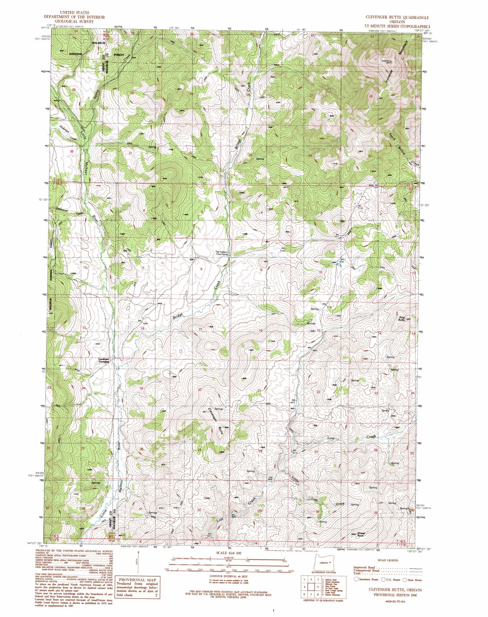
USGS Topo Quad 44118b2 - 1:24,000 scale
| Topo Map Name: | Clevenger Butte |
| USGS Topo Quad ID: | 44118b2 |
| Print Size: | ca. 21 1/4" wide x 27" high |
| Southeast Coordinates: | 44.125° N latitude / 118.125° W longitude |
| Map Center Coordinates: | 44.1875° N latitude / 118.1875° W longitude |
| U.S. State: | OR |
| Filename: | o44118b2.jpg |
| Download Map JPG Image: | Clevenger Butte topo map 1:24,000 scale |
| Map Type: | Topographic |
| Topo Series: | 7.5´ |
| Map Scale: | 1:24,000 |
| Source of Map Images: | United States Geological Survey (USGS) |
| Alternate Map Versions: |
Clevenger Butte OR 1990, updated 1991 Download PDF Buy paper map Clevenger Butte OR 1999, updated 2002 Download PDF Buy paper map Clevenger Butte OR 2011 Download PDF Buy paper map Clevenger Butte OR 2014 Download PDF Buy paper map |
| FStopo: | US Forest Service topo Clevenger Butte is available: Download FStopo PDF Download FStopo TIF |
1:24,000 Topo Quads surrounding Clevenger Butte
Deardorff Mountain |
Rail Gulch |
Unity |
Hereford |
Devils Heel |
Little Baldy Mountain |
Bullrun Rock |
Rastus Mountain |
Eldorado Pass |
Ironside |
Crane Prairie |
Flag Prairie |
Clevenger Butte |
De Bord Peaks |
Clover Creek Ranch |
Knox Mountain |
Buck Trough Spring |
Castle Rock |
Hunter Mtn |
Little Juniper Spring |
Otis Mountain |
Cottonwood Reservoir |
Beulah |
De Armond Mountain |
Westfall Butte |
> Back to 44118a1 at 1:100,000 scale
> Back to 44118a1 at 1:250,000 scale
> Back to U.S. Topo Maps home
Clevenger Butte topo map: Gazetteer
Clevenger Butte: Flats
Black Pasture elevation 1454m 4770′Clevenger Butte: Springs
Byars Spring elevation 1568m 5144′Clevenger Butte: Streams
Anderson Creek elevation 1406m 4612′Bridge Creek elevation 1345m 4412′
Deadwood Creek elevation 1388m 4553′
Little Lost Creek elevation 1442m 4730′
Squaw Creek elevation 1403m 4603′
Clevenger Butte: Summits
Clevenger Butte elevation 1711m 5613′Ironside Mountain elevation 2302m 7552′
Ring Butte elevation 1725m 5659′
Sheep Rock elevation 1790m 5872′
Clevenger Butte digital topo map on disk
Buy this Clevenger Butte topo map showing relief, roads, GPS coordinates and other geographical features, as a high-resolution digital map file on DVD: