Crocker Sw Topo Map South Dakota
To zoom in, hover over the map of Crocker Sw
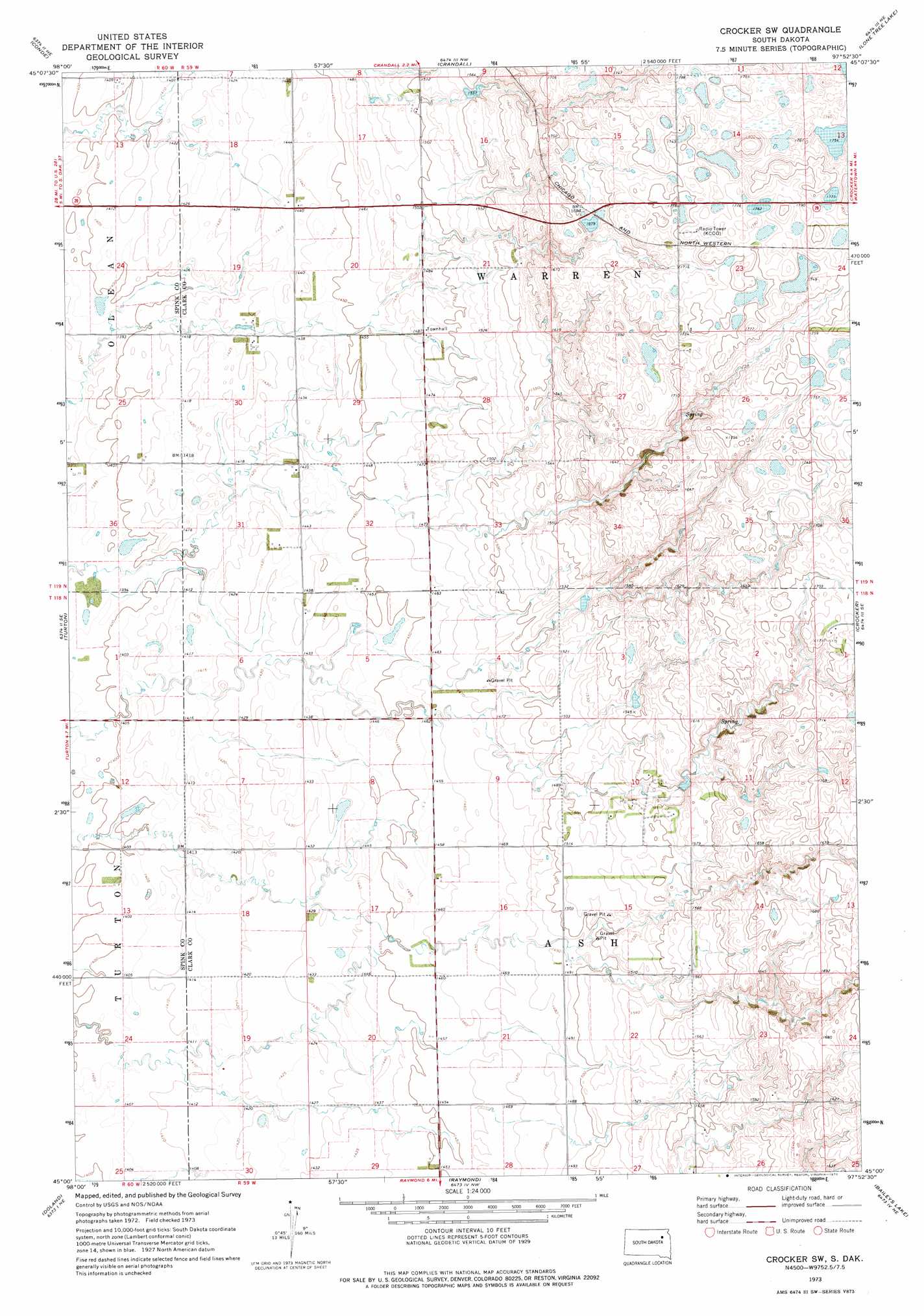
USGS Topo Quad 45097a8 - 1:24,000 scale
| Topo Map Name: | Crocker Sw |
| USGS Topo Quad ID: | 45097a8 |
| Print Size: | ca. 21 1/4" wide x 27" high |
| Southeast Coordinates: | 45° N latitude / 97.875° W longitude |
| Map Center Coordinates: | 45.0625° N latitude / 97.9375° W longitude |
| U.S. State: | SD |
| Filename: | o45097a8.jpg |
| Download Map JPG Image: | Crocker Sw topo map 1:24,000 scale |
| Map Type: | Topographic |
| Topo Series: | 7.5´ |
| Map Scale: | 1:24,000 |
| Source of Map Images: | United States Geological Survey (USGS) |
| Alternate Map Versions: |
Crocker SW SD 1973, updated 1975 Download PDF Buy paper map Crocker SW SD 2012 Download PDF Buy paper map Crocker SW SD 2015 Download PDF Buy paper map |
1:24,000 Topo Quads surrounding Crocker Sw
Groton Sw |
Ferney |
Andover Sw |
Bristol West |
Bristol East |
Randolph |
Conde |
Crandall |
Lone Tree Lake |
Lily |
Conde Sw |
Turton |
Crocker Sw |
Crocker |
Bradley |
Doland Nw |
Doland |
Raymond |
Baileys Lake |
Clark North |
Doland Sw |
Doland Se |
Fordham Dam |
Raymond Se |
Clark South |
> Back to 45097a1 at 1:100,000 scale
> Back to 45096a1 at 1:250,000 scale
> Back to U.S. Topo Maps home
Crocker Sw digital topo map on disk
Buy this Crocker Sw topo map showing relief, roads, GPS coordinates and other geographical features, as a high-resolution digital map file on DVD:
Eastern North Dakota & Eastern South Dakota
Buy digital topo maps: Eastern North Dakota & Eastern South Dakota