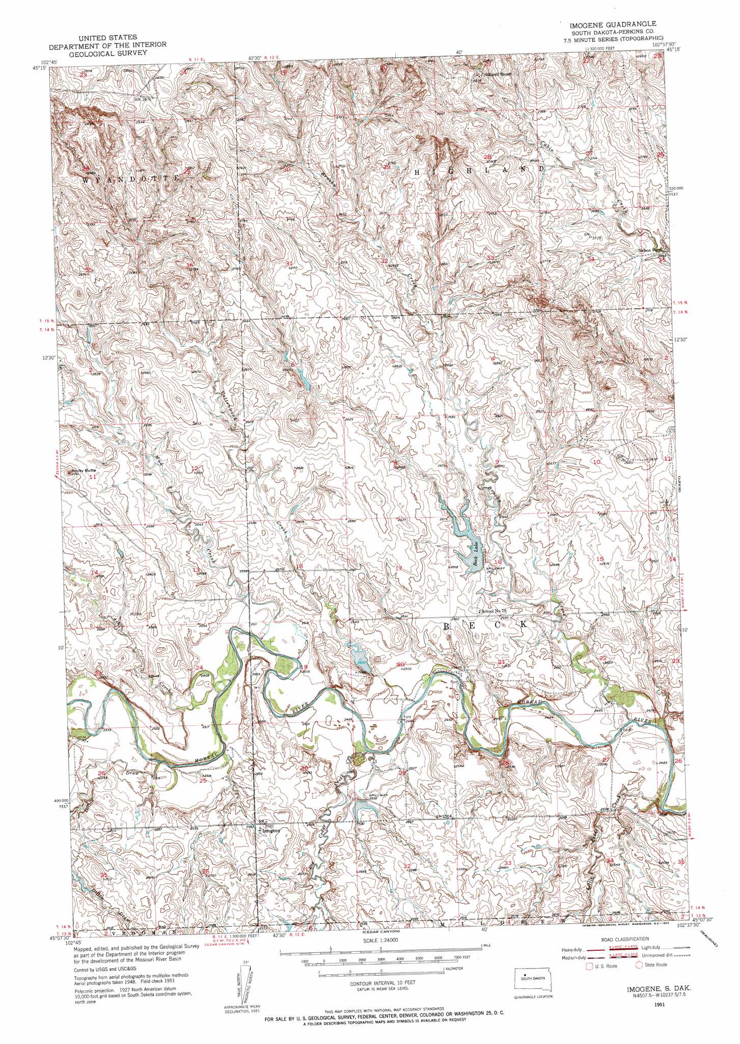
Imogene Topo Map South Dakota
To zoom in, hover over the map of Imogene
USGS Topo Quad 45102b6 - 1:24,000 scale
| Topo Map Name: | Imogene |
| USGS Topo Quad ID: | 45102b6 |
| Print Size: | ca. 21 1/4" wide x 27" high |
| Southeast Coordinates: | 45.125° N latitude / 102.625° W longitude |
| Map Center Coordinates: | 45.1875° N latitude / 102.6875° W longitude |
| U.S. State: | SD |
| Filename: | o45102b6.jpg |
| Download Map JPG Image: | Imogene topo map 1:24,000 scale |
| Map Type: | Topographic |
| Topo Series: | 7.5´ |
| Map Scale: | 1:24,000 |
| Source of Map Images: | United States Geological Survey (USGS) |
| Alternate Map Versions: |
Imogene SD 1951, updated 1953 Download PDF Buy paper map Imogene SD 2012 Download PDF Buy paper map Imogene SD 2015 Download PDF Buy paper map |
1:24,000 Topo Quads surrounding Imogene
Sorum |
Sorum Ne |
Daviston |
Date Ne |
Owen Lake |
Sorum Sw |
Sorum Se |
Date |
Rabbit Butte |
Two Buttes |
Zeona Ne |
Imogene |
Bixby |
Deep Creek Nw |
|
Beverly Creek |
Cedar Canyon |
Maurine |
Signal Butte |
|
Camp Creek |
Frozen Man Creek |
Squaw Buttes |
Opal West |
Opal East |
> Back to 45102a1 at 1:100,000 scale
> Back to 45102a1 at 1:250,000 scale
> Back to U.S. Topo Maps home
Imogene topo map: Gazetteer
Imogene: Airports
Blomberg 42 Ranch Airstrip elevation 794m 2604′Imogene: Dams
Frank Gebracht Dam elevation 795m 2608′Herman Kaubish Dam elevation 772m 2532′
Herman Kaubish Dam elevation 771m 2529′
Vern Anders Dam elevation 766m 2513′
Imogene: Populated Places
Imogene elevation 782m 2565′Imogene: Reservoirs
Beck Lake elevation 777m 2549′Imogene: Streams
Ash Creek elevation 760m 2493′Big Cedar Creek elevation 762m 2500′
Brushy Creek elevation 752m 2467′
Cottonwood Creek elevation 757m 2483′
Little Cedar Creek elevation 752m 2467′
Mud Creek elevation 760m 2493′
Imogene: Summits
Badlands elevation 815m 2673′Rocky Butte elevation 828m 2716′
Imogene: Valleys
Dillon Draw elevation 764m 2506′Imogene digital topo map on disk
Buy this Imogene topo map showing relief, roads, GPS coordinates and other geographical features, as a high-resolution digital map file on DVD:
Eastern Montana & Western North Dakota
Buy digital topo maps: Eastern Montana & Western North Dakota